May 24, 2015: Lamar, Colorado Tornadic Supercell

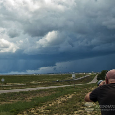
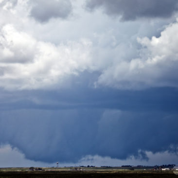
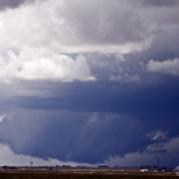
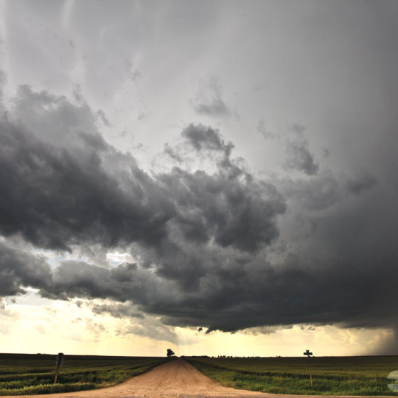
We intercepted several supercells today, the most photogenic supercell being about seven miles south of Lamar, Colorado where at least two tornadoes took place. A satellite tornado (a tornado that happens on the outside edge of the main circulation) briefly touched down just behind our parked location where it destroyed a fence and did some tree damage (there were later horses which escaped due to the destroyed fence and were walking along the highway). In the video here, you can see the funnel of this satellite tornado as it extends up into the mesocyclone. The second tornado also happened just to our north and was occluded in heavy rain, but it’s slightly visible in the video if you look for the contrasting edge in the rain core.

After this tornadic supercell crossed highway 287, moving towards Kansas they begin to become linear. We drove south to a point between Springfield and Campo and shot the video shown in the second scene below. Once this shelf cloud made it to our location, we noticed an extremely large cumulus tower growing to our west and raced into Kansas to intercept that storm’s rotating base where we saw an extremely brief needle-shaped tornado stab the ground for all of the 10-seconds before it dissipated. Soon after this, a truncated cone began to lower to the ground and touched down just north of Liberal, KS at dusk.

Running on vapors, we quickly went into Liberal to refuel, grab some quick food and got back on the road to reacquire the storm, which had by now had a tornado on the ground for well over 30-minutes tracking to the northeast. The scene was a bit haunting with extremely thick fog after dark. We drove nearly all the way to Dodge City, some 80-miles while tracking the storm’s rotating just miles from us along highway 54 and then north on US 283, and got a brief look at a backlit after-dark tornado on Ford Ensign Rd.

Unfortunately, none of this made for great photos or video, but it was interesting and exciting nonetheless, after all, it’s not that often that you intercept tornadoes in thick fog!

May 23, 2015: La Junta, Colorado Tornadic Supercell

May 23rd provided an interesting upslope flow day in the southern portions of Colorado. We started the day in Garden City, Kansas with two potential target areas. To our south in Oklahoma, was the first target area.

However, despite the few things it had going for it, there was more going against it and by mid-morning, the area was socked in with cloud cover and large MCS was pushing out to the east from the Texas Panhandle. The second target area was in eastern Colorado, but eastern Colorado is a very big place, it was difficult to narrow down the target to a precise location.

There was a large upper-level low spinning over central Colorado which was contributing to pulling in moisture from the south, initially, northeast Colorado looked to be the better choice, but we couldn’t turn our back on the possibility of supercells near Pueblo as conviction moved off the mountains.

The trick today would be getting something to hold together once it moved off the mountains and over more flat terrain.

With a split decision on target areas, and being that the target areas were moderately close enough together, I opted to position us between the two targets of NE Colorado and Central Colorado and carefully observe remote sensing imagery via satellite and radar.

By mid-afternoon, a storm had moved off the mountains and was advancing into the front range, which caught my attention and we started driving towards La Junta on Highway 50. The supercell formed a deep, near ground-dragging wall cloud.

Chasing along Highway 50 is always a bit of a challenge when you have safety in-mind as your top priority. We do not park our vehicles on the shoulder of the road if we can at all help it.

Luckily, we found a great parking spot that allowed us to back in and be pointed in the right direction, we quickly set up cameras to document the storm. The wall cloud produced a brief tornado at 4:52 pm MDT.

We would spend the rest of the afternoon playing “leapfrog” with the storm, allowing it to gain on our location and then driving out in advance of it to set up again and start the process over.   A very fun and interesting storm, to see a wall cloud this massive is always impressive!

May 6, 2015: Tornadic Supercell & Mammatus Sunset

There is nothing quite like a sun setting and lighting up a mammatus field. It almost looks like the sky itself is on fire. And, there is only one place in the world to see sunsets this amazing, Tornado Alley!

We woke up in OKC on May 6th and sized up the forecast. We found ourselves once again faced with two possible target areas: Kansas and North Texas.

I liked Texas between the two, strong surface heating was contributing to rapid destabilization of the atmosphere ahead of a diffused dryline boundary as dew points were climbing into the mid-60s.

The only thing that I didn’t like about the day was that there was no CAP whatsoever. I choose Throckmorton as a target area.

The day played out to give us a rain-wrapped tornado in a very wet supercell. Such storms are never photogenic, but what will really make this day memorable, at least two me was the intense mammatus lingering below the anvil of the supercell that lit up like a display of fire at sunset.

We see a lot of mammatus clouds during our storm chasing tours, but this was something special. I’ve decided to make a highlight entry and I am also including a photo of the supercell’s strong updraft and base before becoming HP (high precipitation).

1 2