Tornado Alley’s flat landscapes offer storm chasing adventures at every turn. Experience it yourself with our world-class storm chasing tours. We offer storm chasing tours that generally travel from the South Plains of the Texas Panhandle to the Northern High Plains of the Dakotas. As a result, each tour offers an unforgettable adventure with our knowledgeable and experienced storm chasers as your guides.

Panhandle Insanity Tour
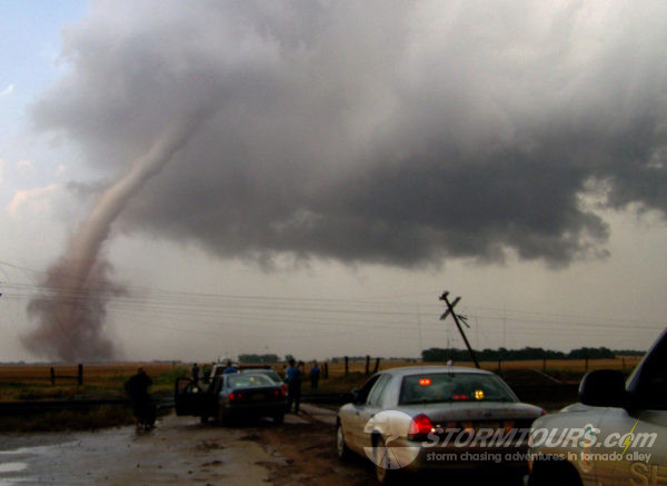
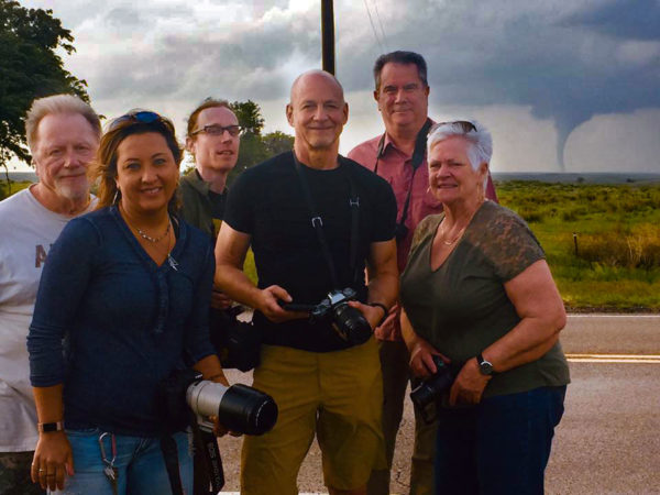
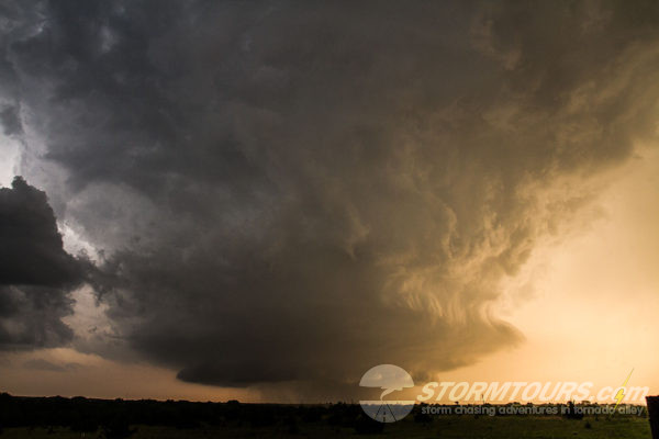
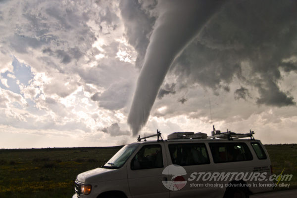
Up close and personal! That best sums up the start to our storm chasing season! We’d love to get close on every tour, as long as it can be done with safety in mind. However, in order to be safe, we need good roads! And as a result, we need to have a clear escape route in mind.
In the early part of the spring storm season, storms are common in the Texas Panhandle. As luck would have it, this area has the best roads in Tornado Alley! In fact, in Texas, most of the farm roads are highway quality. There are a few areas where the road network has limited options, but usually, it’s entirely workable.
This tour starts and ends from Oklahoma City. Each day will start with a briefing of the day’s forecast and potential chase areas. Long drives are also possible on this tour as we will not limit ourselves to just Texas or Oklahoma. Other states that we might chase in include New Mexico, Kansas, Colorado, and Nebraska.
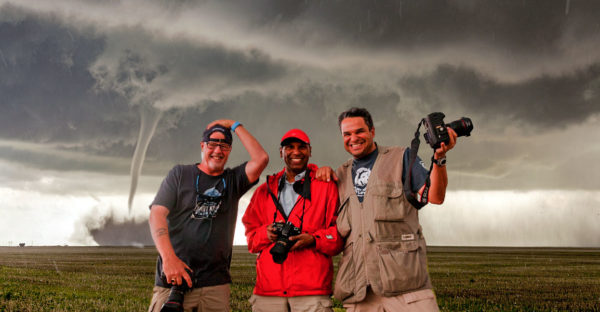
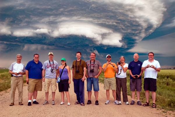
If you want to get close enough you’ll have to duck then this is the tour for you!
May Mayhem Tour
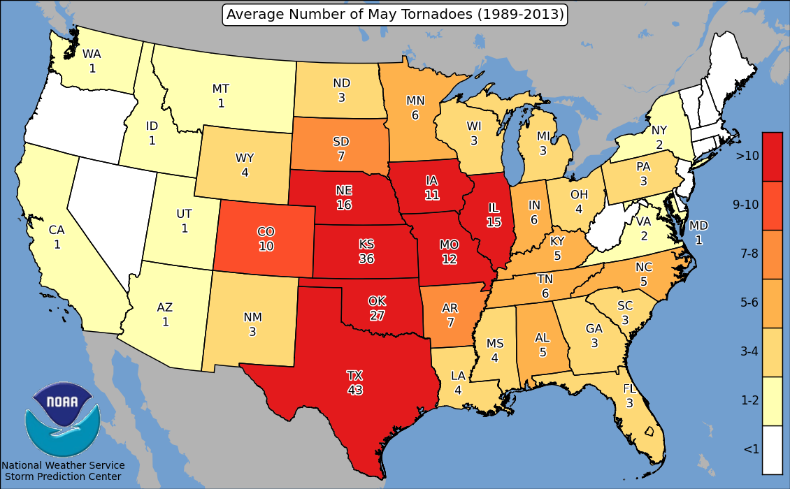
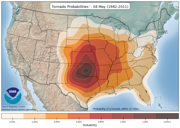
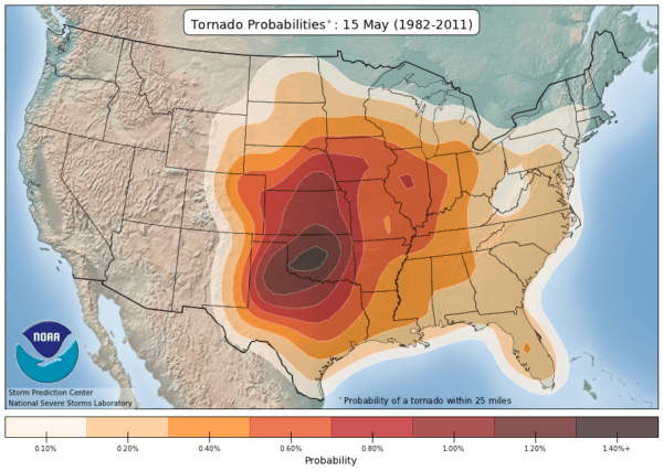
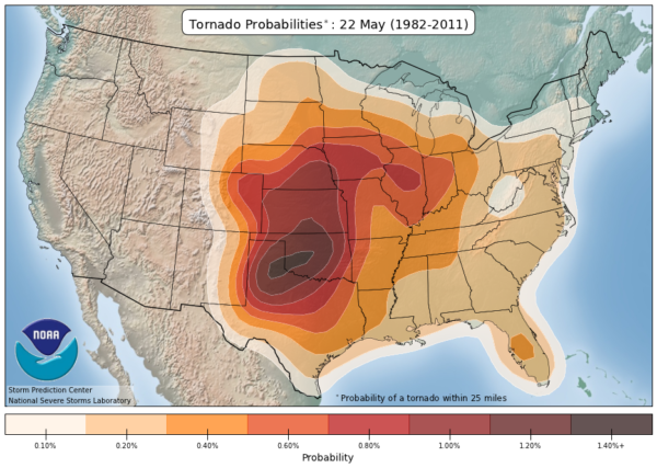
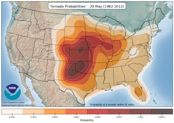
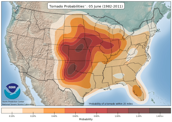
The May Mayhem Tour is one of our most popular tours. Mid-to-late May typically is the time of year when we see the most tornadoes. As the season gets underway, the plains experience numerous low-pressure systems. Each one pulls moisture up from the Gulf of Mexico and into the plains. Typically, by mid-May, there is ample moisture in the Central Plains to provide for massive tornado outbreaks and pure mayhem!
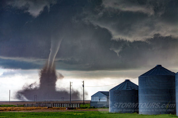
This tour in the past has seen as many as 43 tornadoes in a single week! From slow-moving LP tornadic supercells to fast-moving HP monsters, we’ve seen it all on this tour. Oklahoma and Kansas are common areas we’ll be storm chasing in. Depending on the calendar from year to year, this tour is either a 10 or 11-day storm chasing tour. The general rule-of-thumb is the longer you can chase, the better chances you’ll see more great storms!
Peak Season
Ultimate Tornado Hunt
The Peak Season Tour is our most popular tour. Mid-to-late May typically is the time of year when we see the most tornadoes. As the season gets underway, the plains experience numerous low-pressure systems. Each one pulls moisture up from the Gulf of Mexico and into the plains. Typically, by mid-May, there is ample moisture in the Central Plains to provide for massive tornado outbreaks.
This tour in the past has seen as many as 43 tornadoes in a single week! From slow-moving LP tornadic supercells to fast-moving HP monsters, we’ve seen it all on this tour. Oklahoma and Kansas are common areas we’ll be storm chasing in. Depending on the calendar from year to year, this tour is either a 10 or 11-day storm chasing tour. The general rule-of-thumb is the longer you can chase, the better chances you’ll see more great storms!
This master class tour also includes a series of lectures. Topics include mesoscale convective forecasting, thermodynamic diagrams, and interception strategies. Generally, we teach in the mornings and chase in the afternoons.
Flying Cow Tour
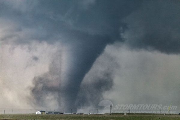
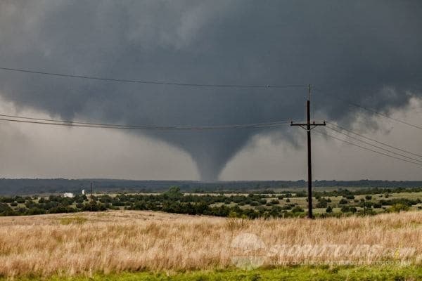
May is the month with the highest number of tornado outbreaks. As the fight between seasons persists, cold air from Canada mixes with warm, moist air from the Gulf of Mexico. This clash of air masses results in the most extreme weather on the planet.
This tour will likely spend most of its time chasing storms in the Southern and Central Plains. Namely, areas of the Texas Panhandle, Oklahoma and Kansas will be visited the most. A boundary separating dry air and moist air, known as the dryline, is commonly the focal point for severe storms.
The downside to this period is that occasionally cold fronts will push the moist air to the Gulf of Mexico. When this happens, it can take several days for the moisture to rebound into the plains. The upside, however, is the frequency of severe storms that are commonly tornadic.
Dryline Magic Tour
** This tour is not available in 2022. We look forward to possibility reinstating it in 2023.
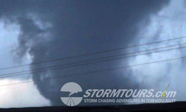
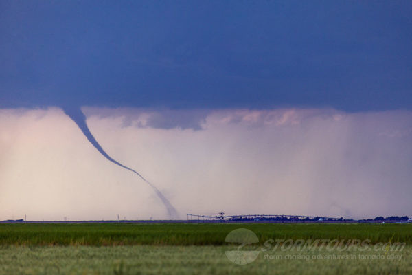
The dryline is a boundary across a continent that separates moist air and dry air. While they occasionally occur in a few places on Earth, the most prominent example occurs in central North America. Specifically, in the Texas Panhandle, Western Oklahoma, and Kansas.
The dryline is often a focal point for severe weather. This boundary typically advances eastward during the afternoon and retreats westward at night. Tornadic thunderstorms often occur along the dryline, especially when it’s moving eastward. There are usually multiple target areas along with them on any given day when an upper-level low is overhead.
This tour starts and ends from Oklahoma City. We will regularly be overnighting in towns such as Lubbock, Amarillo, Woodward or various locations in Western Kansas. Each day of chasing will begin immediately after a morning weather briefing. While this tour can drive long distances, shorter drives of less than 200 miles are more common. It’s also common to essentially wake up in our target area. As a result, we’ll spend the morning discussing whether and chase in the afternoon.
Upslope Photography Tour
** This tour is not available in 2022. We look forward to possibility reinstating it in 2023.
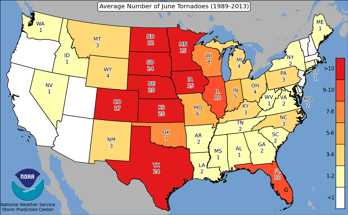
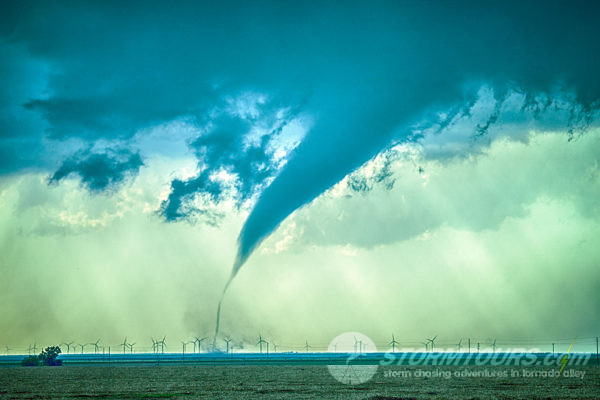
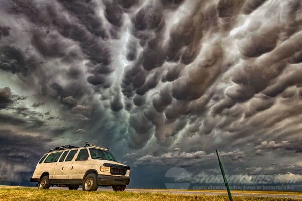
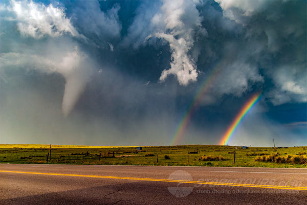
As the seasons progress into summer, low-pressure systems typically are located further north. As a result, the pull the moisture from the Central Plains “upslope” into the High Plains. This upslope flow can lead to almost magical looking storms. Because of the higher elevations, the air is “thinner” and as a result, storms can form with less moisture. This also makes the air less hazy which makes storms in the High Plains perfect for photography!
Colorado has three distinctive topographical features that form tornadic supercells. They are The Raton Mesa, The Palmer Divide, and The Cheyenne Ridge. The Palmer Divide commonly creates a feature known as the “Denver Cyclone Convergence Zone” (DCVZ).
As the air moves up from the terrain, it meets a wind from the west that is blowing off the foothills and creates a cyclonic low-pressure system at the surface. The result of this DCVZ is some of the most breathtakingly gorgeous storms one could ever hope to see!
We have witnessed over a hundred tornadoes in this region over the years and this tour happens right at the peak of the DCVZ activity! We will start this tour in Denver and move upslope on this tornado adventure tour to end the tour in Denver.