May 28, 2013: Monster Wedge Tornado!

May 28 2013 Convective Outlook

Storm chasing often involve a lot of driving. We have averaged about 400 miles per day on this tour so far.

After checking some forecasting data from our Hays, KS hotel, I knew this wasn’t going to be one of those often days.

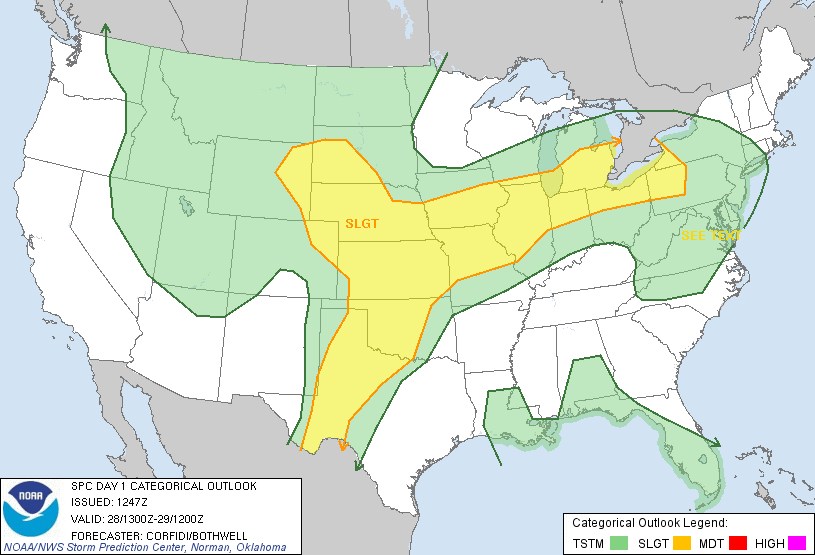
A Slight Risk area that covered most of Tornado Alley was issued by the Storm Prediction Center. Between the large risk area and the short distance to our target area, I received some confused looks after telling our storm chasers we’d only be driving about 100 miles today.

We were basically already in our target area for the day. By early afternoon, we had driven from Hays to Salina, a whopping 95 miles, which took a little under an hour and a half.

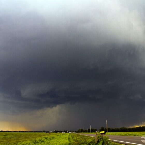
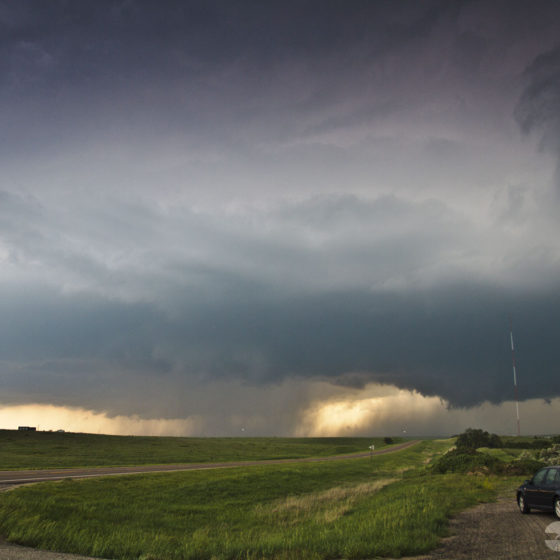
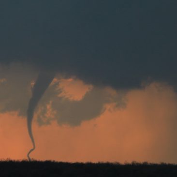
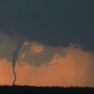
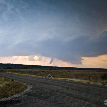
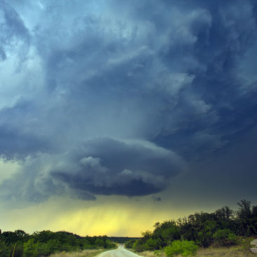
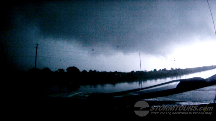
By mid-afternoon, the cumulus field that had developed in advance of the dryline was boiling over our heads. We watched the clouds form that cauliflower-like shape, almost as if a nuclear bomb had been detonated.

One of those updrafts would become the focal point for the storm that created the monster tornado of 2013. We had no idea as of yet what was to become.

The storm chasing tour literally watched the storm appear from a blue sky. We drove another 10 miles to the north and parked. This would become our viewing place for the rest of the day.

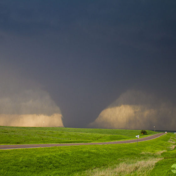
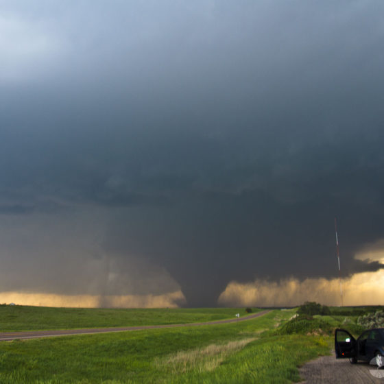
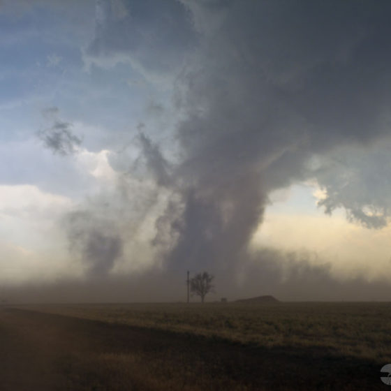
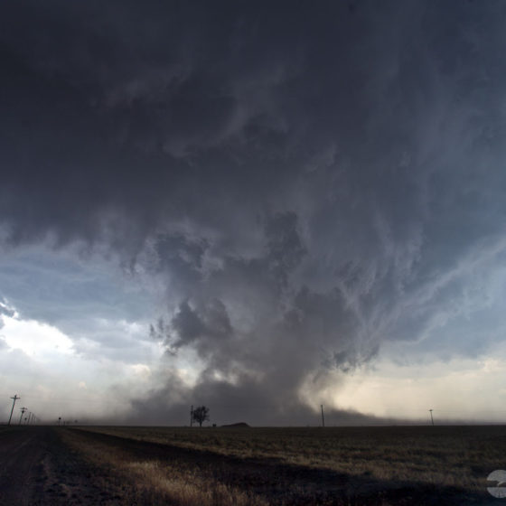
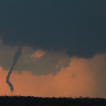
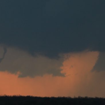
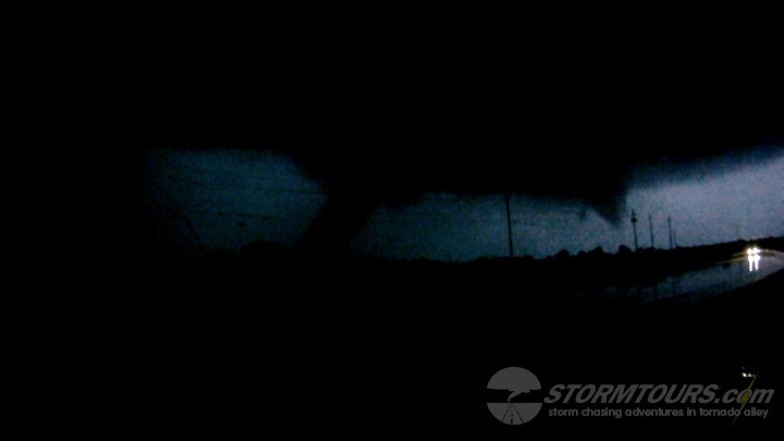
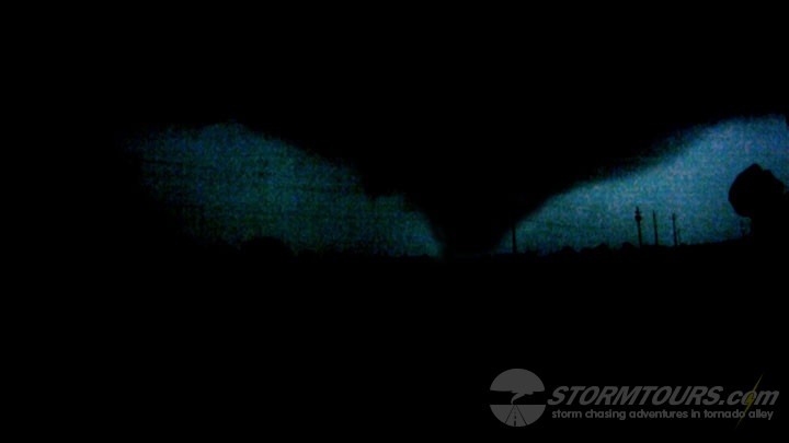
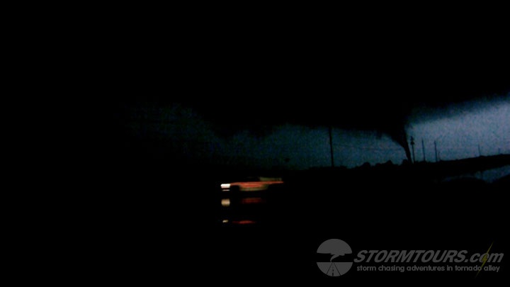
Within an hour, a tornado formed nearly right in front of us. It morphed into a giant wedge, perfectly backlit with strong contrast just west of our location.

The best part, it didn’t move! This storm was anchored and dug its heels in deep, literally spinning over open farmland and giving us the show of the year for more than 40-minutes!

All that patience from a long day of waiting paid off!

An interesting note about this storm: The National Weather Service originally rated the tornado an EF-4, based on wind speed measurements by the Doppler On-Wheels (DOW) which was in the area. However, because tornadoes are offically rated by the damage they cause and since this tornado didn’t have any structures nearby to cause such damage to, it was later downgraded to an EF-3. However, the National Weather Service still maintains that the storm produced EF-4 winds at the surface of 166 mph. Their survey notes are located at https://www.ncdc.noaa.gov/stormevents/eventdetails.jsp?id=443197.

May 23, 2013: Cedar Hill, TX Dusty Tornado

May 23rd included a few surprises. We started the day in Roswell, New Mexico looking for things that were out of this world.

After spending a few hours exploring Roswell, we begin driving towards the day’s target area near Lubbock. A shortwave trough over Arizona was advancing towards the Texas Panhandle.

There was an outflow boundary from earlier convection in Oklahoma that was pushing to the southwest, and dewpoints in the area were in the upper-60s with strong backed winds. MLCAPE values on forecast soundings showed nearly 4000 j/kg, and there was a strong capping inversion.

All we needed was for all these things to meet up at the same place, at the same time, and then break through the cap, and it happened. What we should have been more prepared for, I guess, was the fact that it had not rained in west Texas in quite some time, and with today’s large wind event setting up, we ended up with a haboob and a tornado!

The tornado was brief and happened just a few hundred yards in front of us while we experienced 80+ mph winds along the rear-flank. These winds were dust loaded, it was, to say the least, “insane!”

After the tornado event, we drove into Lubbock just-in-time to watch a wall of dust, that rose at least a thousand feet into the air, envelope the city to near-zero visibility conditions!

May 17, 2013: Eliasville, TX Tornado

Today was unseasonably warm with temperatures climbing into the high 90s and low 100s. Dewpoints were in the upper-60s and low 70s across the target area of Stephens County, TX.

Due to the large temp/dewpoint spread indicated to more of a hail threat rather than a tornado threat. But, nature makes her own rules and a tornado she provided.

We started the day in the Dallas metro and worked our way west towards the target area where the dryline was bulging.

By late afternoon, our first supercell of the day was in-progress and providing us with a great lightning show, as well as some golf ball size hail.

Another cell formed just off the dryline bulge to our west. We were in the process of relocating our position for a better view when we witnessed the first tornado of the day quickly extend from the base and make contact for about 20-seconds before roping out.

Setting up the tripods in record time, we begin watching supercell number two for tornado two, and within minutes, we got it. The ground was very dry which created for a lot of blowing dust.

Thankfully, that happened along the rear flank of the storm and when combined with the light getting lower on the horizon, made for a beautiful reddish contrast backlighting the tornado for our photography.

May 15, 2013: Cleburne, TX Nighttime Tornado

It’s a bit frustrating when you work all day to narrow down your target area only for a storm to form at dusk and create a nighttime tornado event.  We do have a rule pertaining to chasing at night.

If a night chase is going to happen, we must have good data coverage in the area for up to the second radar information and we must have a good road network.  Chasing at night can be extremely dangerous without having good remote sensing capabilities and good roads, dirt roads won’t do, because you can not judge the road conditions ahead of you.

Lucky for us, Texas paves just about every road in the state so the roads weren’t a problem, and there is excellent mobile data coverage so that wasn’t a problem, with neither being an issue, I opted for a night chase and  it paid off.  The imagery below are video stills showing the tornado backlight by the storm’s lightning.  Later validation would show this to be an EF-3 rated tornado with most significant damage just south of Lake Pat Cleburne.