May 28, 2009: Wink, TX Beautiful Supercell & Hail

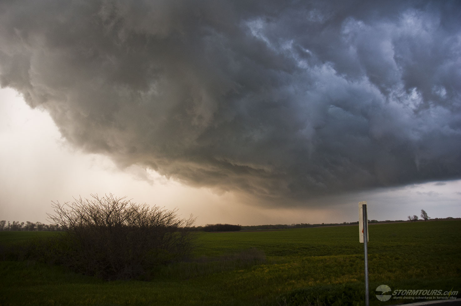
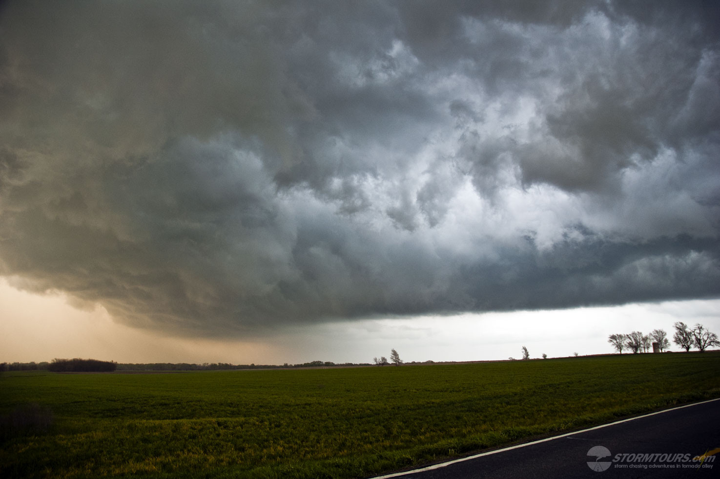
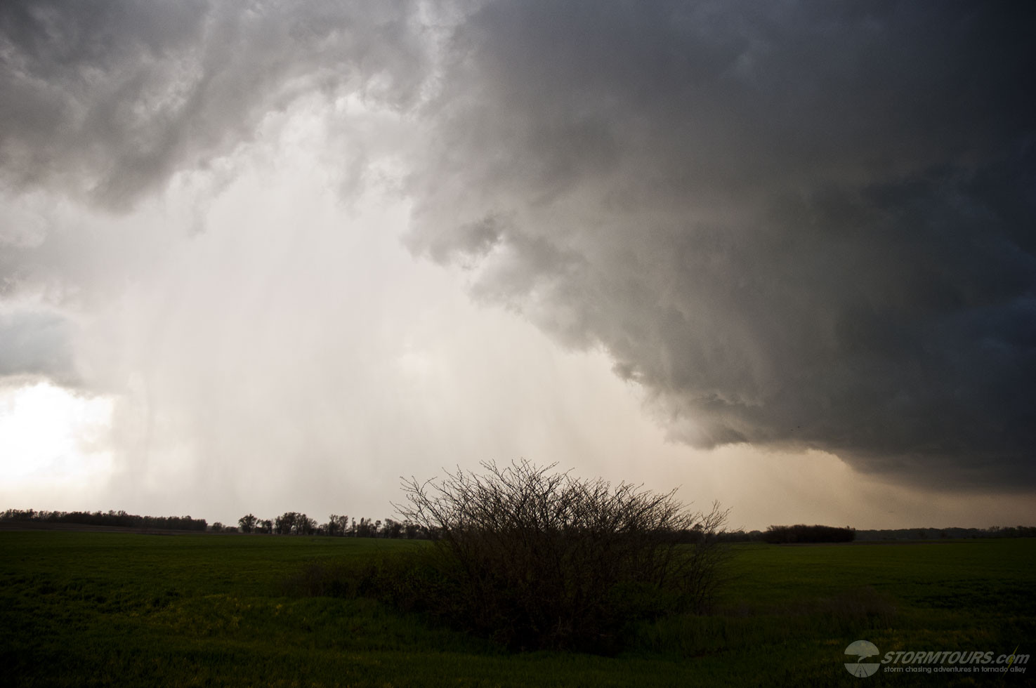
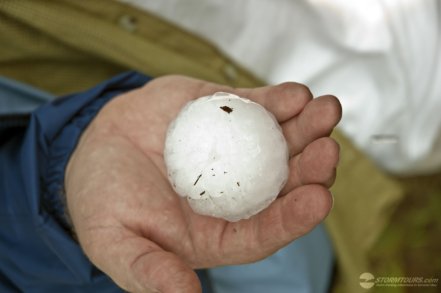
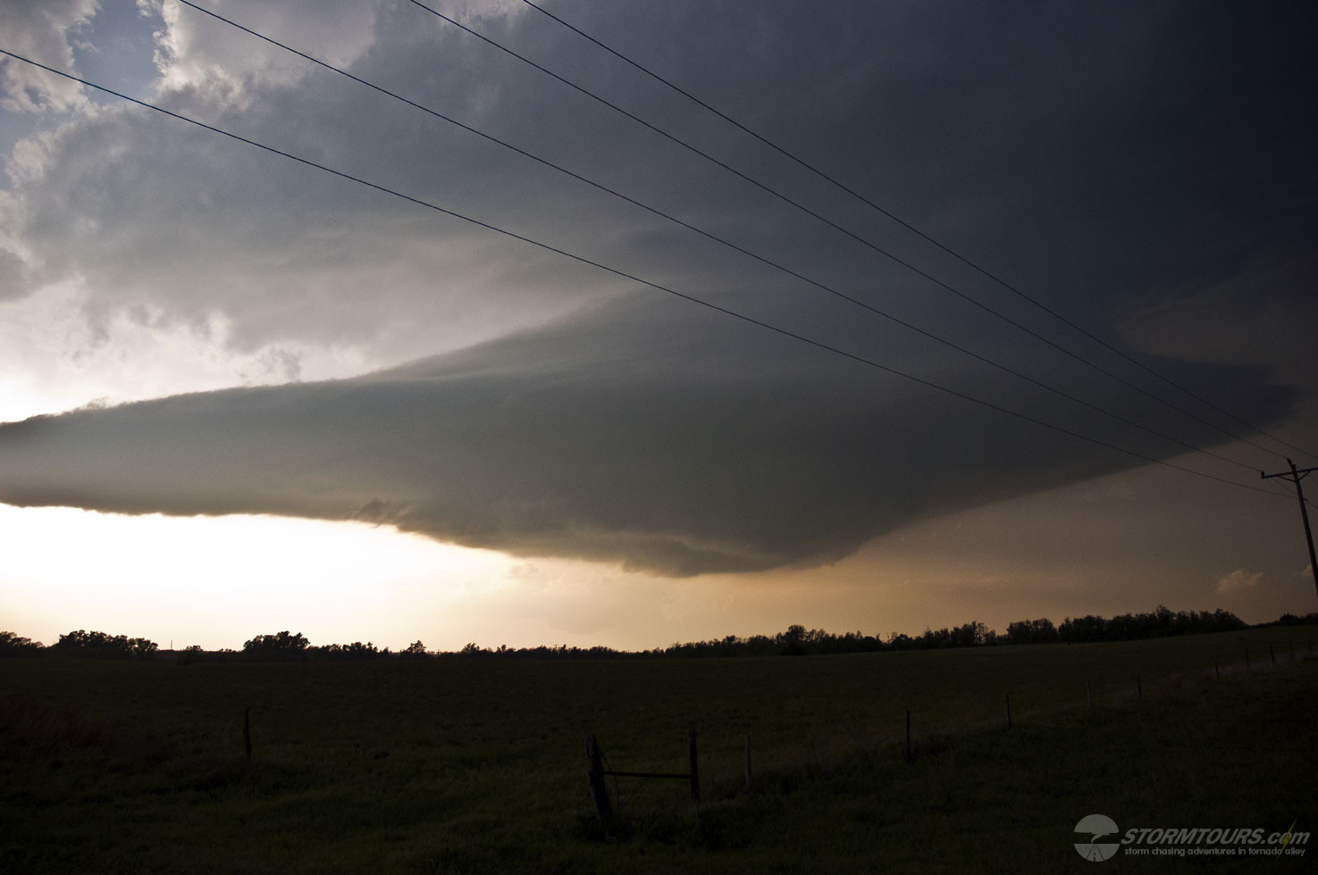
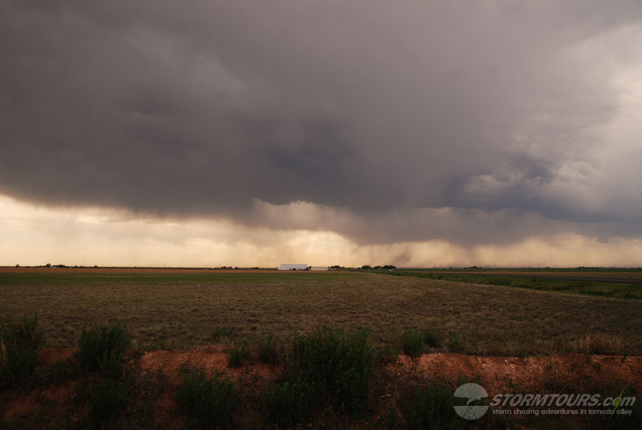
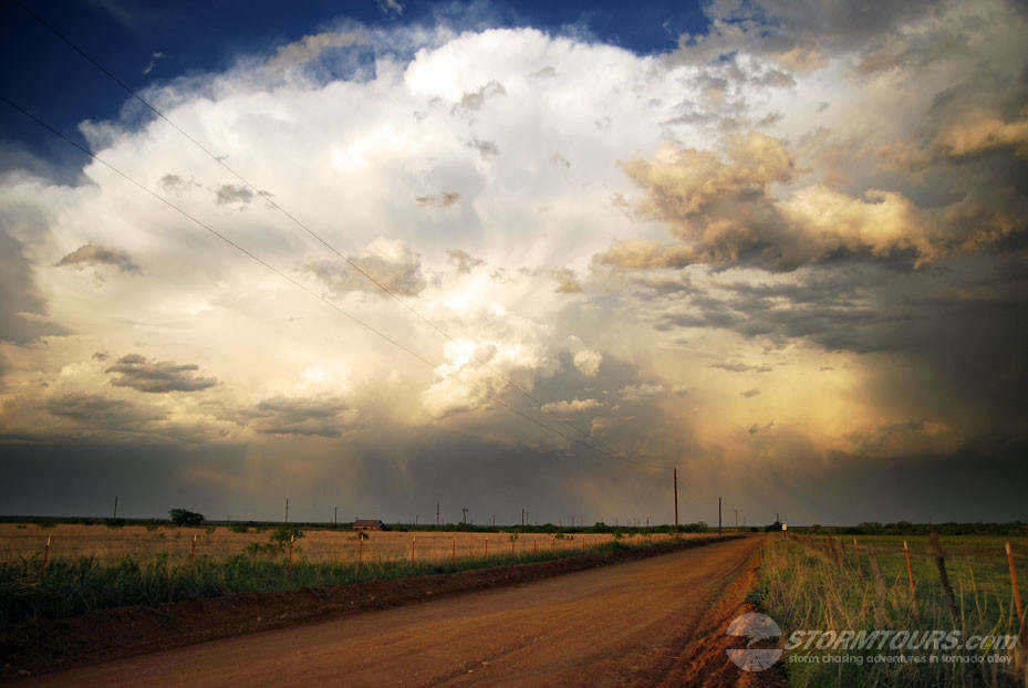
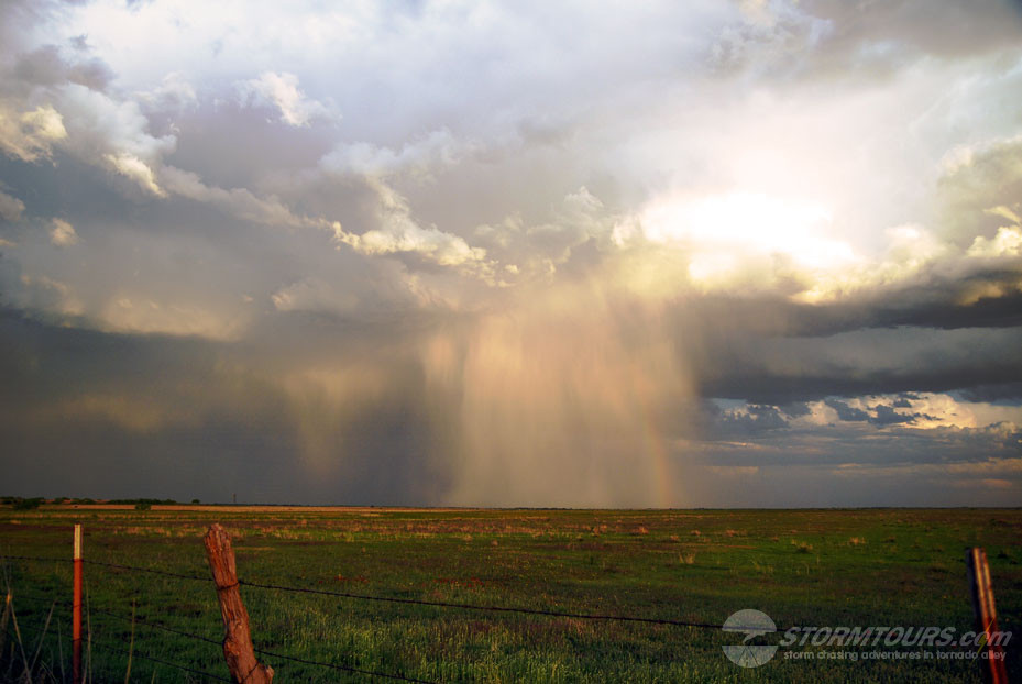
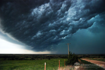
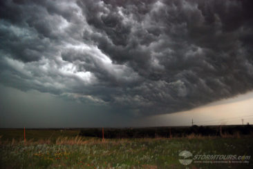
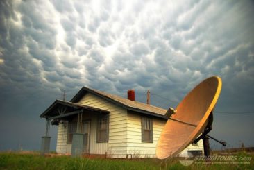
A very interesting day of storm chasing in Texas. We intercepted a beautifully structured supercell thunderstorm that was tornado warned for over an hour but never produced a tornado. Despite that, the storm had some of the most unique base structure I have ever seen while storm chasing. It looked almost like a giant starship was floating through the atmosphere. We also experienced tennis ball-sized hail, which was insane. At the end of the day, we were treated to a beautiful sunset with sun tinted hail shafts.

April 26, 2009: Crawford, Oklahoma Tornado

April 26 2009 Convective Outlook
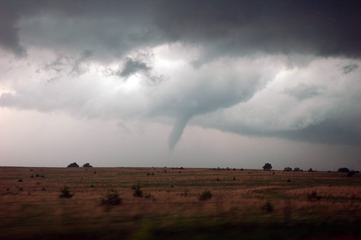
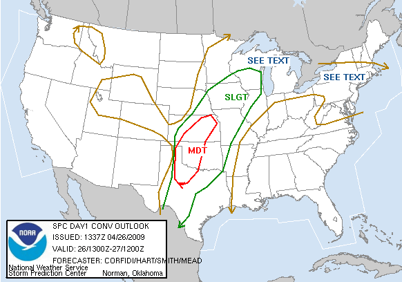
The day began with a forecast that indicated a chance of a tornado or two in western Oklahoma.

A slow eastward progression of a trough over the western states helped maintain a broad current of 60 knot mid-level south to southwesterly flow over most of the southern and central plains. Combined with deep shear over the region, the day appeared favorable for organized and sustained supercells from Lubbock, Texas to Kansas City.

We started the day in Amarillo and drove east into western Oklahoma where we waited. And waited. And waited some more. Until mid-afternoon when the dryline exploded and a supercell rapidly formed.

We followed Highway 33 into Roger Mills County while monitoring a rapidly rotating wall cloud and cascading action on the storm’s base. A funnel of the northern edge of the wall cloud began to take shape within moments, we had a brief tornado over open land.