May 24, 2016: Dodge City Tornado Outbreak

May 24 2016 Convective Outlook* Includes Storm Chasing Drone Video *

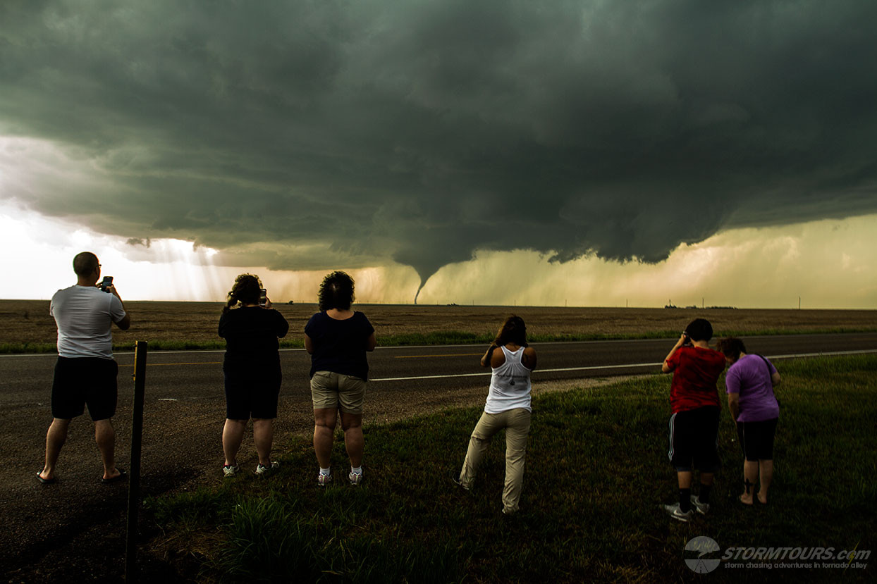
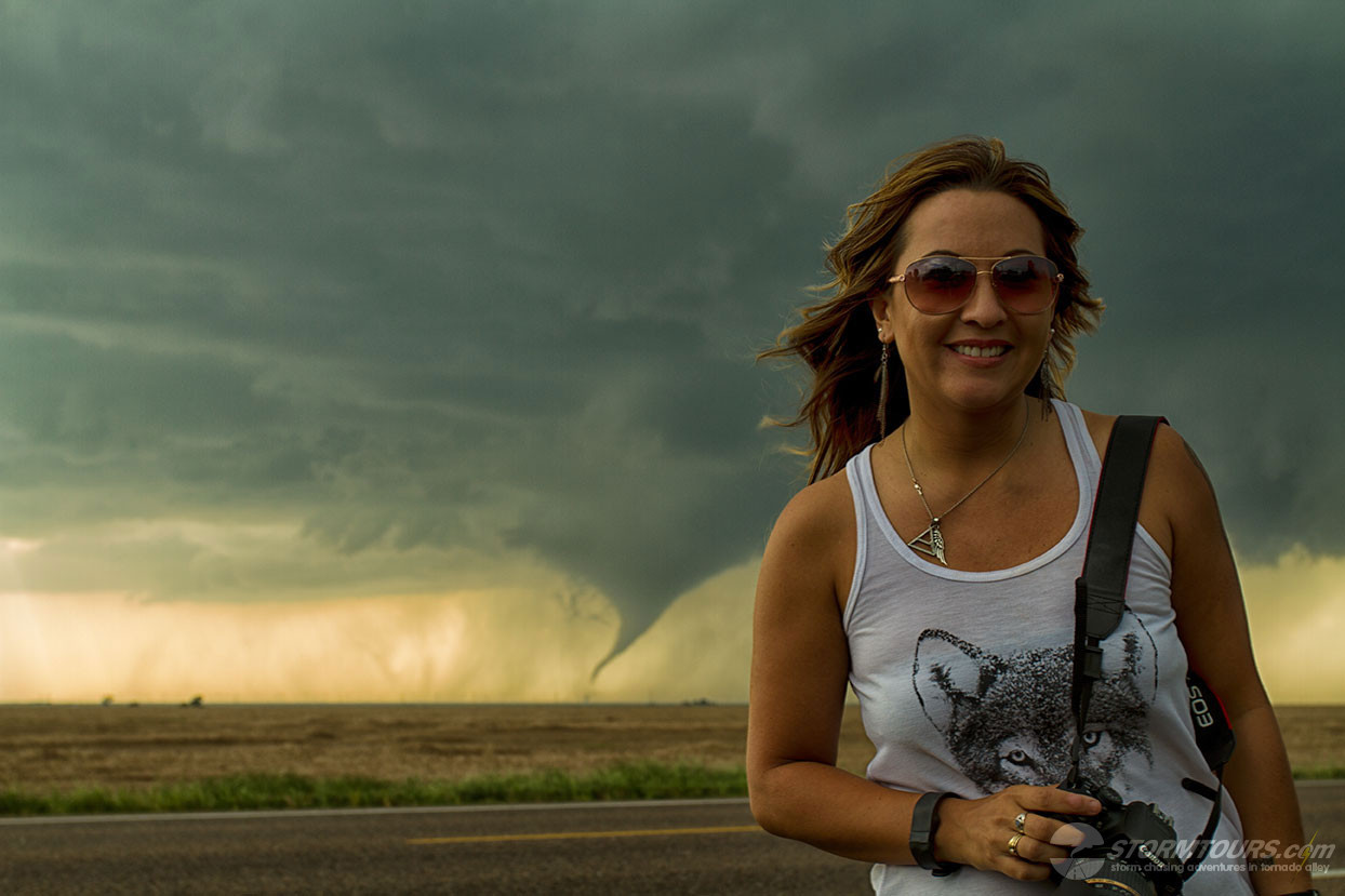
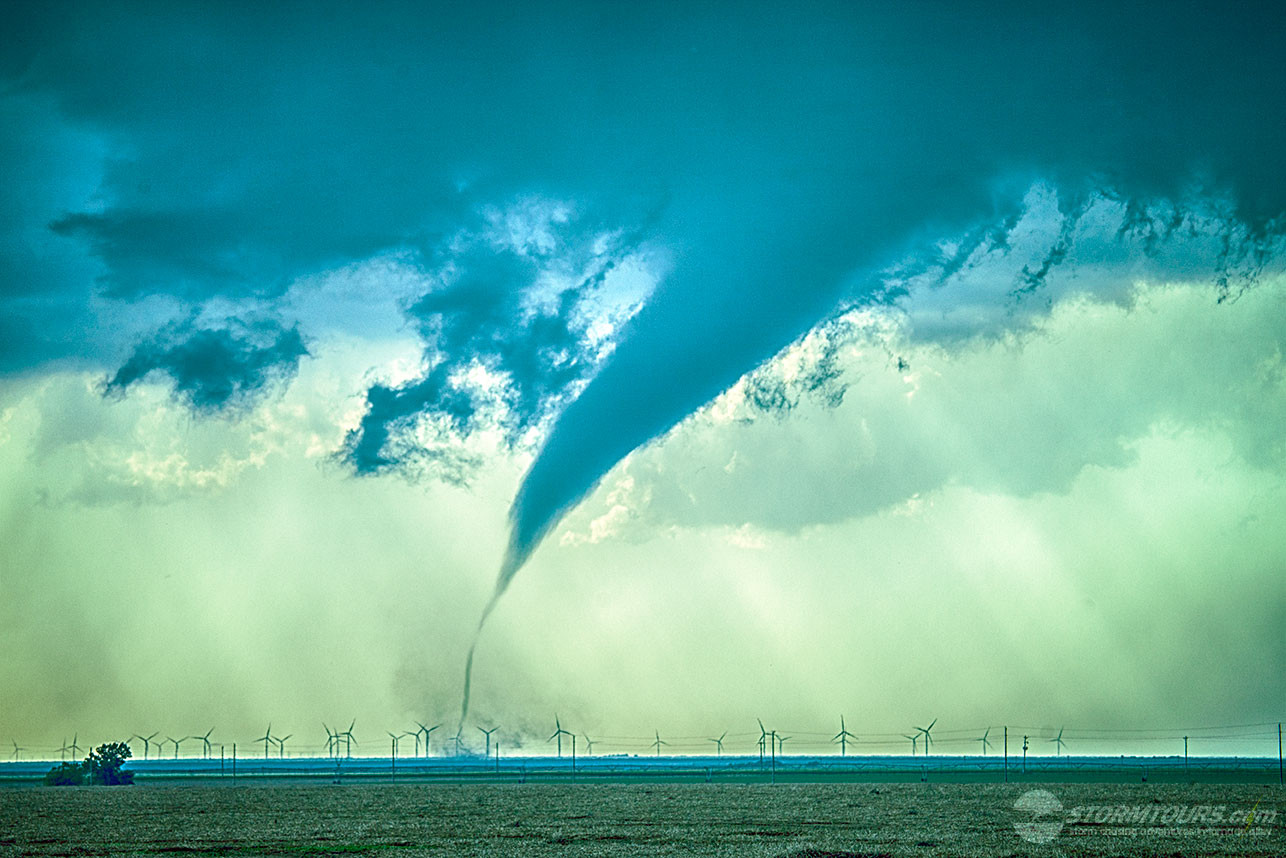
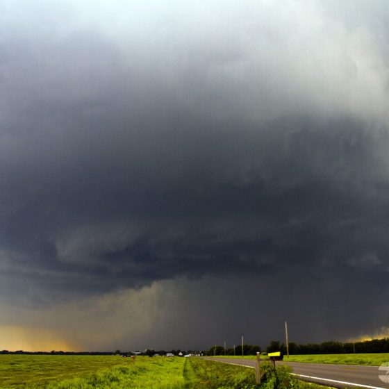
An incredible day of storm chasing during a tornado outbreak event in southwest Kansas near Dodge City. Just today alone, we witnessed over a dozen tornadoes!

I’ll repeat that in case you missed it, today we witnessed at least a dozen tornadoes!

Triple Threat Tornadoes

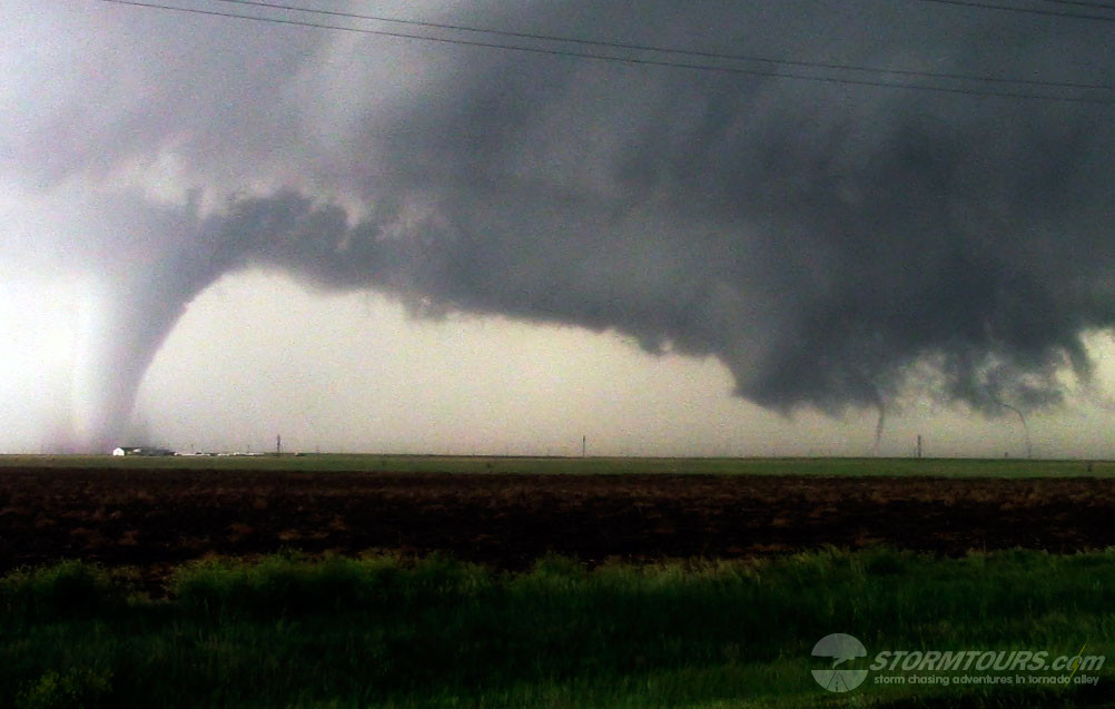
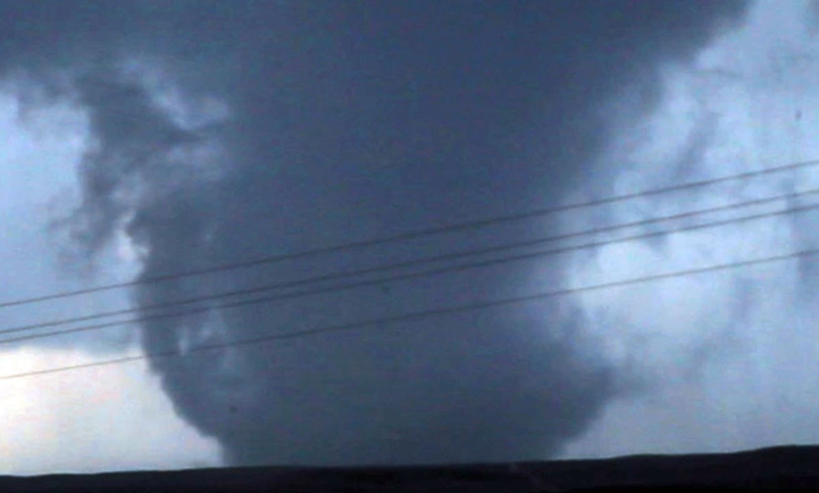
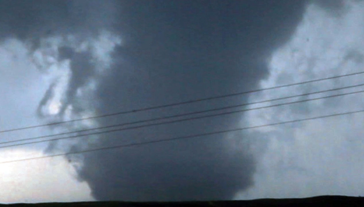
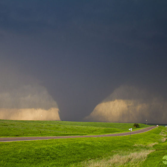
The day actually started with three tornadoes on the ground at the same time from the same storm cell. We were able to document the triple threat tornadoes on video.

In the gallery below, is a frame of the video showing these three tornadoes. Two rope satellite tornadoes on the right, and a large center-of-circulation tornado on the left.

Drone Flight…

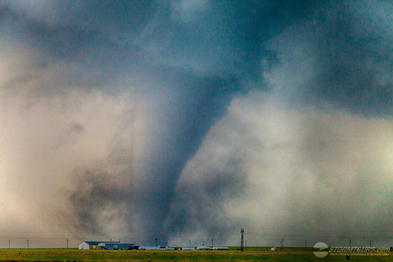
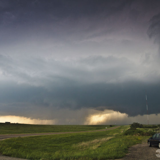
I’ve been waiting all month for the perfect opportunity to attempt to capture tornado footage with our new drone. Today it worked out flawlessly.

While watching the first tornado of the day, I noticed that we were close enough to get a good video with the drone’s wide-angle camera, yet the inflow winds were not outside of our flight limitations.

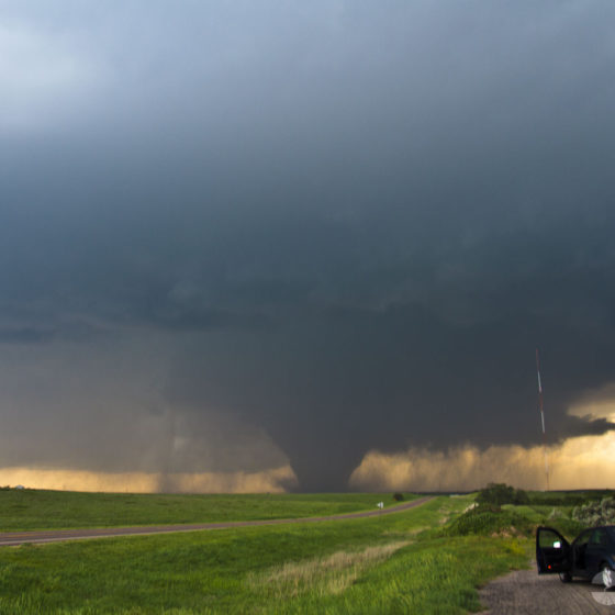
It took about 30 seconds to get the drone launched and it successfully captured nearly five-minutes of amazing video.

It was the first time a storm chaser intentionally pursuing a storm has been able to document the tornado with the use of a drone.

After successfully landing the drone (due to flight level winds increasing) were able to pursue this supercell for almost two hours while witnessing nearly a dozen other tornadoes from it.

May 27, 2015: Canadian, Texas Panhandle Tornado

Today ended one of the most memorable tornadoes of the season. We started the day in Oklahoma City and drove into the eastern portions of the Texas Panhandle with our target being near the town of Canadian. The setup was a May tornado classic for the panhandle, temps were in the mid-80s while the dew point was in the mid-60s with steep low-level lapse, creating strong instability with MLCAPE values in excess of 2500 J/KG. It didn’t take long for the abundant moisture to break through the cap and cumulus towers begin forming. We witnessed the first couple of tornadoes of the day from a distant viewing point of about 10-miles and then moved into a position to await the arrival of the storm (due to limited roads) while it was cycling through a reorganization phase. A few miles before the storm made it to us, it quickly tapped into some deep, moist air and ramped up to the point of tornado insanity.


May 28, 2013: Monster Wedge Tornado!

May 28 2013 Convective Outlook

Storm chasing often involve a lot of driving. We have averaged about 400 miles per day on this tour so far.

After checking some forecasting data from our Hays, KS hotel, I knew this wasn’t going to be one of those often days.

A Slight Risk area that covered most of Tornado Alley was issued by the Storm Prediction Center. Between the large risk area and the short distance to our target area, I received some confused looks after telling our storm chasers we’d only be driving about 100 miles today.

We were basically already in our target area for the day. By early afternoon, we had driven from Hays to Salina, a whopping 95 miles, which took a little under an hour and a half.

By mid-afternoon, the cumulus field that had developed in advance of the dryline was boiling over our heads. We watched the clouds form that cauliflower-like shape, almost as if a nuclear bomb had been detonated.

One of those updrafts would become the focal point for the storm that created the monster tornado of 2013. We had no idea as of yet what was to become.

The storm chasing tour literally watched the storm appear from a blue sky. We drove another 10 miles to the north and parked. This would become our viewing place for the rest of the day.

Within an hour, a tornado formed nearly right in front of us. It morphed into a giant wedge, perfectly backlit with strong contrast just west of our location.

The best part, it didn’t move! This storm was anchored and dug its heels in deep, literally spinning over open farmland and giving us the show of the year for more than 40-minutes!

All that patience from a long day of waiting paid off!

An interesting note about this storm: The National Weather Service originally rated the tornado an EF-4, based on wind speed measurements by the Doppler On-Wheels (DOW) which was in the area. However, because tornadoes are offically rated by the damage they cause and since this tornado didn’t have any structures nearby to cause such damage to, it was later downgraded to an EF-3. However, the National Weather Service still maintains that the storm produced EF-4 winds at the surface of 166 mph. Their survey notes are located at https://www.ncdc.noaa.gov/stormevents/eventdetails.jsp?id=443197.

1 2