We spent the day driving from Oklahoma City to South Dakota with an expectation of a chase in the northern plains on June 19th.
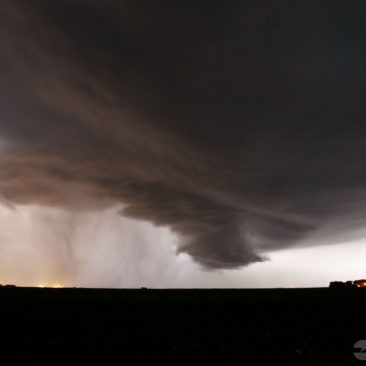
We were settled into our hotel rooms when Tony Laubach checked the radar. He noticed a developing storm about 15 miles northeast of Watertown, SD.
As the sun went down that evening, a low-level jet strengthened. As it did, it carried a moist current of air. A cold front provided enough lift to create an unexpected supercell.
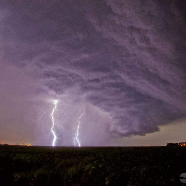
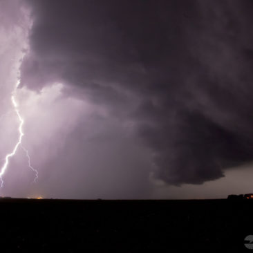
We couldn’t resist, we quickly got everyone together and hit the road in hopes of obtaining some good lightning photos.