2021 Chase Highlights Coming Soon.

It’s been a crazy few years! Due to the pandemic and various travel restrictions in-place around the world, we postponed our 2020 tours. It would have been our 20th “full year” of operations, but it just wasn’t possible to operate since the majority of our customers were not able to travel and we did the proper thing and stayed home. I mean, we really stayed home! Brian didn’t even chase a single day and that was the first year of his adult life that didn’t include a tornado (he’s over the hill now, so that’s a big deal to him).

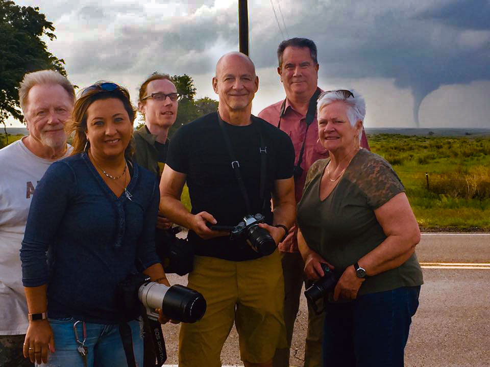
In 2021 we got the wheels rolling again with a limited tour lineup, but we were chasing again nonetheless. It was great to be back out in the openness of the Great Plains once again and after a year around the house, we really needed it! Every tour that we offered in 2021 intercepted tornadic thunderstorms! The “quality” (photogenic-ness) of the tornadoes could have been better. Quite a few of them were short-lived events. Tour 3 (I believe) intercepted a massive wedge in SE Colorado that nearly crossed the state line into the Oklahoma Panhandle. We met a few new people and I hope we made some long-term friendships along the way. All in all, it was just what the doctor ordered (to get our sanity back).

You may have noticed that we’re once again running a trimmed down schedule in 2022. Missing a year really hit us hard and we’re just trying to keep the wheels rolling until the world is once again back to full travel operations. We were hoping that would happen in 2022, but it appears that some countries will still have some limited travel restrictions in-place.

As a result, we do expect a few less customers, so we have opted to cut out of few of the tours, specifically our June offerings as this is the most expensive time to travel in the Great Plains it coincides with the peak of tornado season starting to wind down. We hope to bring back our June tours in a later year, but for now, we believe this is best. If however we receive strong demand to bring back a photography tour in June, it is something that we can certainly put together in a very short amount of time. So, if that interests you, please let us know!

I’ll update the chase logs here in the coming months, there won’t be many, but I have a lot of projects in the works for the time being. I’m still trying to figure out how to denote 2020 since there are no chase logs and we hate just leaving a gap… maybe just “Closed for Apocalypse,” I’ll figure something out. In any event, please chase with us in 2022, we look forward to it!

— Brian and Tam

June 08, 2019: Tornadoes in Northwest Kansas

Convective Outlook for June 8, 2019

June 8th allowed us to continue our tornado streak for each tour of the 2019 season. Today’s landspouts were not the same type of tornadoes the other tours saw, but they were more photogenic.

After a chase day in eastern Colorado, we started today’s chase in Burlington. A potent shortwave trough would shift east from the Rockies into the Central Plains. There was southwesterly mid-level flow of about 40-knots that overspread much of the plains into the Dakotas. The dewpoint temps ranged in the mid-60s ahead of a surface boundary where temps were warming into the upper 80s. As a result, a corridor of decent instability ahead of the cold front developed by midafternoon.

After departing the hotel, we took a short trip into Colby, KS. While at the gas pump, the first tornado warning was issued. The storm developed from our origination point near Burlington. After topping off the tank, we drove back towards Burlington while observing that no tornado was present.

We pulled off the interstate at Goodland, KS to monitor the storm as it passed by. Soon afterward, a new area of interest developed just to our west, still over Colorado and within view. After watching for about an hour, a funnel descended from a flat base just to the north of Goodland. Soon afterward, we could see a small debris swirl on the ground associated with the funnel. This was a landspout tornado and the first of four for the day.

For a brief time, about five minutes, two tornadoes were present. Eventually, the second landspout tornado became more dominant as the first tornado roped out. We followed the storm south and east and witnessed two more tornadoes about 10 miles to the south of Brewster. Aside from the tornadoes, we also saw golf ball-sized hail. And there was a spectacular mammatus field that was amplified by a setting sun.

A day with non-destructive and photogenic tornadoes in open fields was a great way to end our 2019 season!


Video while looking for a *radar indicated* tornado, which would have been the 5th tornado of the day.

May 17, 2019: Tornadoes in Oklahoma and Kansas

Convective Outlook for May 17, 2019

There are lots of reasons to decide on a professionally guided storm tour as opposed to trying the DIY method. The most obvious is having someone with the ability to forecast severe storms. Yes, it’s possible to just drive to a bullseye enhanced or moderate risk area. But, even if an inexperienced person did that, they’d still need experience to successfully intercept a severe storm without injury. Today was a good example of at least the first reason.

We started this tour from Oklahoma City. SPC’s forecast offered two enhanced risk areas. The first covered much of the South Plains in Texas. The second covered most of central Nebraska. I had my doubts that due to our starting point that we could make it to either in time. After performing my own extremely thorough mesoanalysis, I found us a target area. It was, however, outside of a slight risk area.

Here is the risk from a tour operator’s perspective: customers look at SPC data every morning. When a tour operator makes a decision to chase outside of a risk area, they better know what they’re doing. If the chase busts and there are no storms, people get angry. If there is a storm or a tornado, they can’t believe you pulled it off.

Personally, I’d prefer to chase more secondary targets these days anyway. Especially in the middle of May when there is a giant bullseye over an area. The vast number of people attempting to chase storms quite honestly creates additional risks. So, if it’s possible to get severe storms in an area with fewer chasers – I’m in! May 17th was a perfect example.

As stated, we started the day in Oklahoma City because it was the first day of the tour. After a careful mesoanalysis, I advised the group of our options. Texas, where we probably wouldn’t be on time. Nebraska which was straight-up impossible to make it on time. Or, a marginal area in the Oklahoma Panhandle that had rather impressive dynamics.

There was a dryline in play with strong heating along the boundary to get our storms going. However, the deep, tropical moisture we needed for tornadoes would setup several miles east. That’s probably why SPC didn’t extend the slight risk area further south. That said, it appeared a dry punch would move the dryline further east than what SPC expected. If that happened, we’d be in business.

We made it to the Oklahoma Panhandle with time to spare. There were two cells developing when arrived in Beaver County. We were able to take a break from the road and stretch our legs while watching the storms brew. The nicest thing about all of this was that our group was pretty much alone. We had these storms all to ourselves while hundreds of other chasers were all in Nebraska. I sure wasn’t complaining!

As the lee trough at mid-levels began shifting to the east-northeast, our storms became to move with it. Back on the road, we were now chasing a severe warned supercell. The storm was moving primarily north, but it did have an easterly draw to it. If it could tap into the moisture just to our east, I felt like it could tornado.

We followed the storm for about 30-minutes before I noticed a developing wall cloud. That was it, it was taking in the higher surface dewpoints, finally! A few minutes later and we had a beautiful elephant trunk tornado! We did, however, see two other storm chasers in a single car. I was really hoping the tornado would be all ours, but we had to share. What’s fair is fair.

All in all, it was an amazing day with a very pretty tornado. We followed the storm north across the state line into Kansas. Soon after entering Kansas the storm really picked up forward speed moving over open country. It became evident that we were not going to be able to keep up with it much longer.

I found a high spot to park on (there are a few) so we could watch for as long as possible. We ended up seeing a second tornado, very briefly, as the storm moved away from us towards Dodge City. Eventually, the RFD swung around and wrapped the southern view of the tornado in rain.

Another storm was developing in Texas along the state border of the Oklahoma Panhandle. We drove the 30-miles across Oklahoma, entered Texas and continued chasing a second supercell. The second storm had two tornado warnings on it but did not produce a tornado. Still yet, at this point, it was just a bonus storm anyway. It did, however, have some nice storm structure and made for some great photos.

We finished the day at a very authentic Mexican restaurant in the Texas Panhandle and then booked it to our hotel. We have prepared a video showing the radar presentation along with our GPS location marked on the map. Be sure to check that out. We hope to see you on a storm chasing tour, we’d love to share the next tornado with you! Vaya con dios!


June 19, 2018: Tornado near Keenesburg, Colorado

June 19 2018 Convective Outlook
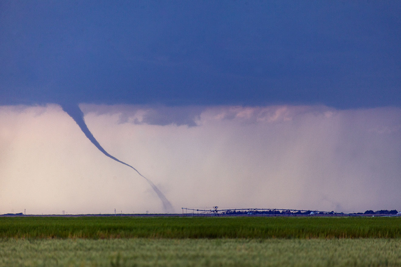
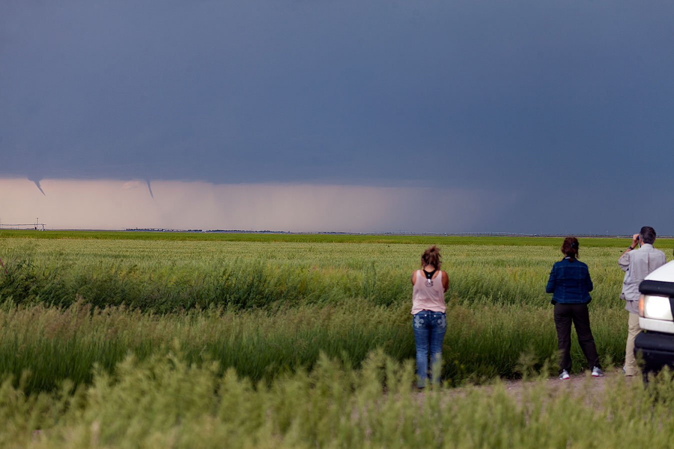
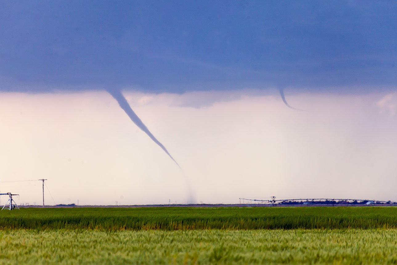
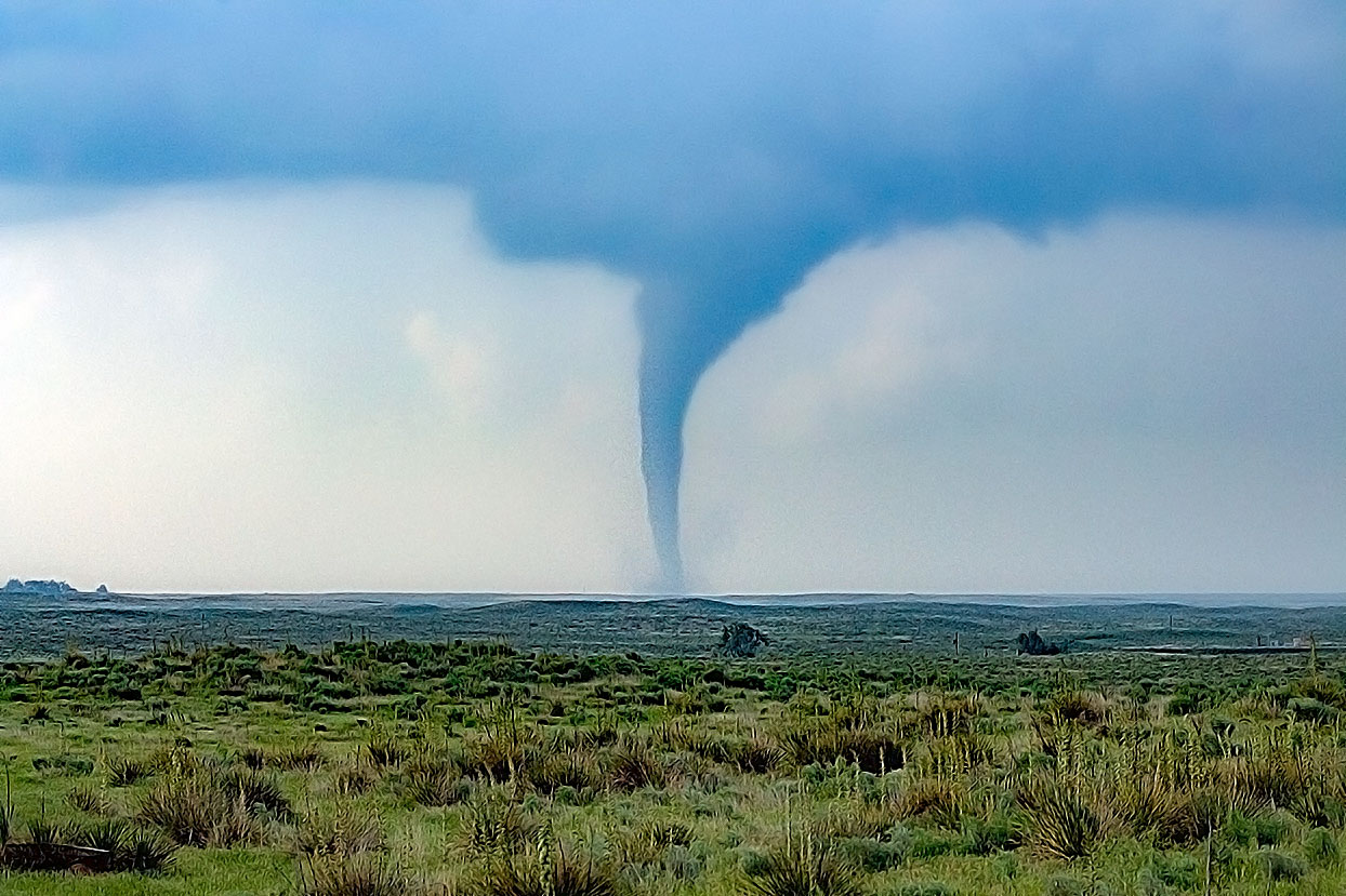
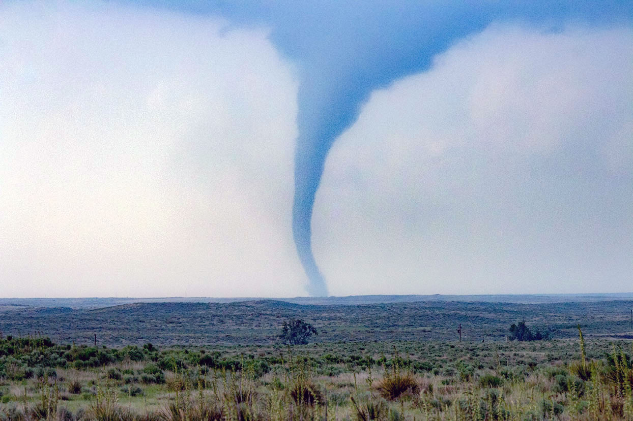
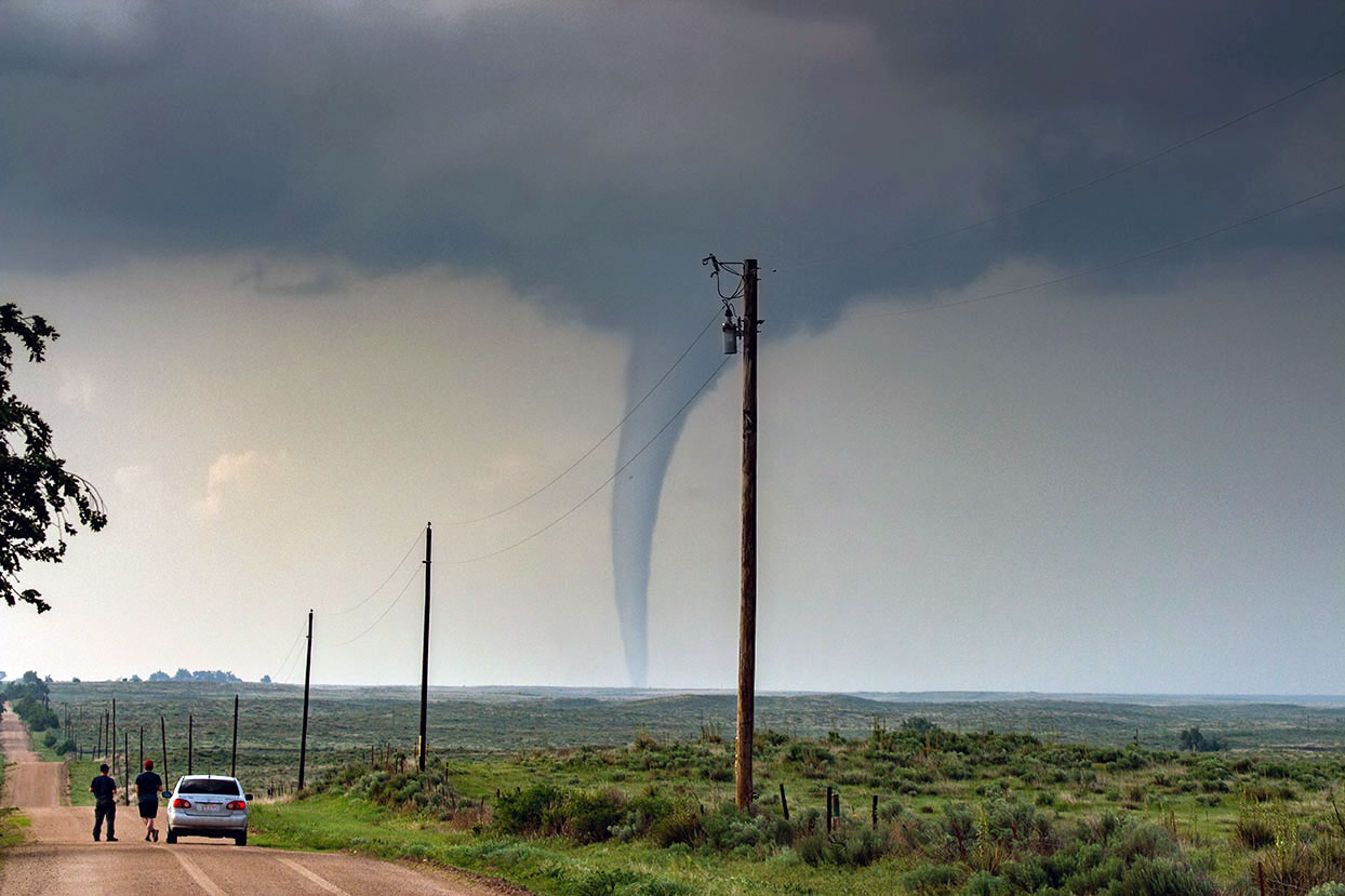
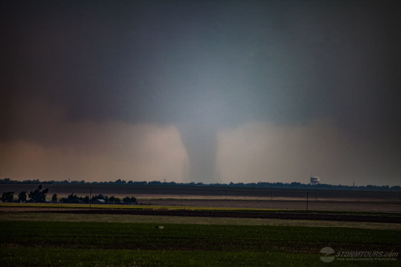
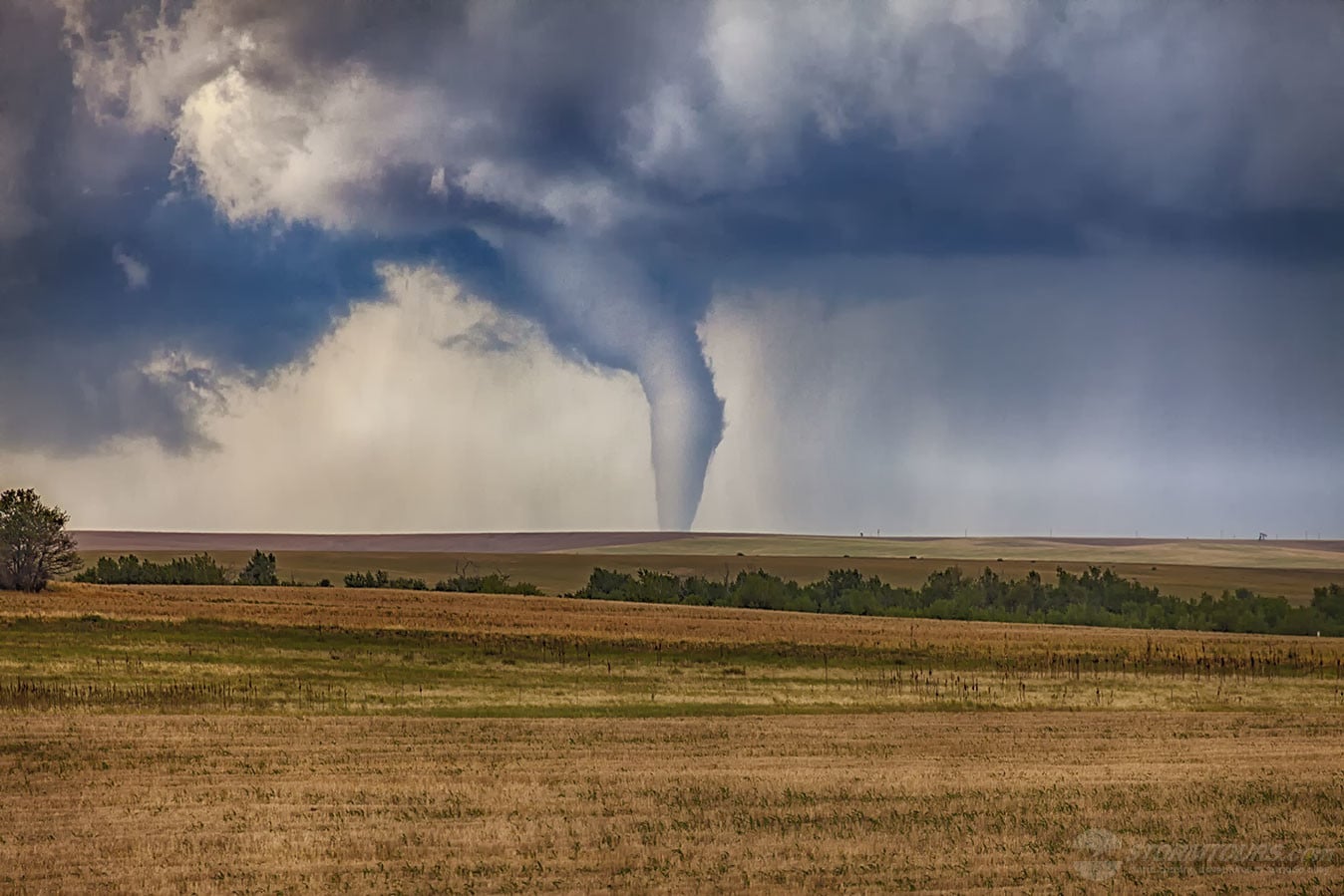
Tour 4 was treated to a great tornado on the last day of the tour an hour north of the Denver metro area near the rural town of Keenseburg.

This was the second-day supercells starting near Boulder took the same path. The evening before this event, we were in Keenseburg experiencing large hail and torrential rain.

In fact, due to the heavy rains on the previous day that soaked the rural dirt roads, we opted to stay a bit further south so that we could not only keep a better eye on two tornadic supercells (one to our North near Keenesburg, and one to our south moving towards Simla), but also keep the vehicles wheels on solid roads.

The Keenesburg Tornado was the first of the day. After it roped out, we quickly moved south and then continued east allowing the storms to chase us all the way to Limon, where we intercepted another tornado.

However, due to it being occluded in heavy rain and our light was quickly diminishing, it was as nearly as photogenic as the earlier tornado, even though we were much closer to it.

May 29, 2018: Southwest Kansas Tornadoes

May 28 2018 Convective Outlook
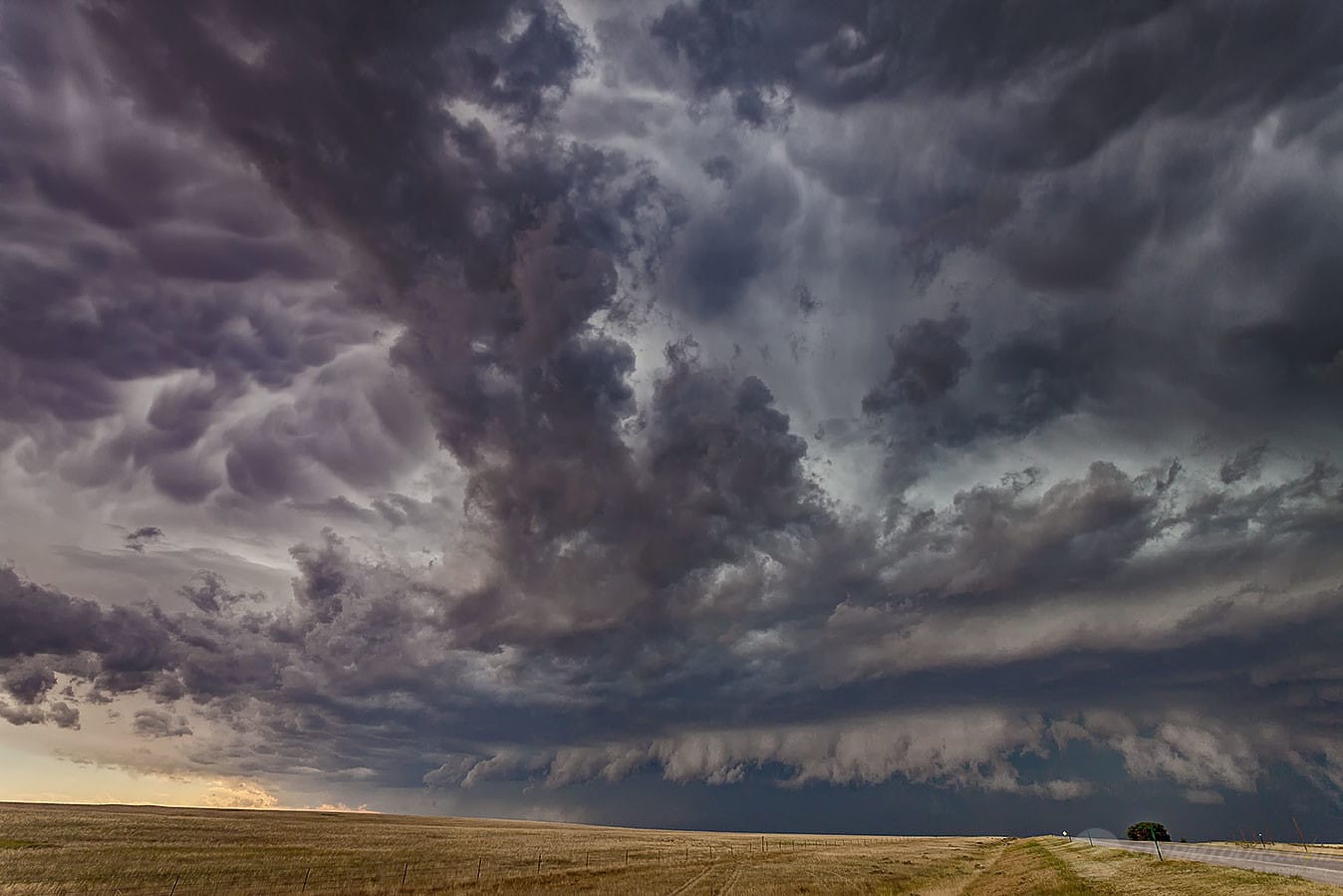
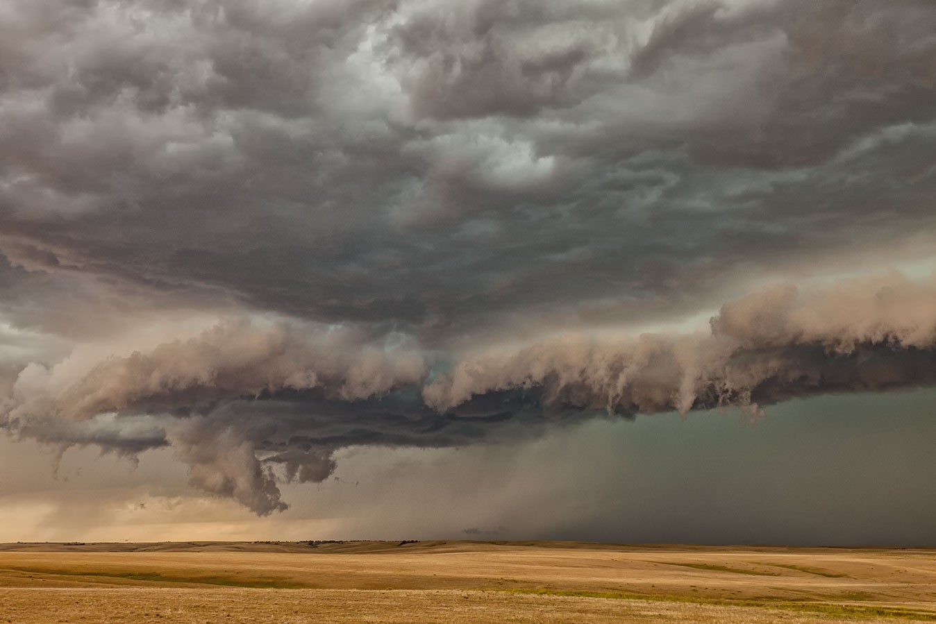
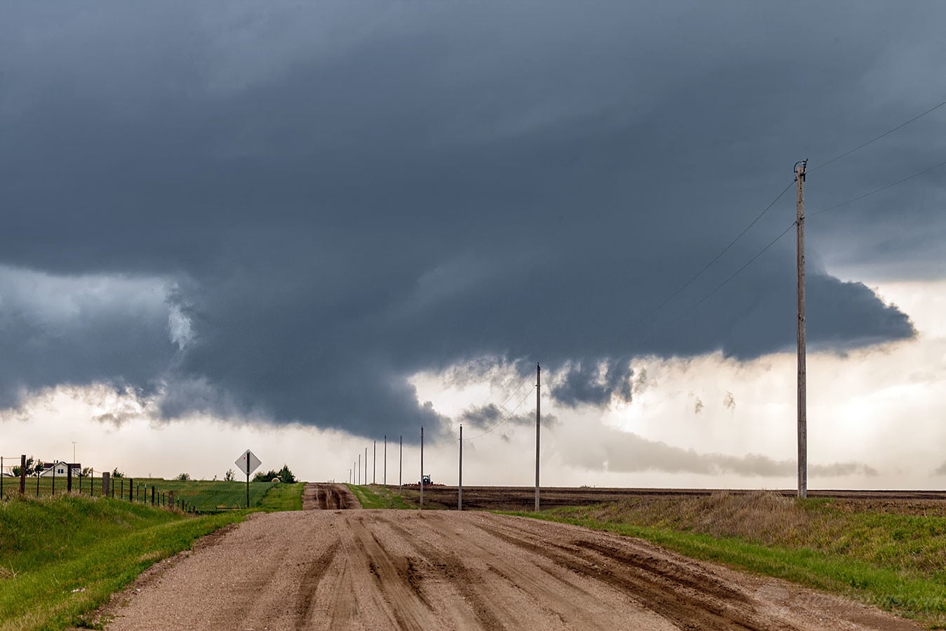
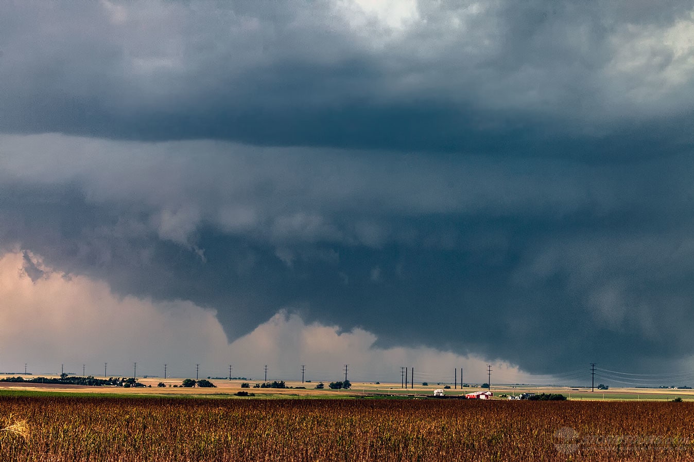
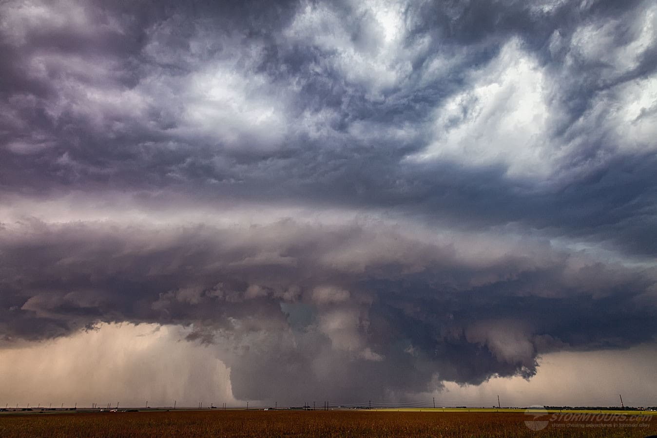
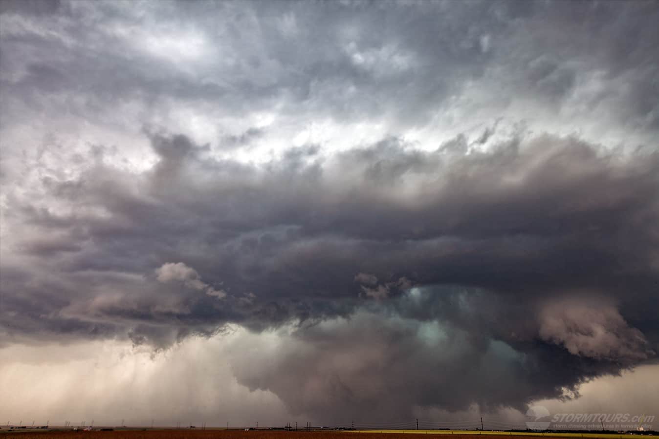
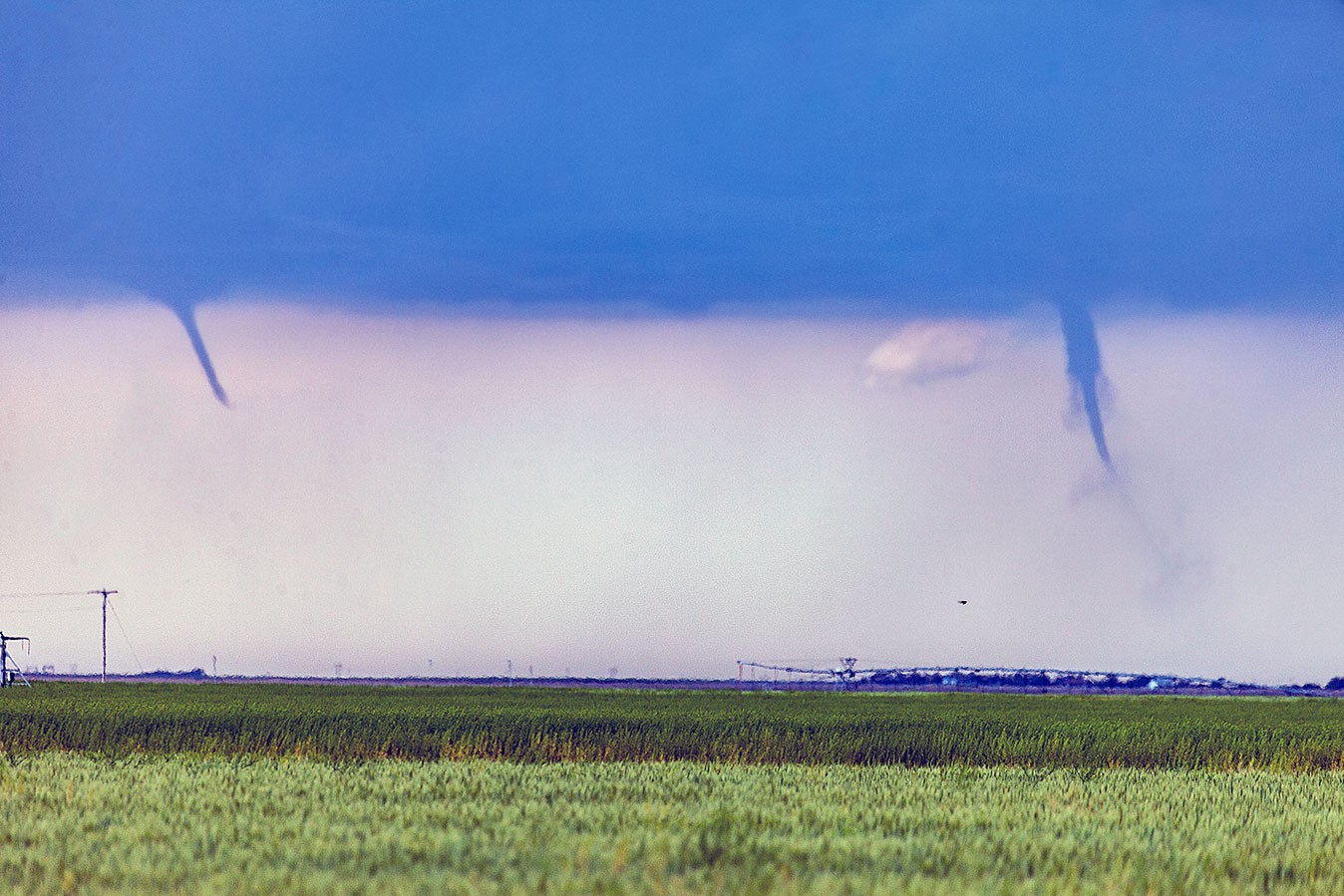
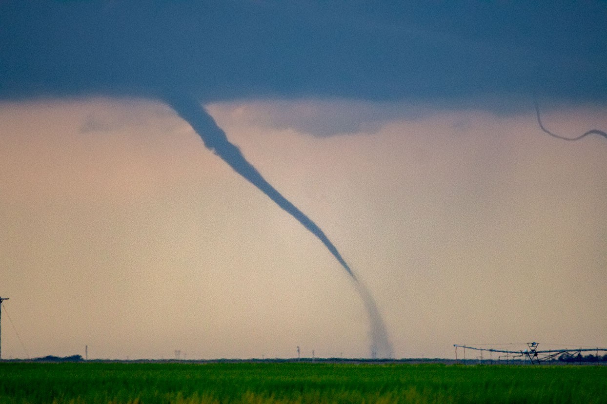
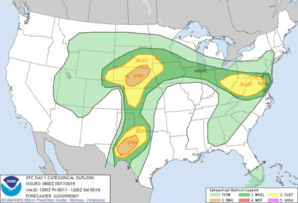
We started this day on Tour 3 in Colby, Kansas up near the Colorado/Nebraska border and headed south with an expected forecast of tornadic storms near the Dodge City, Kansas area.

Our timing was pretty spot on, we stopped in a small town just north of Dodge City to fuel the vehicles up and supercells were already building in the area, there were two of them.

Just as we got back on the highway, the one closest to us began a phase of rapid intensification and produced our first tornado of the day.

Just on the northern limits of Dodge City, we pulled over as Brian thought he saw a contrasting edge hidden in a wet core under the base of the northernmost supercell. Sure enough, with a bit of straining – the elusive Southwest Kansas tornado began to show itself!

It wasn’t the easiest tornado to see and the cameras had a difficult time with it, but it is visible in the photo posted here (the contrast had to be blown out of the photo to bring the tornado out in the photo – this tornado was wrapped in heavy rain, not always visible, but in this case it was).

After the stovepipe tornado roped out, we quickly made our way through Dodge City as the storm was approaching from the west. We had to go all the way through the city to catch our next highway which would take us east and allow us to stay ahead of the storm.

After we were 10 or so miles ahead of the storm, near a small unincorporated town named Kingsdown, we stopped and set up the cameras. We now had the more southern supercell heading straight towards us and it was looking better than ever!

We decided to let the storm pass just to our north and as it did, it produced an incredibly low hanging wall cloud that was quickly rotating. The entire base of the storm seemed to be dragging the ground, literally about a one-mile-wide area of rotation right in front of us.

It’s difficult in these situations to see any specific spin-ups on the ground, but the entire rotating base had basically become a giant multi-vortex wedge tornado! The tornado report from 2235 confirmed the tornado: https://www.spc.noaa.gov/climo/reports/180529_rpts.html

1 2 3 4 15