May 21, 2016: Kansas Sunset for Storm Chasers

May 21 2016 Convective Outlook
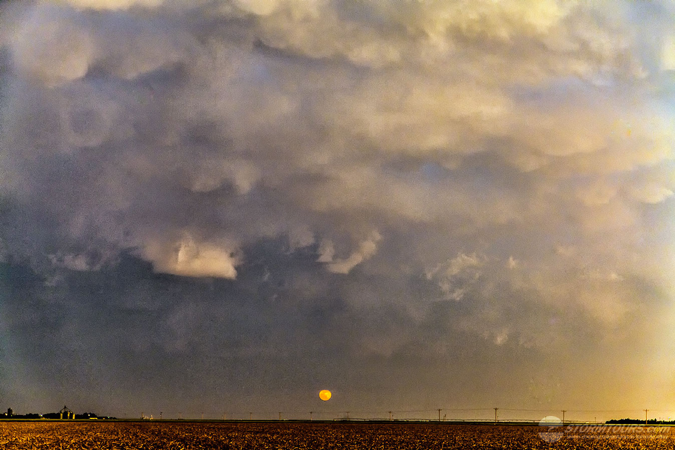
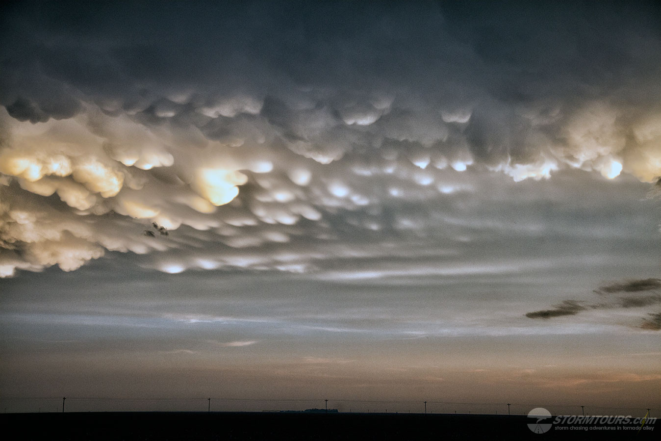
On May 21st the storms were few, but the storm chasers got an amazing sunset!

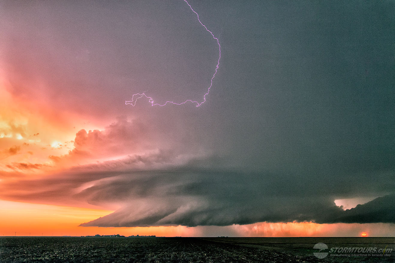
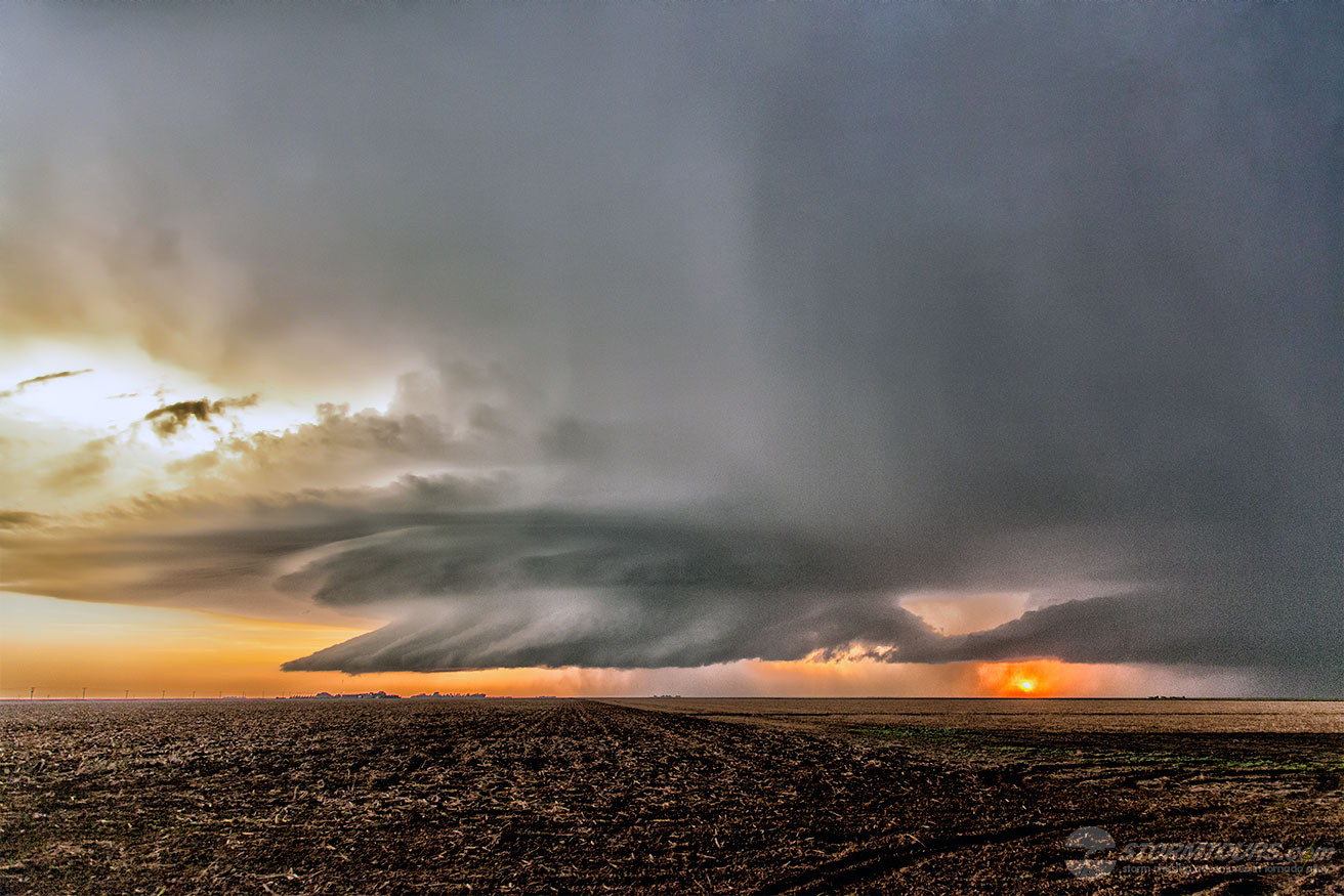
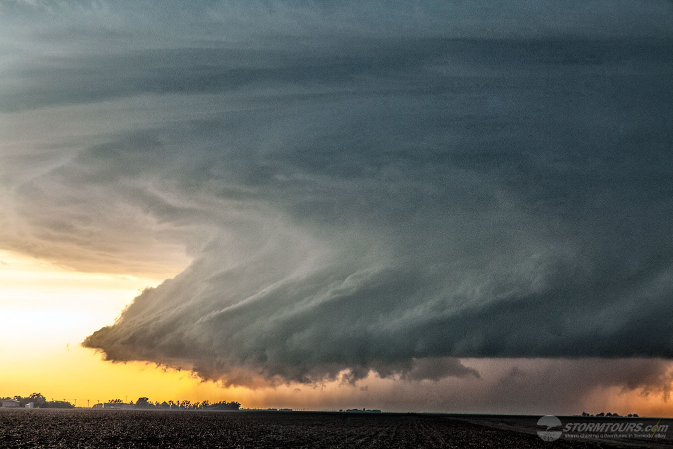
What started as a somewhat messy cluster of storms eventually transformed into one of the most beautiful supercell thunderstorms I’ve seen in the Great Plains in more than 25-years!

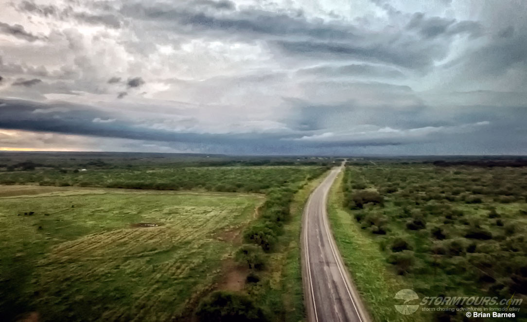
It was a fairly classic triple-point set up, very common in western Kansas. Warm and moist air flooded into the region from the south as a dry line strengthened near the Colorado-Kansas border.

The dry line is a boundary between dry and moist air, acting as a conduit for storm formation. In addition, a warm front draped across the area.

The warm front helped turn a mess of storms into a more focused zone of intense activity. From there, a magical scene was born.

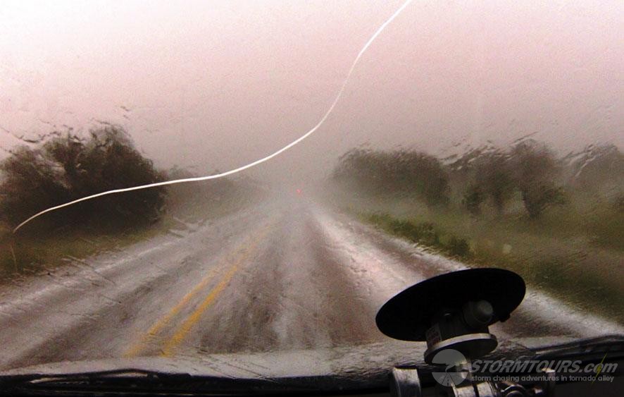
We intercepted one tornado from this storm, but it was difficult to see from our vantage point due to being rain-wrapped. There were a lot of storm chasers out.

The big show, however, was the supercell structure of this incredible storm! I decided to go back east and set up for some time-lapsed video since the storm structure was intense. As I was shooting video, we were getting pelted with golfball-sized hail.

By far, this was one of the prettiest supercells I have witnessed, the sunset just topped off the vista. This is the reason why we chase storms! I could have stayed in that moment forever.

May 16, 2016: Fort McKavett, Texas Hail Storm

An exciting day of storm chasing in south-central Texas, which ended with a busted windshield due to hail! We started in the day in Lubbock and worked our way south towards Eldorado where we intercepted a decent looking, well-structured supercell with a rotating base.   Hopes were up as the storm began to lower and built an intense-looking rotating wall cloud, but this storm wouldn’t produce a tornado, even though it tried very hard to do so!

Our road options weren’t “picture perfect,” but the storm was traveling due east, so we traveled along with it on highway 190 towards Menard. Near Fort McKavett, the storm began a more southeasterly track and crossed the highway in front of us.  With little road options open, our only choice was to either lose sight of the updraft base, or punch through the core of the storm to advance our position to the next available south road option — we decided to take the adventurous route and 10 minutes later, the windshield in the lead chase van was completely destroyed by hail, which also completely covered highway 190!

It became obvious after punching through the storm that it was going to get away from us as it gained forward speed and moved over the South Texas Hill Country. We decided to fly the drone and shoot some video from the air as we parted ways with the floating icebox, then headed back into San Angelo and set up an appointment for a new windshield.

1 2