June 20, 2012: Northeast Colorado Hail Storm

June 20 turned out to be a fun day with hail covered roads in Colorado. With most of the focus for severe weather in the Great Lakes region out of our reach, we ran to the high plains and caught a supercell that developed in moist southeasterly upslope flow beneath a northwesterly flow in the mid and upper levels.

We intercepted three supercells, including a beautiful low-precipitation supercell after dark that was fun to photograph due to the insane amounts of sheet lightning within it.

June 18, 2012: Manley, Minnesota Supercell Lightning

We spent the day driving from Oklahoma City to South Dakota with an expectation of a chase in the northern plains on June 19th.

We were settled into our hotel rooms when Tony Laubach checked the radar. He noticed a developing storm about 15 miles northeast of Watertown, SD.

As the sun went down that evening, a low-level jet strengthened. As it did, it carried a moist current of air. A cold front provided enough lift to create an unexpected supercell.

We couldn’t resist, we quickly got everyone together and hit the road in hopes of obtaining some good lightning photos.

May 21, 2012: Adrian, Texas Tornadic Supercell

This was one of those days where a storm chaser can do pretty much everything right, get within a mile of a tornado and still not be able to see it due to the rain under the base and the terrible road network.

We started the day in Salina, Kansas and made the long journey to the Texas Panhandle. The day had tremendous potential.

A warm front lay across the Texas Panhandle with a dryline intersecting it southwest of Adrian. By late afternoon, a supercell formed and moved along the warm front.

It quickly became severe and tornado warned. Although reports of a tornado came in, we were directly under the circulation and only experienced rear-flank downdraft with a large amount of dirt being kicked up.

It’s quite likely that someone mistook the dirt being lifted by the RFD as a tornado and called in an erroneous report.

The storm moved northeast and became very high based and eventually died. By this time, we saw the tail end storm rapidly intensify and nearly anchor, so we blasted back southwest and arrived as the tail end supercell became intensely tornadic.

The supercell was well matured and the updraft base was completely wrapped with heavy rain. Unfortunately, the road network wasn’t in our favor and it was impossible for us to safely get a look into the notch of this incredible storm.

June 16, 2011: Oshkosh, Nebraska Supercell

June 16, 2011 Convective Outlook

We began our day in Colby, Kansas, often referred to as the Oasis of the Plains. With the only Starbucks between Denver and Salina, Kansas, we made sure we topped up before leaving town! The most important part of a storm chaser’s morning is coffee after all.

A warm front was moving through the Nebraska Panhandle and had limited moisture behind it. Despite the large slight risk area issued by the Storm Prediction Center, this boundary seemed to be the best focal point for today’s storms.

Another problem the day we faced today was surface heating. Most of the region was cloudy and littered with reminments from the previous day’s storms. Without good surface heating, getting a storm to get beyond  severe seemed unlikely.

We drove to Goodland, then north towards Nebraska. A line of storms was already in-progress near the Interstate-80 corridor. Once those storms passed the area and begin to die, they kicked an outflow boundary back to the southwest. That boundary began the new focus for storm development as it would help create additional lift.

At 6:35 pm, a storm to our west went severe and it looked nice! Tornado probabilites were low, but this storm was a photographer’s dream! We photographed lightning as it moved over open wheat fields.

May 29, 2011: Cawker City, Kansas Supercell Hail Storm

May 29 2011 Convective Outlook

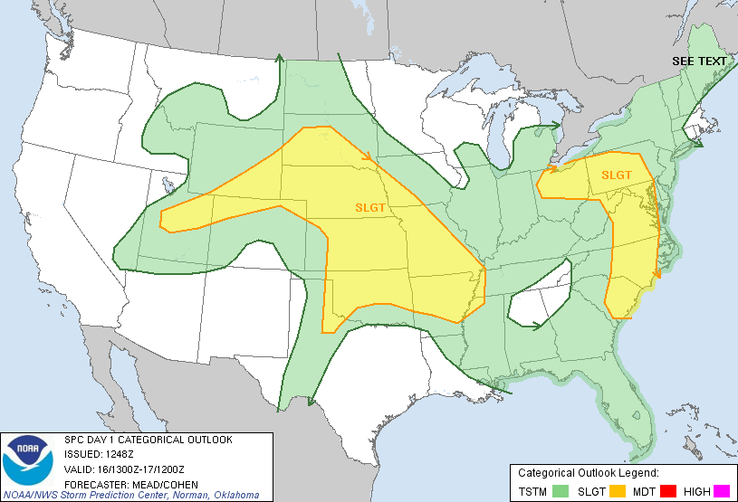
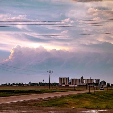
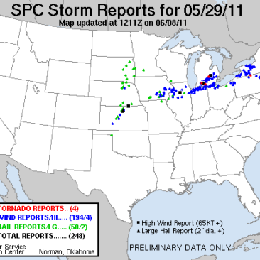
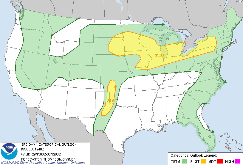
The Storm Prediction Center issued a slight risk in western Oklahoma on May 29, 2011. After looking at numerical model data, we picked a target area well outside of the slight risk area. The day brought us to Cawker City, Kansas.

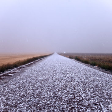
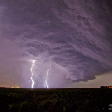
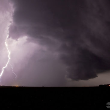
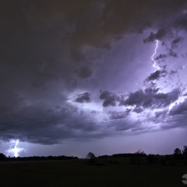
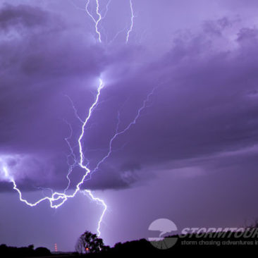
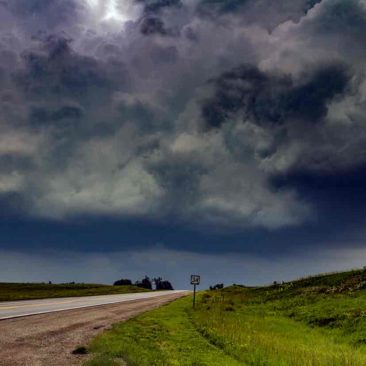
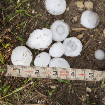
Anytime we pick a target area outside of an SPC risk area, our customers get concerned. Today was no different. As it turned out, SPC received no reports of severe weather in the slight risk area along the dryline and we ended up with rotating thunderstorms that produced golfball-sized hail.

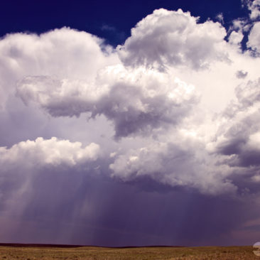
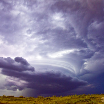
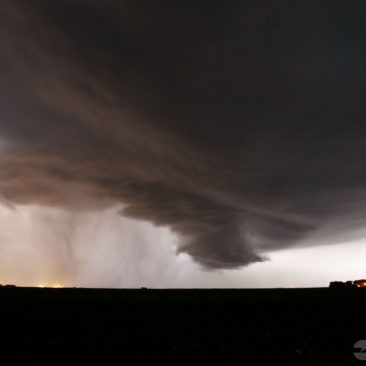
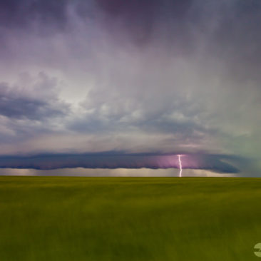
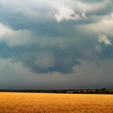
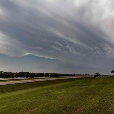
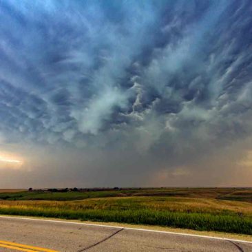
At one point, we had a nice supercell with a distinctive lowering. As a result, it tried hard to produce a tornado but never did.

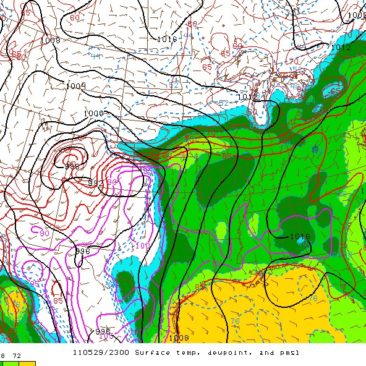
To sum up the mesoanalysis, there was a surface low over southeastern Colorado. A southern low-level jet of about 10 knots was over much of central and eastern Kansas. A dryline was in-place near just west of the I-35 corridor and a surface warm front was pushing north from near Interstate-70.

Backed Surface winds were turning sharply east near Salina. As a result, there were two possibilities, either the dryline or the convergence zone northeast of the low. We picked the convergence zone. With limited heating along the dryline, it didn’t seem like a good option.

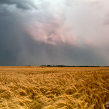
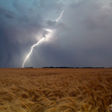
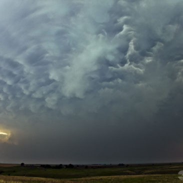
All of the day’s reported tornadoes were well outside of Tornado Alley. Three in Michigan and another in Pennsylvania. The only storm in Oklahoma was right on the Texas State Line in the corner of the Oklahoma Panhandle. North-central Kansas, however, had the largest hail in the area, so by that measure, we made the right decision.

That all said, good results come to those who do their own forecasting and who don’t pay too much attention to bullseye maps.

1 4 5 6 7 8 9 10 15