June 19, 2018: Tornado near Keenesburg, Colorado

June 19 2018 Convective Outlook
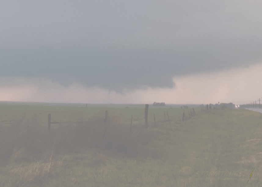
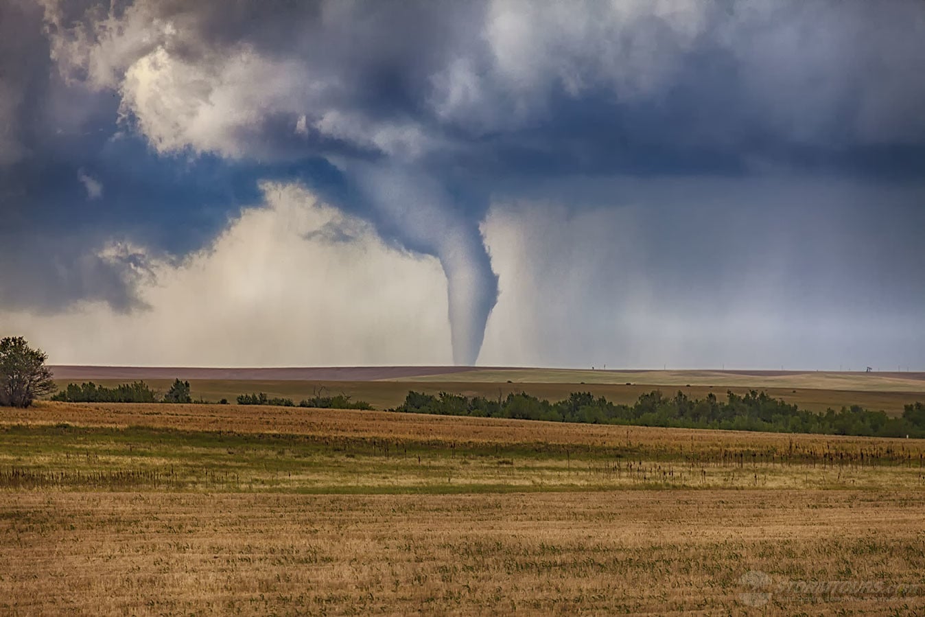
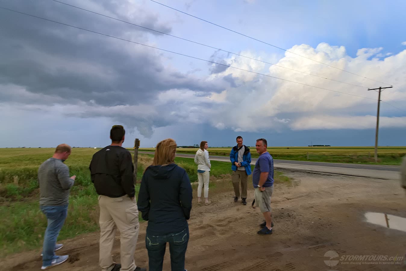
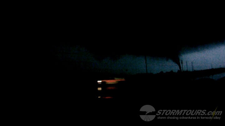
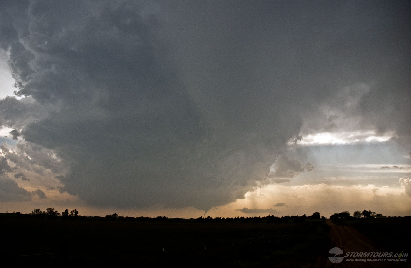
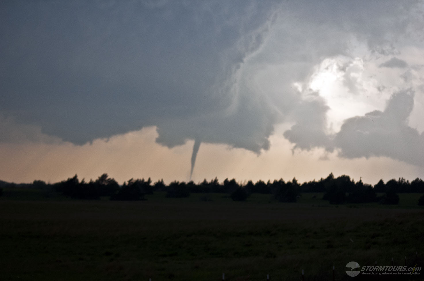
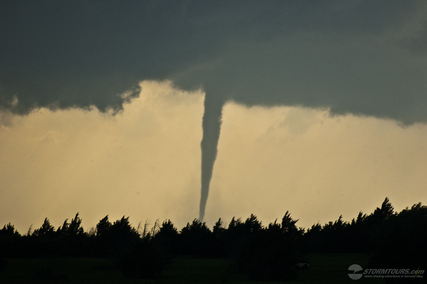
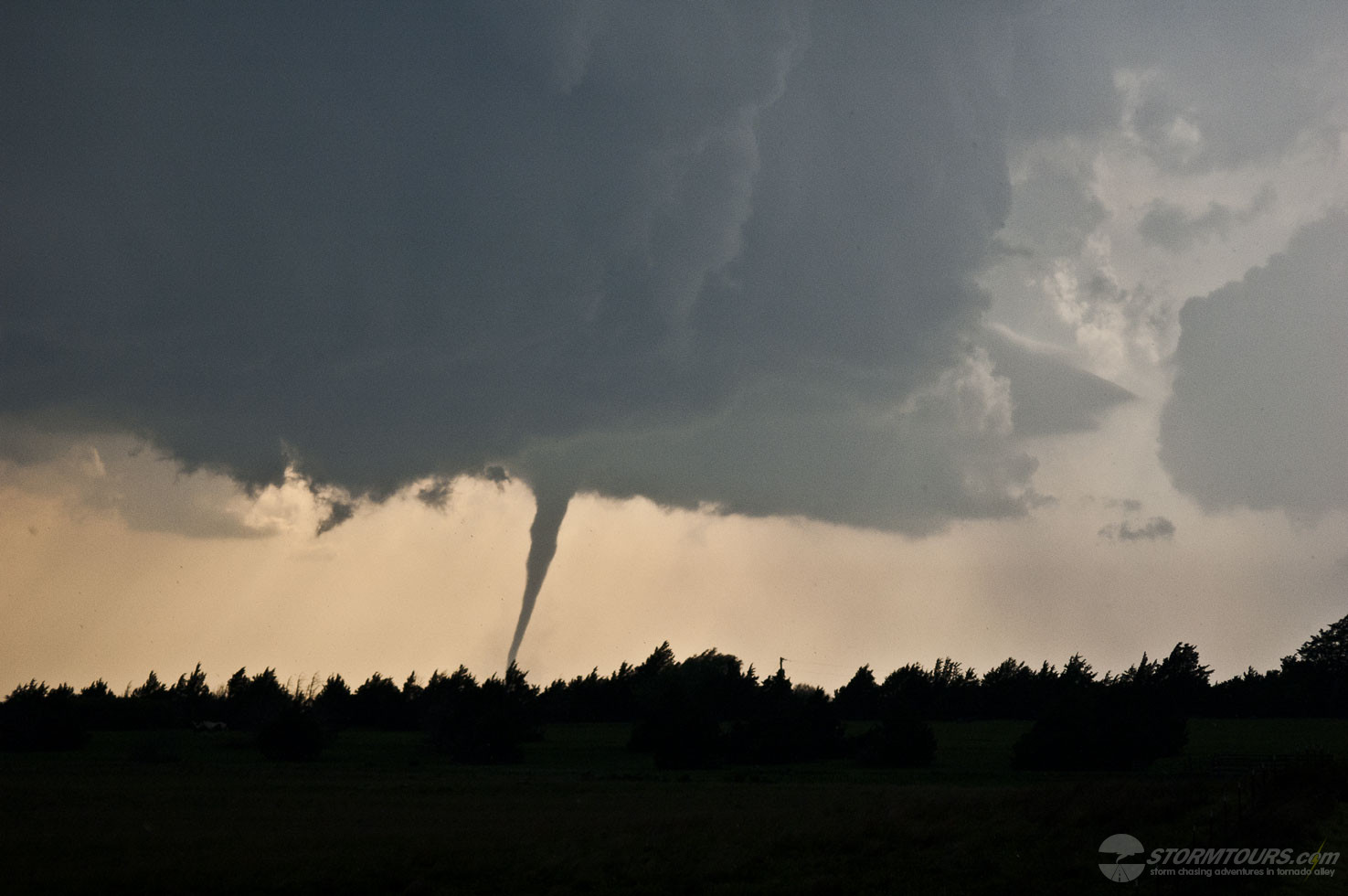
Tour 4 was treated to a great tornado on the last day of the tour an hour north of the Denver metro area near the rural town of Keenseburg.

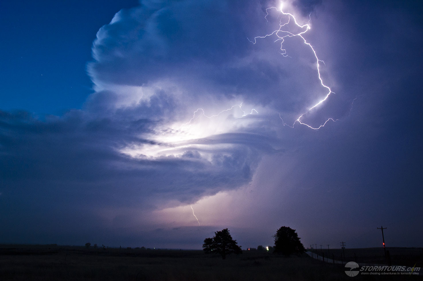
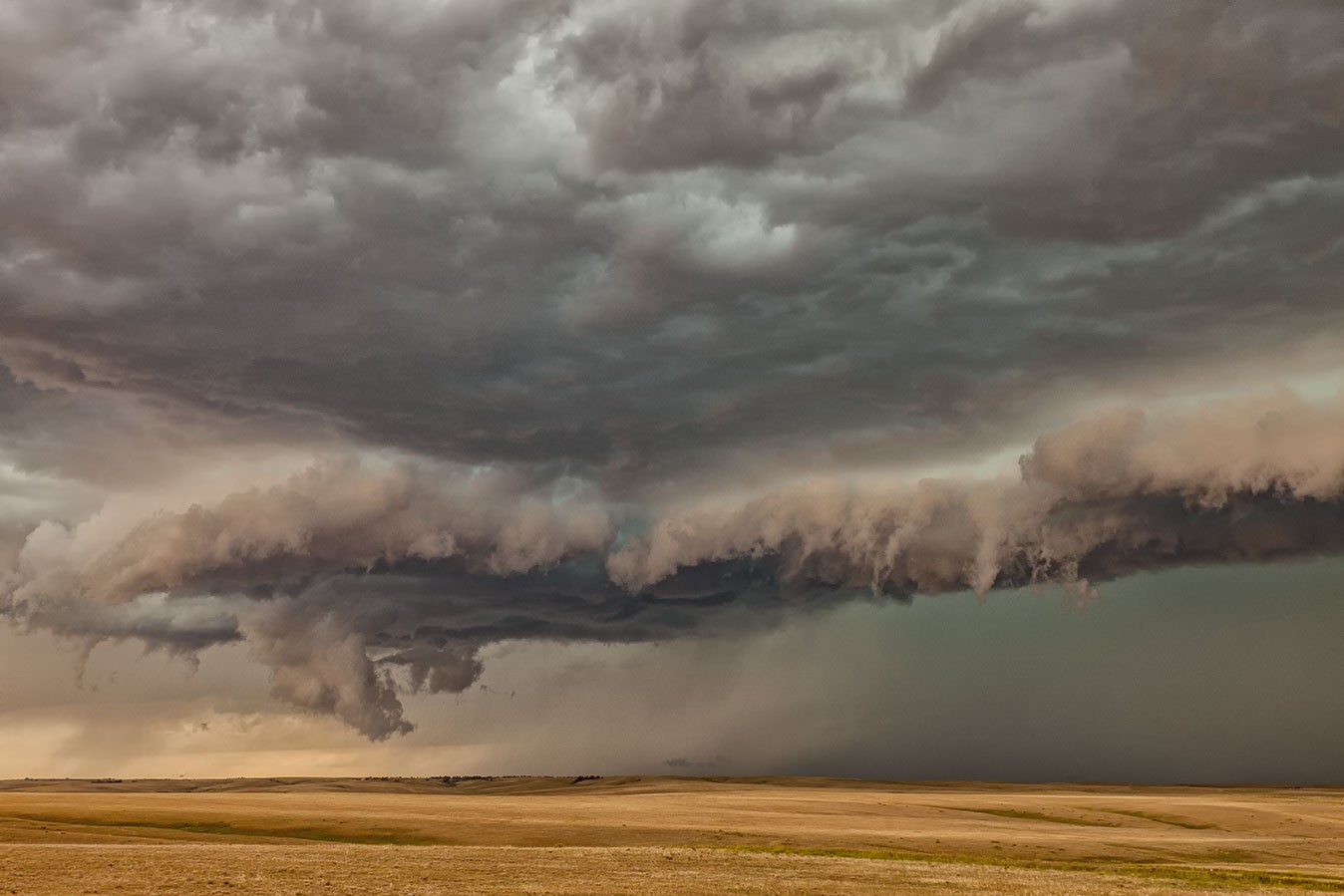
This was the second-day supercells starting near Boulder took the same path. The evening before this event, we were in Keenseburg experiencing large hail and torrential rain.

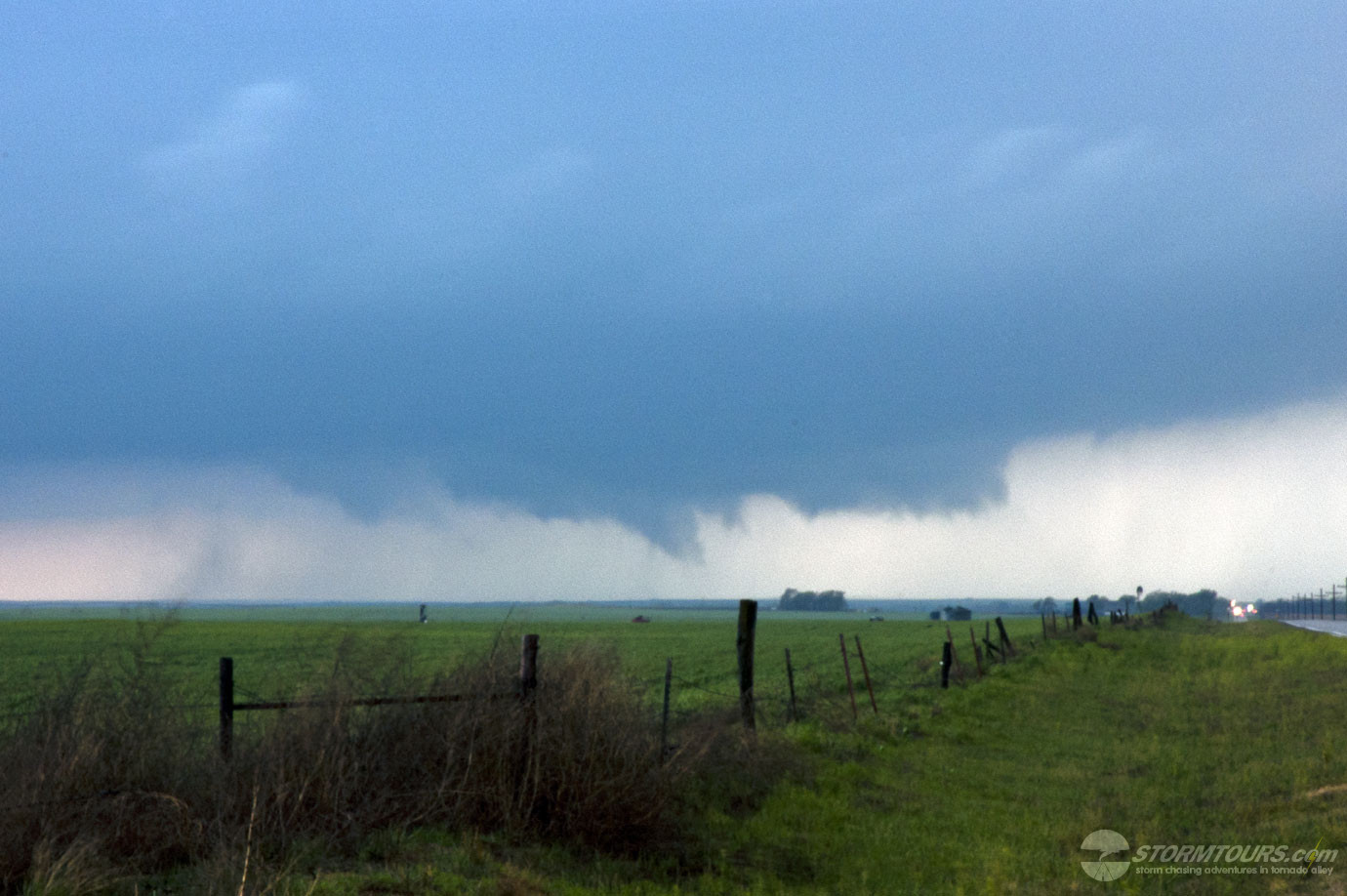
In fact, due to the heavy rains on the previous day that soaked the rural dirt roads, we opted to stay a bit further south so that we could not only keep a better eye on two tornadic supercells (one to our North near Keenesburg, and one to our south moving towards Simla), but also keep the vehicles wheels on solid roads.

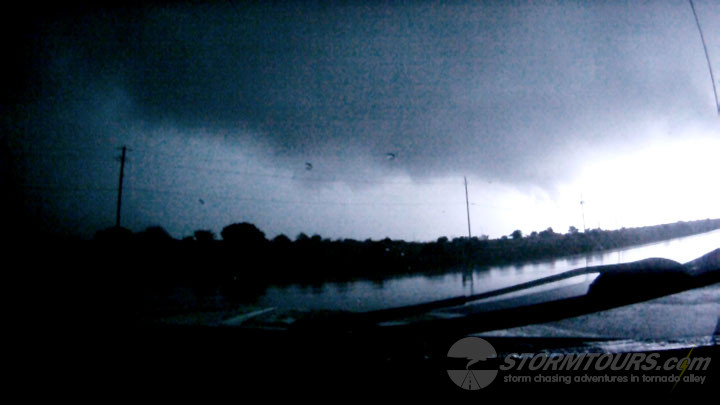
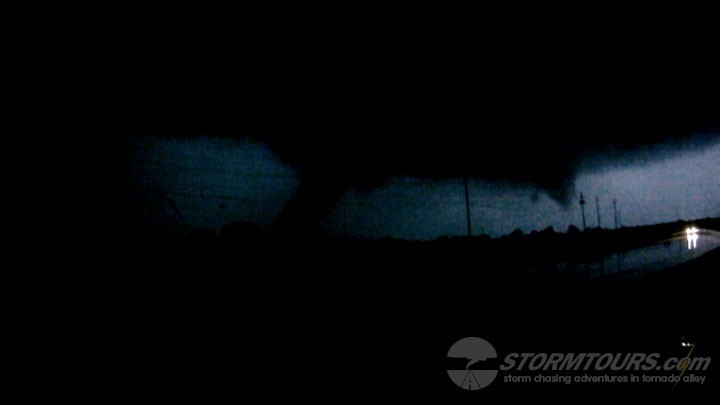
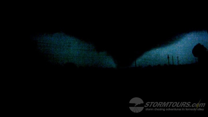
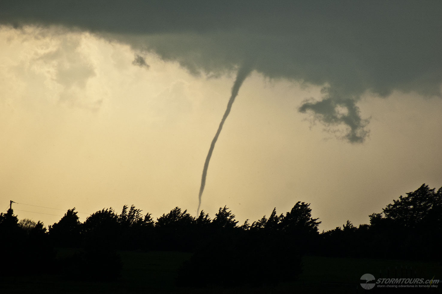
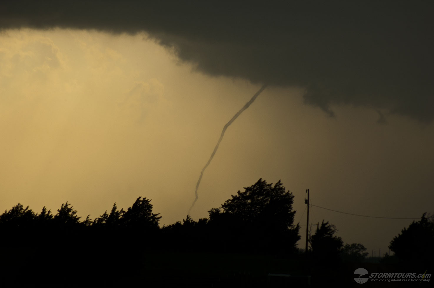
The Keenesburg Tornado was the first of the day. After it roped out, we quickly moved south and then continued east allowing the storms to chase us all the way to Limon, where we intercepted another tornado.

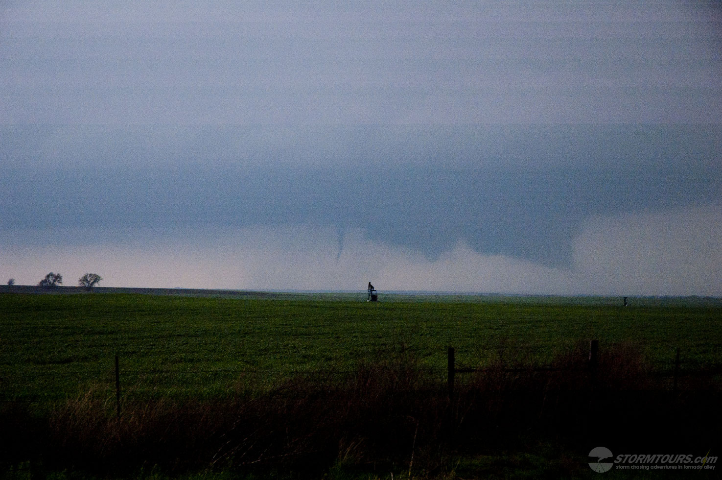
However, due to it being occluded in heavy rain and our light was quickly diminishing, it was as nearly as photogenic as the earlier tornado, even though we were much closer to it.

May 18, 2017: Tornado near Chester, Oklahoma

May 18 2017 Convective Outlook
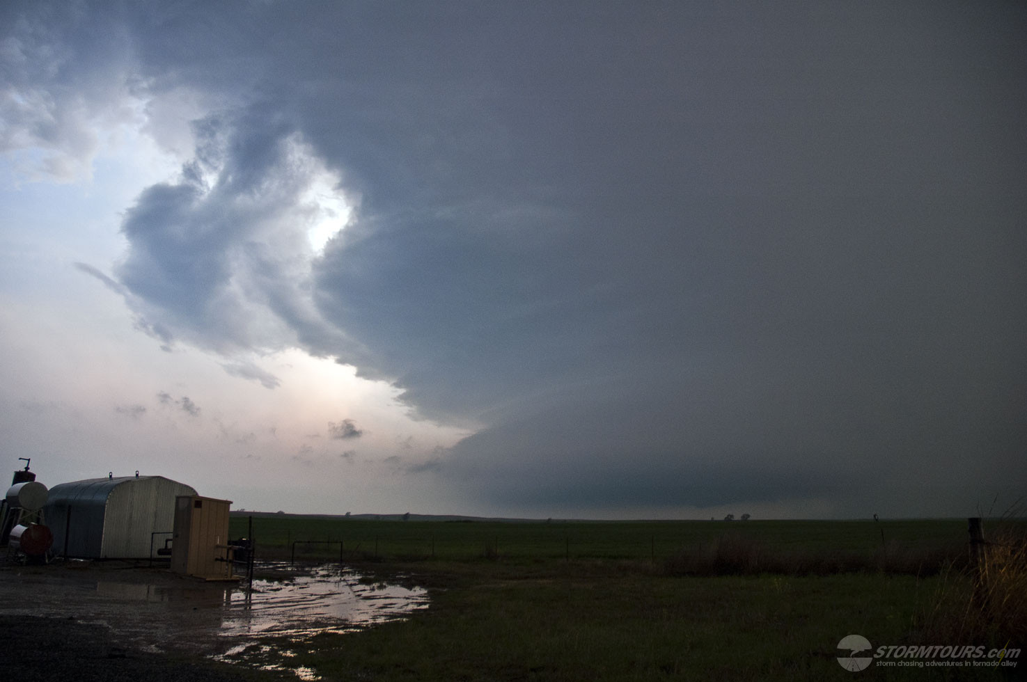
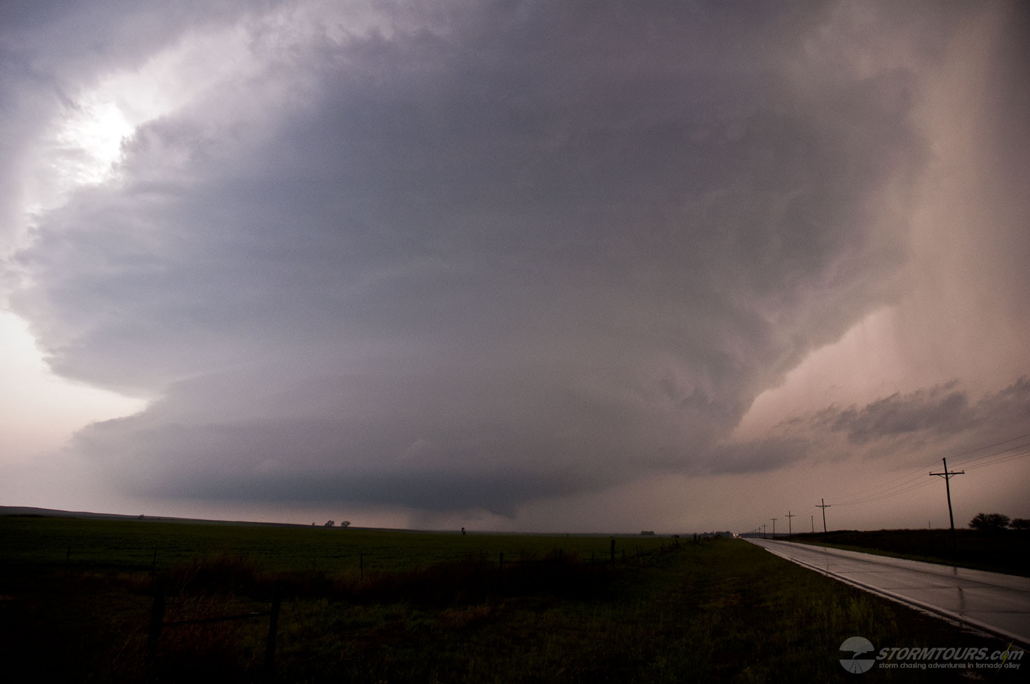
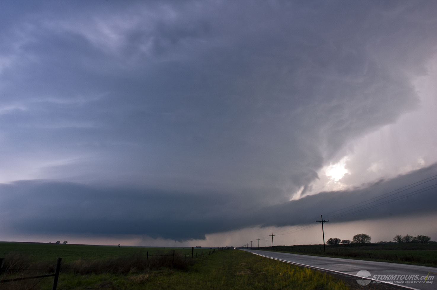
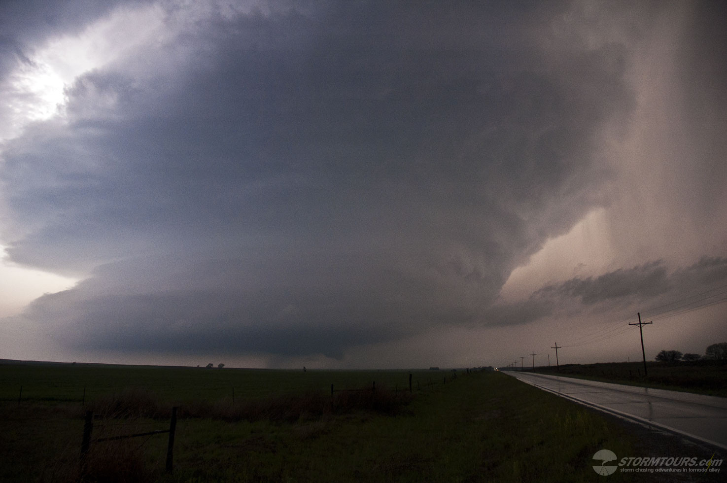
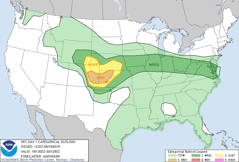
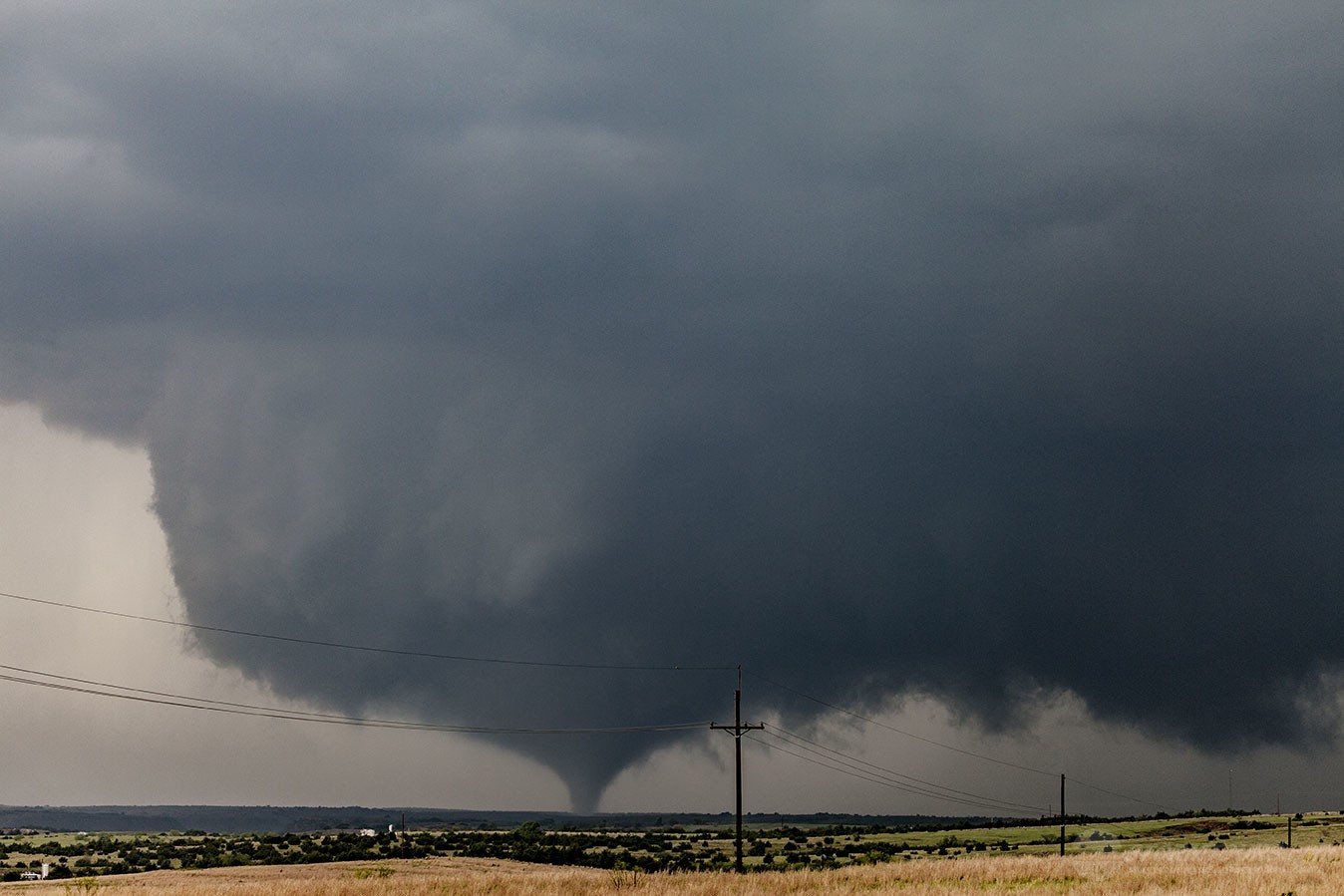
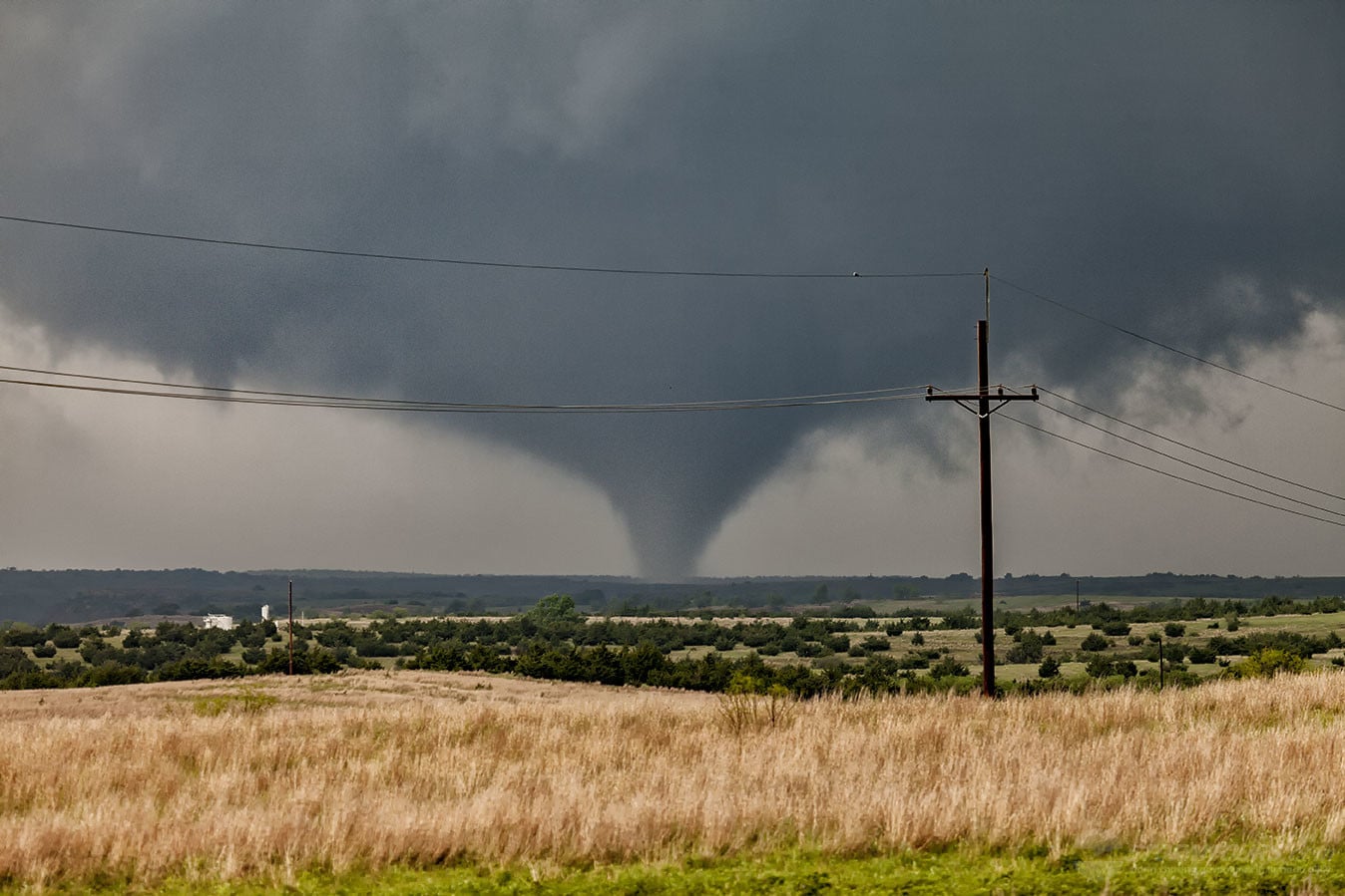
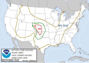
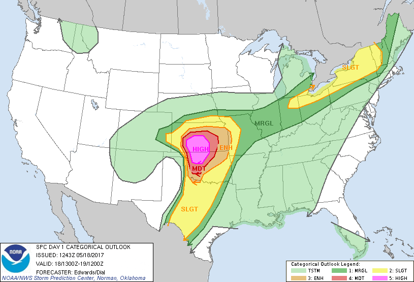
The day had incredible potential. Good shear, moisture and instability were all in place on a day that the Storm Prediction Center issued a High Risk for parts of Oklahoma and Kansas.

We started out from Oklahoma City and took our time getting to northwest Oklahoma. Our target area was generally between Seiling and Woodward, Oklahoma. But, we opted to stay east of the target area where we could monitor the day while having good road options.

As we were en route, we watched as the towering thunderstorms were growing along the dryline to our west. Canton, Oklahoma was our waiting area while we monitored visual satellite imagery.

Within an hour of arriving in Canton, the first Severe Thunderstorm Warning was issued. We had a pretty decent view of the storm and it looked ripe! We proceeded along Highway 51 towards Seiling, Oklahoma.

As we got closer to the storm, we had a better view of the storm’s base, we could see a definitive lower on the storm. Soon, a funnel emerged from the rotating wall cloud and we had our first tornado of the day. That storm created two tornadoes.

Neither of these tornadoes impacted structures or they would have likely produced major damage. The first tornado roped out as it approached Highway 281 about 8 miles north of Chester at 3:36 pm CDT.

A second tornado quickly developed and that one was on the ground for 20 minutes before lifting just southwest of Waynoka. Both tornadoes exhibited behavior that you would expect with strong (EF2+) tornadoes.

Fun and exciting chase day in Western Oklahoma that ended with a large tornado and an amazing sunset that illuminated the supercell near Chester in Woodward County. Not every High Risk day ends up deserving of such an accolade, today certainly did!

May 15, 2013: Cleburne, TX Nighttime Tornado

It’s a bit frustrating when you work all day to narrow down your target area only for a storm to form at dusk and create a nighttime tornado event.  We do have a rule pertaining to chasing at night.

If a night chase is going to happen, we must have good data coverage in the area for up to the second radar information and we must have a good road network.  Chasing at night can be extremely dangerous without having good remote sensing capabilities and good roads, dirt roads won’t do, because you can not judge the road conditions ahead of you.

Lucky for us, Texas paves just about every road in the state so the roads weren’t a problem, and there is excellent mobile data coverage so that wasn’t a problem, with neither being an issue, I opted for a night chase and  it paid off.  The imagery below are video stills showing the tornado backlight by the storm’s lightning.  Later validation would show this to be an EF-3 rated tornado with most significant damage just south of Lake Pat Cleburne.

May 04, 2007: Arnett, Oklahoma – Tornadic Supercell

May 4th originally brought us to western Oklahoma along the border of the Texas Panhandle where we intercepted a severe warned supercell that quickly produced a needle shaped tornado which lasted for nearly 20 minutes.  This supercell would later track northeast across the Kansas state line and become tornadic again after dark, producing the first ever EF-5 tornado (on the new Enhanced Fujita Scale).  Due to the fact that these events took place in different states and a few hours apart, we’re entering them as different events and there will be another entry for the Kiowa County, Kansas tornado that struck Greenburg on the evening of May 4th.

April 23, 2007: Tornadoes near Protection, Kansas

day1otlk_20070423_2000_prt
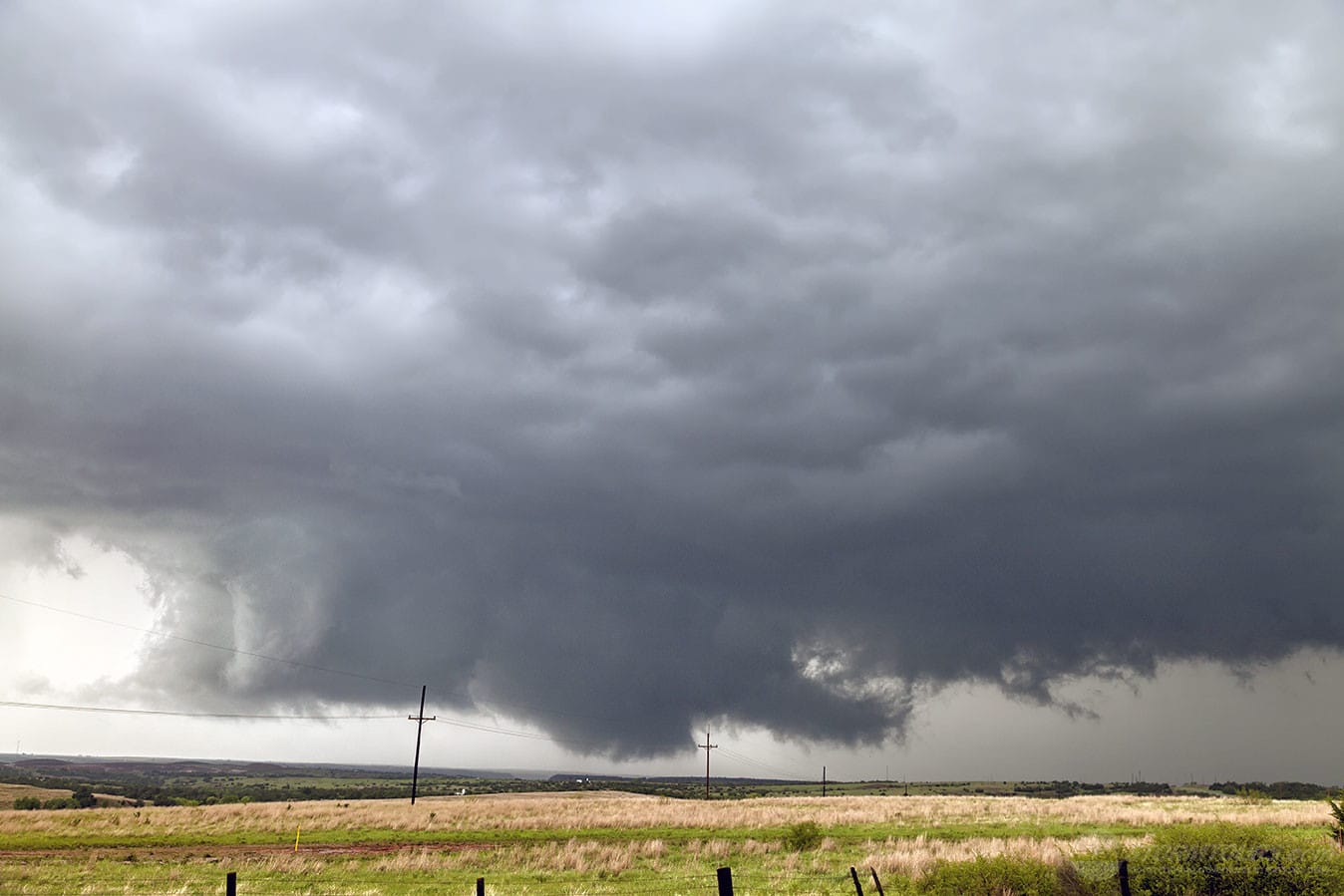
What a day this turned out to be! Not only did the folks on Tour 2 get an up and personal meeting with a tornado on the 21st of April. But, just two days later they saw seven tornadoes in Southwestern Kansas on the 23rd!

The day presented many challenges with a couple of interesting target locations. The Texas Panhandle and southwestern Kansas were both in-play.

The Storm Prediction Center issued a Slight Risk area extending from near Lubbuck, Texas to northwest in extreme southwestern Nebraska. Additionally, there was a Moderate Risk area covering most of western Kansas.

Starting off from Amarillo, Texas, our original target was the northern Texas panhandle. But, it became evident by early afternoon that it was the wrong play as moisture was just too limited in this area with low dewpoint values. We repositioned on the second area of interest in southwestern Kansas and northwestern Oklahoma.

The first storms of the day were intercepted near Buffalo, Oklahoma. We witnessed our first brief tornadoes of the day (I believe there were three out of this storm) just to the north.

That cell died out and a new cell formed on its southern flank. As a result, we drove north to intercept the new supercell as it crossed into Kansas.

When the storm finally caught up to us it went crazy! Producing tornado after tornado for a show that lasted several hours.

As the evening progressed and sunlight grew dimmer, we moved a few miles to the west and continued shooting video of this tornado producing beast.

We caught a total of at least seven tornadoes between these two supercells. Spending much of the early evening hours photographing lightning out of this thing as it moved away from us to the northeast.

What an incredible day for an already incredible tour!

1 2