September 02, 2016: Hurricane Hermine

Hurricane Hermine Radar
Hermine Radar about 30 minutes after landfall in Florida

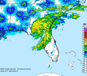
Hurricane Hermine was the first hurricane to make landfall in Florida since Hurricane Wilma in 2005, and the first to develop in the Gulf of Mexico since Hurricane Ingrid in 2013.

The ninth tropical depression, eighth named storm, and fourth hurricane of the 2016 Atlantic hurricane season, Hermine developed from a long-tracked tropical wave that had produced torrential rainfall in parts of the Caribbean.

After being designated on August 29, Hermine shifted northeastwards due to a trough over Georgia and steadily intensified into a Category 1 hurricane just before making landfall in the Florida Panhandle during September 2.

We initially set up in Crystal River, along with dozens of satellite newsgathering trucks from various networks. However, it was expected that Hermine’s eye was going to make landfall in the corner of Florida’s Panhandle.

Our goal was to intercept and document Hermine’s western half, where the winds and storm surge were forecast to be the greatest.

As the hurricane neared landfall, we moved north along Highway 19 to the north of Chiefland, FL. The attached video shows the intense rain and zero visibility conditions along Highway 19 running along the Gulf Coast.

We would like to also note that we do not offer tours for hurricanes. To do so is far more complicated and would require any tour customer to be with us up to a week prior to landfall.

When we intercept hurricanes, we often leave several days before expected landfall to make sure that we don’t have to fight or impede evacuations and traffic.

Hurricane chasing also requires us to stay extremely mobile, there are no hotels (hurricane chasers often have to sleep in their vehicles with all their equipment, supplies, and extra fuel as local stores quickly sell out of everything including gasoline).

We’re very sorry, but we just cannot offer hurricane interception tours — but we hope that you’re with us to see the next tornado in Tornado Alley!

June 07, 2016: Pikes Peak Tornado Warned Hail Storm

Usually, while conducting a storm chasing tour, we normally stay in the plains, but there are occasions when we break from tradition.

During the first week of June, a high-pressure ridge had set up over the plains which shut down the possibilities of storms there. But, in situations such as this, you can usually depend on the mountains to provide some lift which will create rotating thunderstorms capable of producing lots of hail and even a few tornadoes from time to time.

In fact, El Paso County Colorado has more hail storms per year than any other county in America! So, we took a day trip up to the summit of Pikes Peak and watched the clouds begin to build. Once we were so cold we could no longer stand to be there, we traveled back down and jumped into the middle of the hail storm as if moved off the mountain.

This is one of the many ways that our team always gets our customers great storms, even when the weather pattern shuts down the action in Tornado Alley!

May 25, 2016: Marginal Risk Kansas Tornado Fest

May 25 2016 Convective Outlook
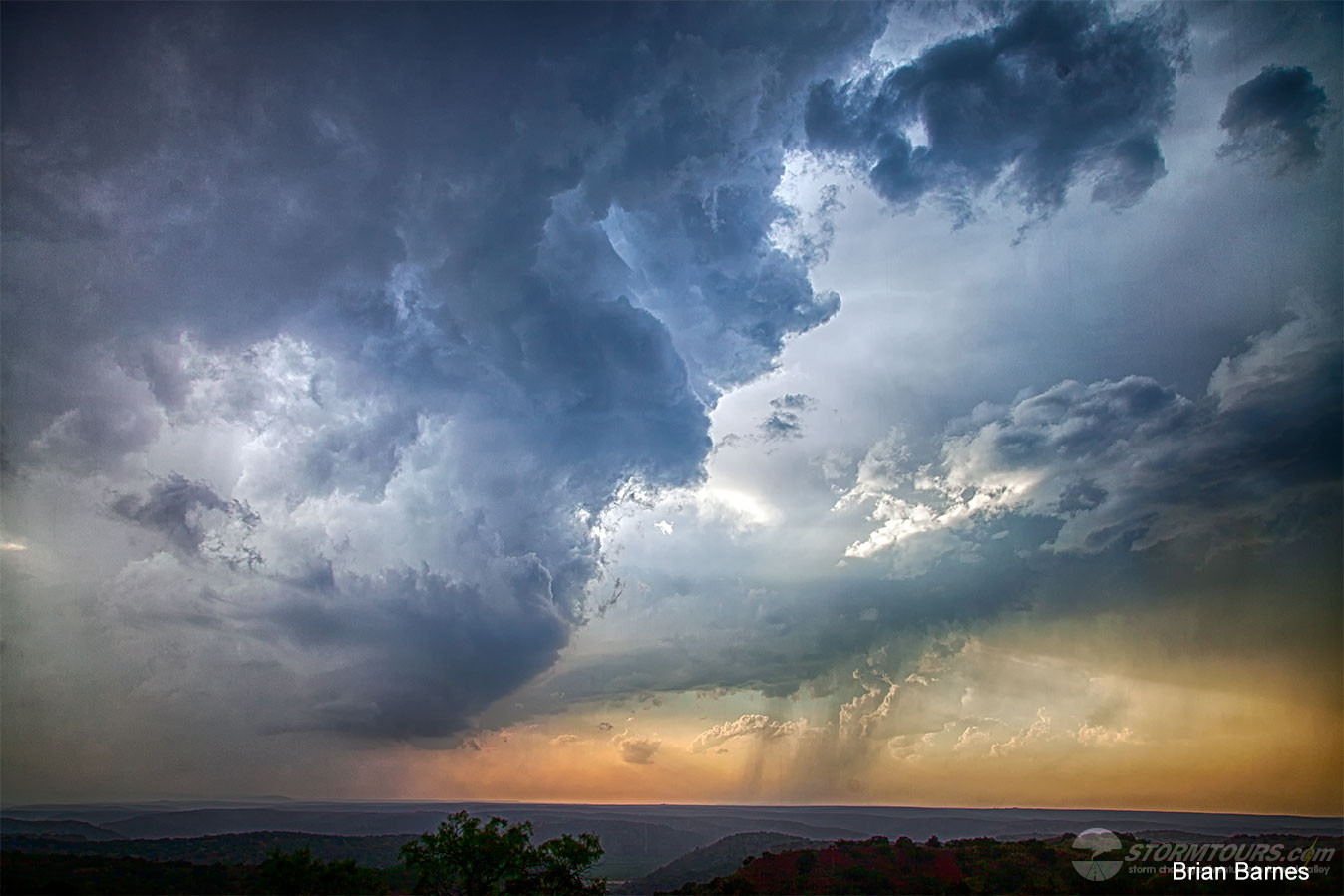
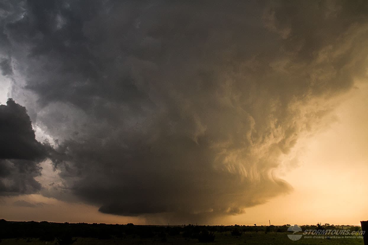
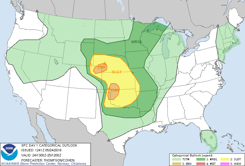
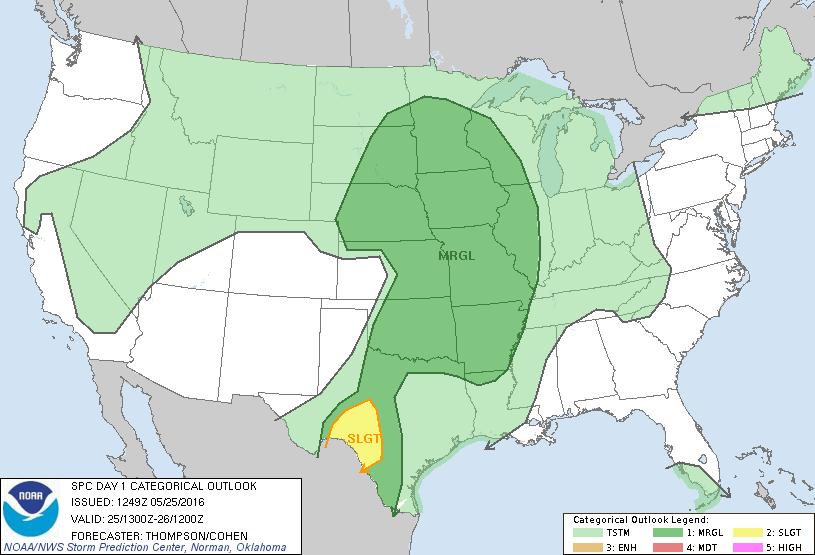
We started our day from Garden City, Kansas. I met the storm chasing group in the hotel lobby, not many of them were bright and cheery.

It’s common for our customers to look over the Convective Outlook issued by the Storm Prediction Center. This morning’s outlook didn’t show much promise for the day and that had the group down a bit. SPC issued a marginal risk for much of Tornado Alley. As such, the group was expecting me to call a “severe clear” day and look for alternative activities. But, I had different plans.

I typically don’t look at SPC’s Convective Outlooks. I do like to include them in our chase logs here on the website because it adds depth to the account. But, I prefer to forecast the day’s probabilities myself using numerical forecast models and I thought the day actually did hold some promise. My initial target area for the day was Salina, Kansas.

I spent an hour going over my forecasting thoughts with the tour group to get us all on the same page. There was a steady flow of deep moisture from the south. Dewpoints into the high 60s were reaching as far as the Nebraska border. Aside from moisture, there was a dry air punch near the Interstate-35 corridor in central Kansas. Forecast MUCAPE, however, was rather low at about 1500 j/kg forecast.

Once we arrived in Salina a few small storms begin to fire up. As a result, we relocated to a familiar parking area near Bennington, Kansas about 25-miles north.

This was the same parking lot where we witnessed a monster wedge tornado from just a few years prior. Today, we sat in that same parking space and watched yet another tornado birth, amazing!

There were a total of four tornadoes from this isolated supercell. The largest was a long-track violent EF4 tornado that was on the ground for over an hour and was a half-mile wide at times.

This tornado developed just north of Niles Kansas around 7:07 pm. It moved ESE damaging and destroying everything in its path as it passed about two miles north of Abilene.

It then weakened for a time as it moved to the northeast of Abilene. However, it re-intensified and took a southeast turn as it approached Interstate 70. Then, it went on to produce the most severe damage after crossing the interstate just a mile or two southwest of Chapman.

The photo provided here with the truck in it was taken from an interstate overpass. This was when the tornado was at its widest, a full-blown wedge. The tornado then moved east passing one mile south of Chapman and finally dissipated at 8:37 pm just west of the Dickinson and Geary County line.

We zig-zagged along the back roads and stayed well east of it. We had almost perfect views of the storm for nearly an hour before it finally roped out.

A remarkable day that started with little hope. The lesson learned today was that a Convective Outlook risk area doesn’t always come to fruition. In fact, there have been many high risk days that have fallen flat and many marginal risk days that end with outbreaks.

That said, the team at SPC is no doubt the best tornado forecasters in the world. With the low CAPE forecast, this day was indeed a marginal risk. But even a marginal risk day can end with a tornado outbreak.

May 24, 2016: Dodge City Tornado Outbreak

May 24 2016 Convective Outlook* 
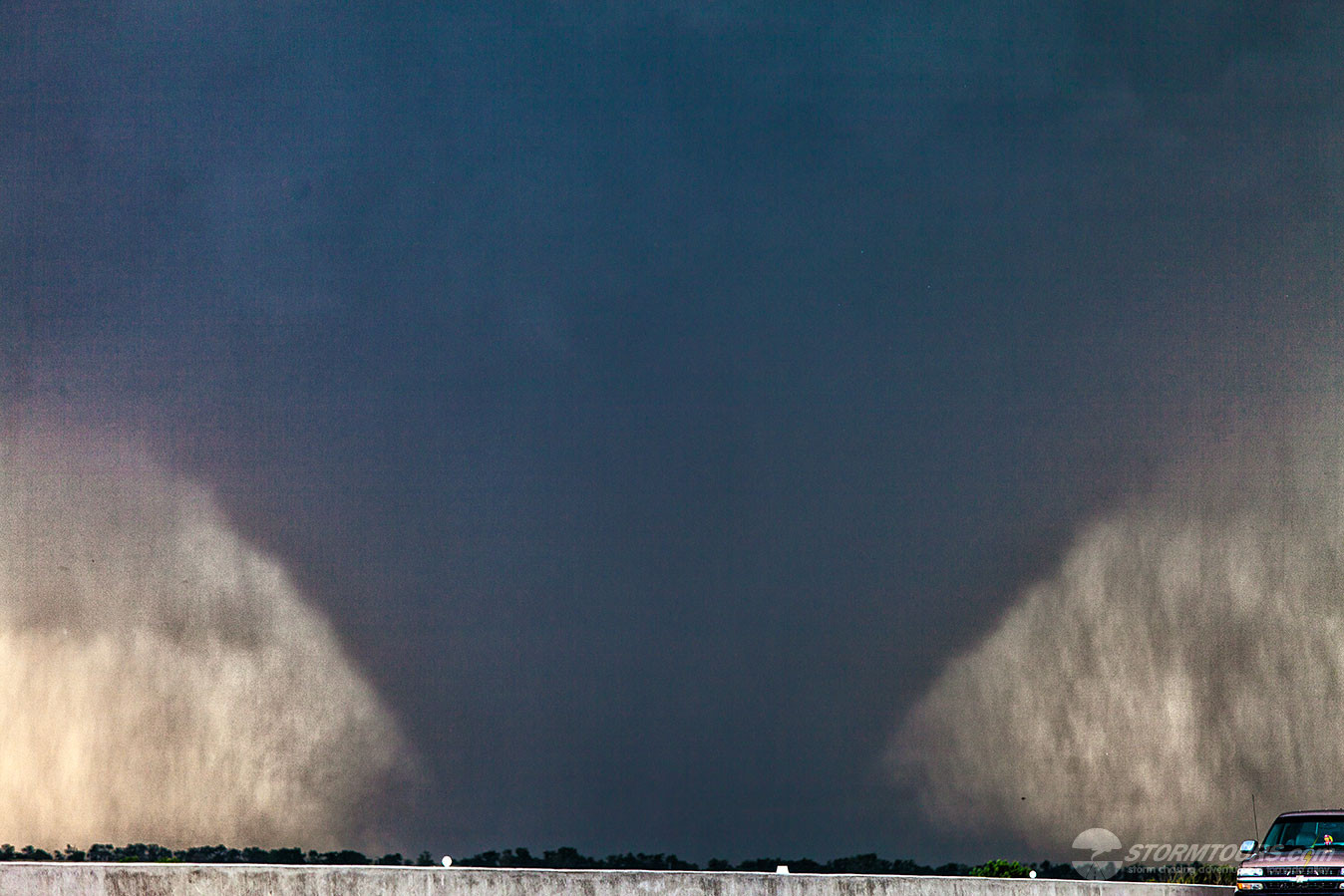
Includes Storm Chasing Drone Video *

An incredible day of storm chasing during a tornado outbreak event in southwest Kansas near Dodge City. Just today alone, we witnessed over a dozen tornadoes!

I’ll repeat that in case you missed it, today we witnessed at least a dozen tornadoes!

Triple Threat Tornadoes

The day actually started with three tornadoes on the ground at the same time from the same storm cell. We were able to document the triple threat tornadoes on video.

In the gallery below, is a frame of the video showing these three tornadoes. Two rope satellite tornadoes on the right, and a large center-of-circulation tornado on the left.

Drone Flight…

I’ve been waiting all month for the perfect opportunity to attempt to capture tornado footage with our new drone. Today it worked out flawlessly.

While watching the first tornado of the day, I noticed that we were close enough to get a good video with the drone’s wide-angle camera, yet the inflow winds were not outside of our flight limitations.

It took about 30 seconds to get the drone launched and it successfully captured nearly five-minutes of amazing video.

It was the first time a storm chaser intentionally pursuing a storm has been able to document the tornado with the use of a drone.

After successfully landing the drone (due to flight level winds increasing) were able to pursue this supercell for almost two hours while witnessing nearly a dozen other tornadoes from it.

May 23, 2016: Night Time Tornado near Turkey, TX

May 23 2016 Convective Outlook
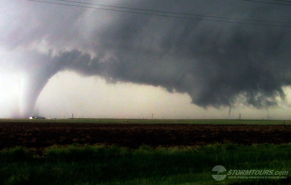
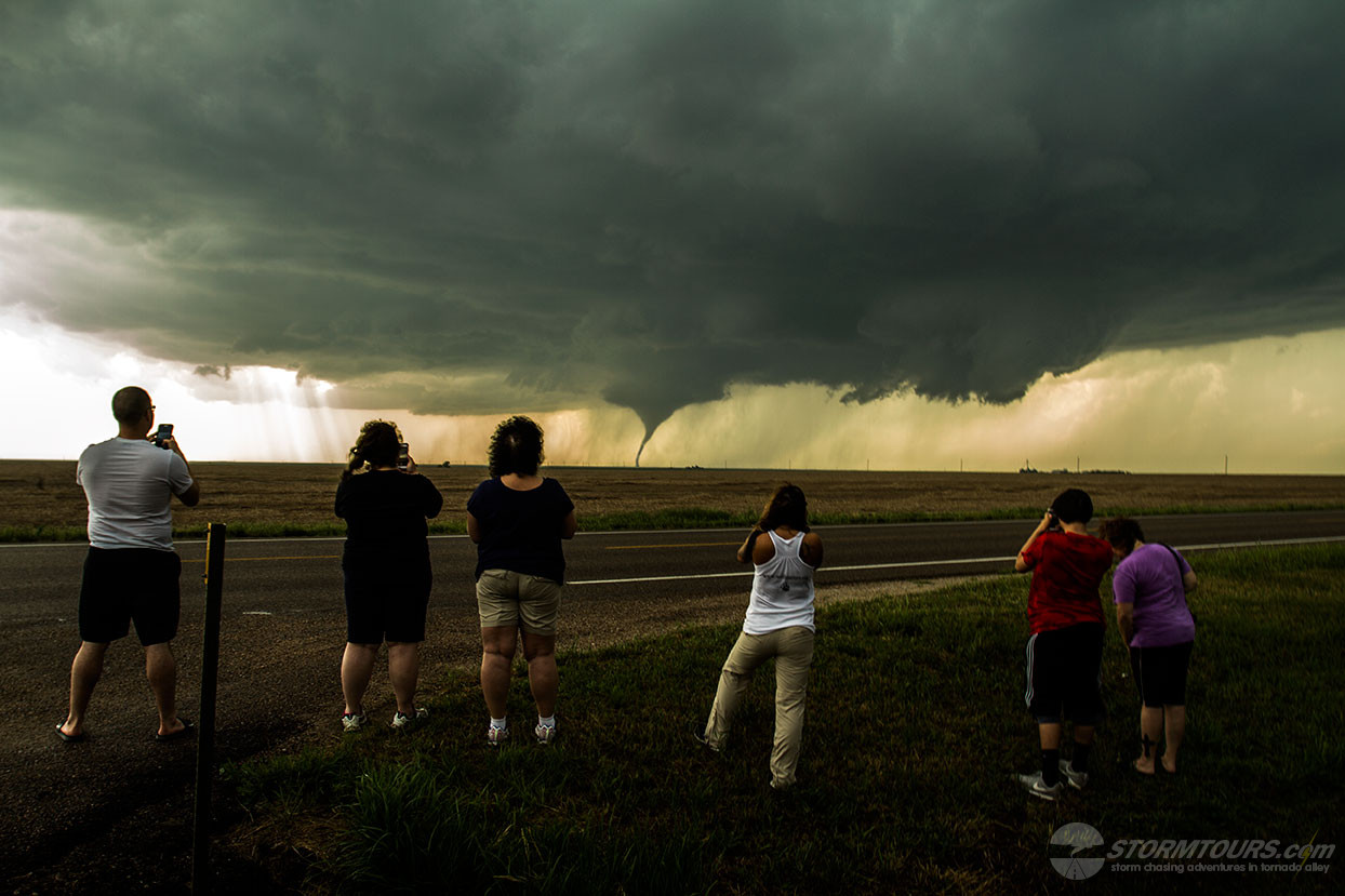
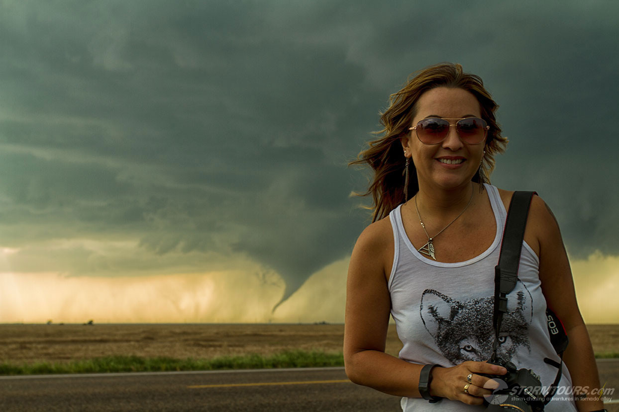
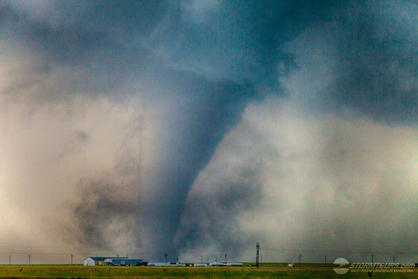
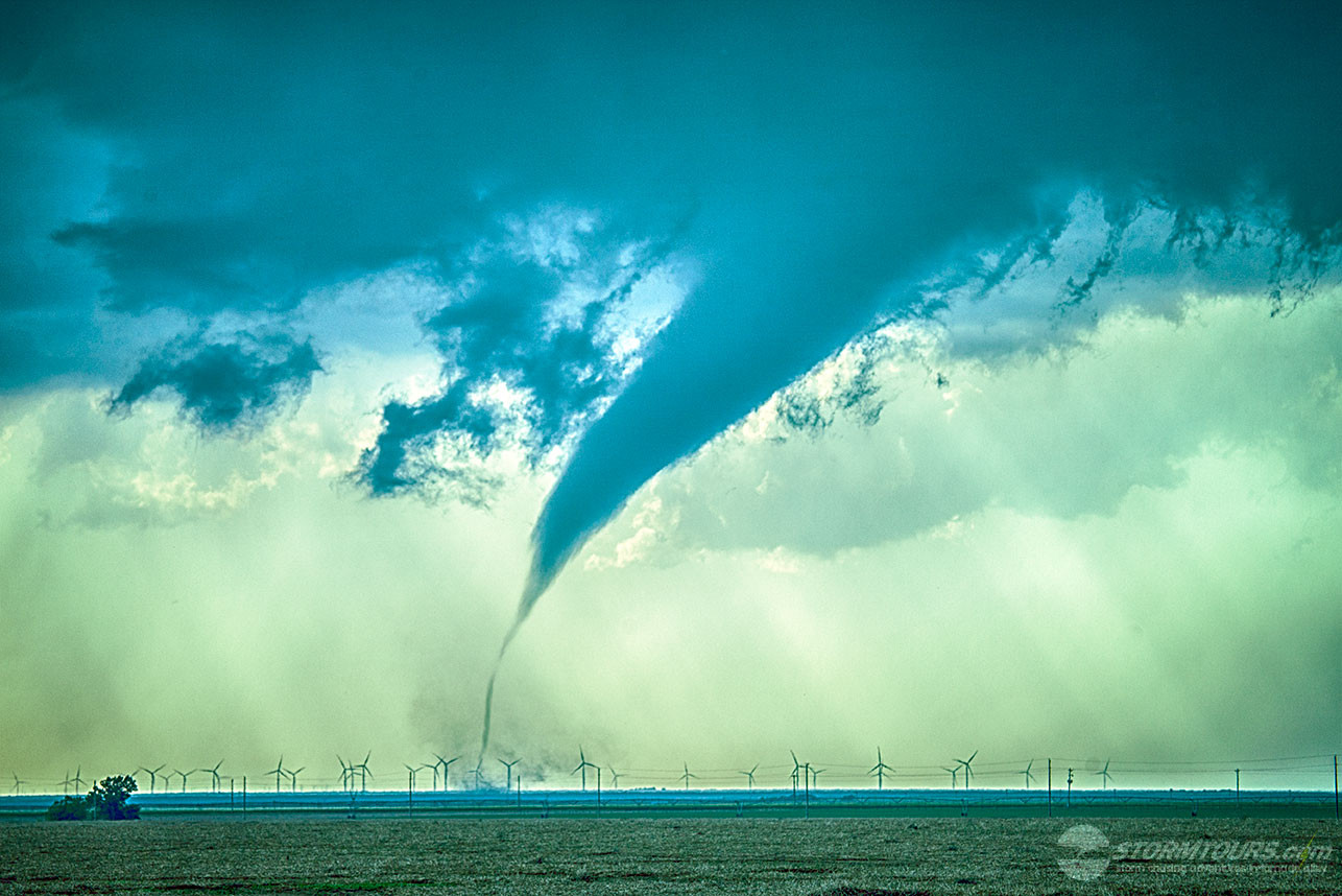
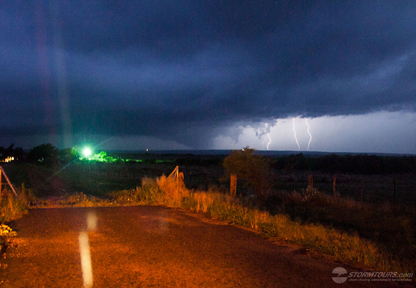
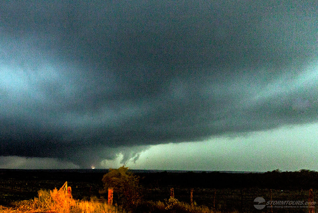
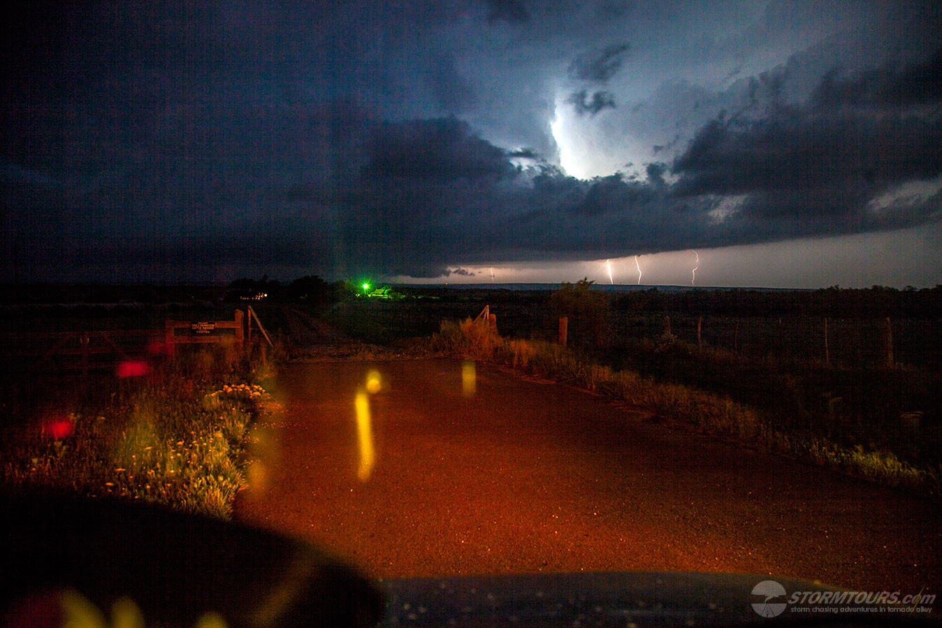
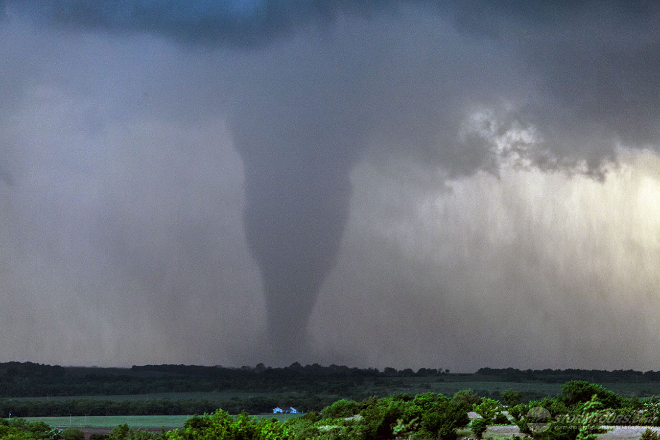
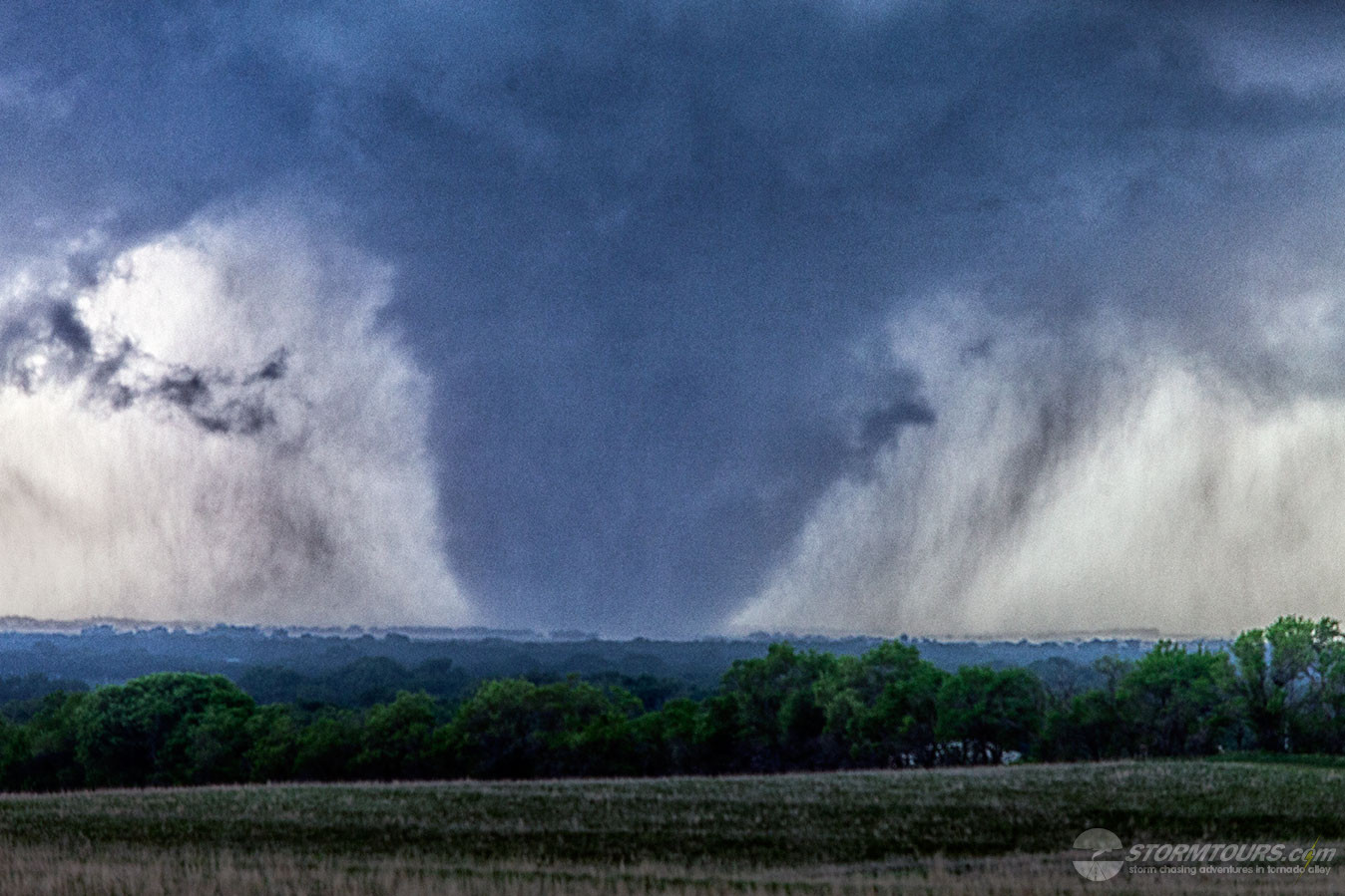
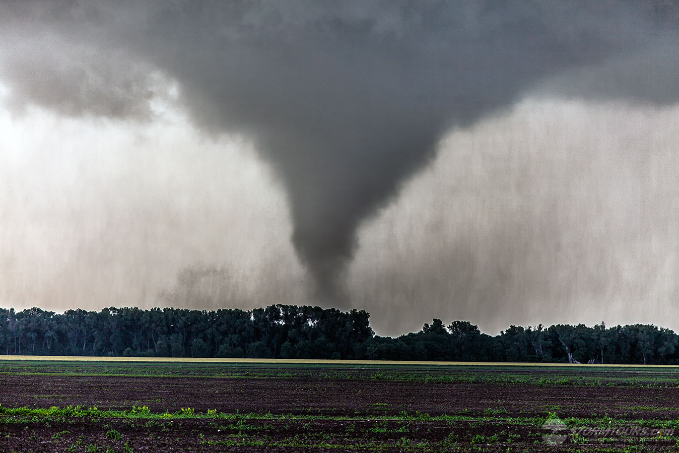
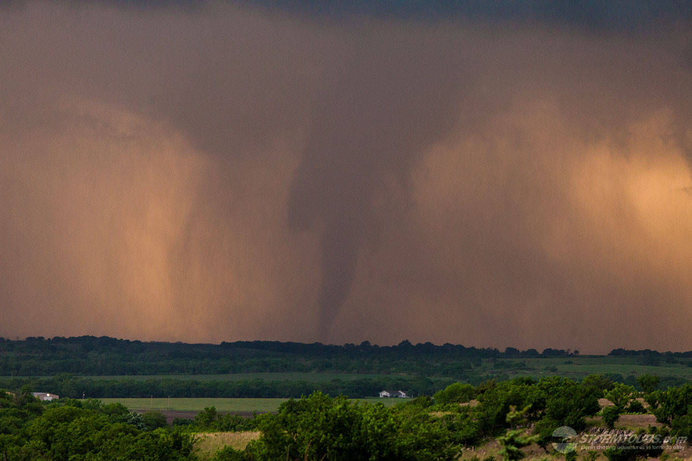
Storm chasing days like this are both frustrating and rewarding. The day ended with a tornado forecast validation. However, the tornado happened after sunset.

Chasing storms at night not only makes it more difficult to obtain good photos of the tornado. But also changes the way in which we pursue a storm due to possible flash floods.

The Storm Prediction Center had issued a Slight Risk covering most of western Texas and Oklahoma.

Additionally, an Enhanced Risk area was issued for much of the South Plains. The day, however, looked to struggle from limited moisture return.

We targeted an area just north of the Enhanced Risk area, hoping for the Caprock to provide its magic and create the lifting mechanism that would be needed for today’s forecast.

We began the chase while flying the drone. I captured some nice videos of the beginning stages of the supercell while it was over farmland.

The storm began to rapidly intensify and came very close to producing a tornado quite a few times during the daylight. However, the supercell remained low-precipitation and never fully matured to the tornado producing stage.

Just after sunset, we were ready to give up because it became to difficult to monitor the base. As we were backing out to drive away, I caught a glimpse under the base when a lightning strike illuminated it – I thought I saw a tornado!

I pulled back into the spot and waited for the night lightning strike to once again illuminate the base.

Validating this tornado was difficult. The lightning wasn’t constant enough to get a good visual. I knew from the radar that we were safe as we were a few miles to the east.

The radar was also indicating a velocity couplet, which helped to confirm my suspicion of a tornado. I decided to set up a still camera and take some long exposure photographs hoping that we’d get our confirmation from photo evidence.

Within a minute, another lightning strike backlight the base and I checked the camera – tornado confirmed! A few minutes after that we saw power flashes on the ground as the tornado was moving through powerlines and causing the transformers to explode.

We had to move further away than we’d normally attempt for safety reasons to continue to monitor the storm. Eventually, we were starting to get pinned in by the road networks.

Not wanting to travel through the Palo Duro at night during a potential flash flood, I decided to end the chase. We went south to get away from the storm, and then back west to the Interstate for the trip to Amarillo.

An exciting end to a mediocre chase day. All it took was a low-level jet to intensify after the sunset to give this little storm just enough to shear to create a tornado.

1 2