
Highlights with photos, video and narrative of some of our more memorable past storm chasing accounts.
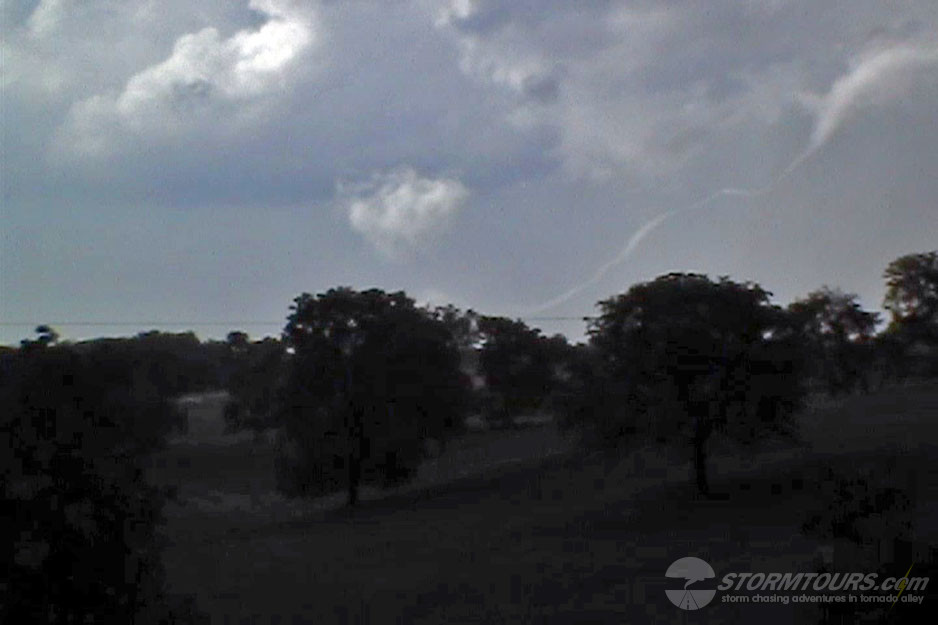
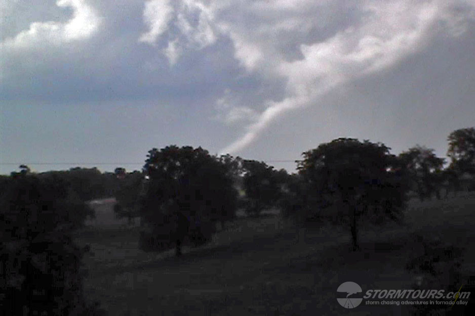
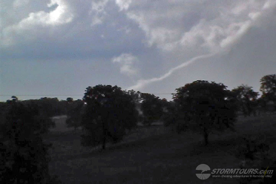
 A long intense chase day that ended with a beautiful supercell thunderstorm that produced a funnel, but no tornado.
The day started in Oklahoma City. The tour group met fairly early at 7:00 am in the lobby. We did our initial forecast assessment and mesoanalysis, which told us we’d once again be traveling to the Texas Panhandle.
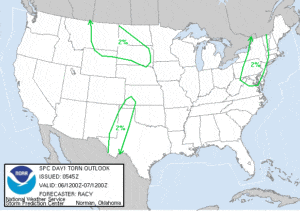
Later that morning, the Storm Prediction Center issued a Convective Outlook that covered West Texas, portions of northwest Oklahoma and nearly all of Kansas. On days with such a large area of convective possibilities, the forecaster has to look for what is different about a particular given area.
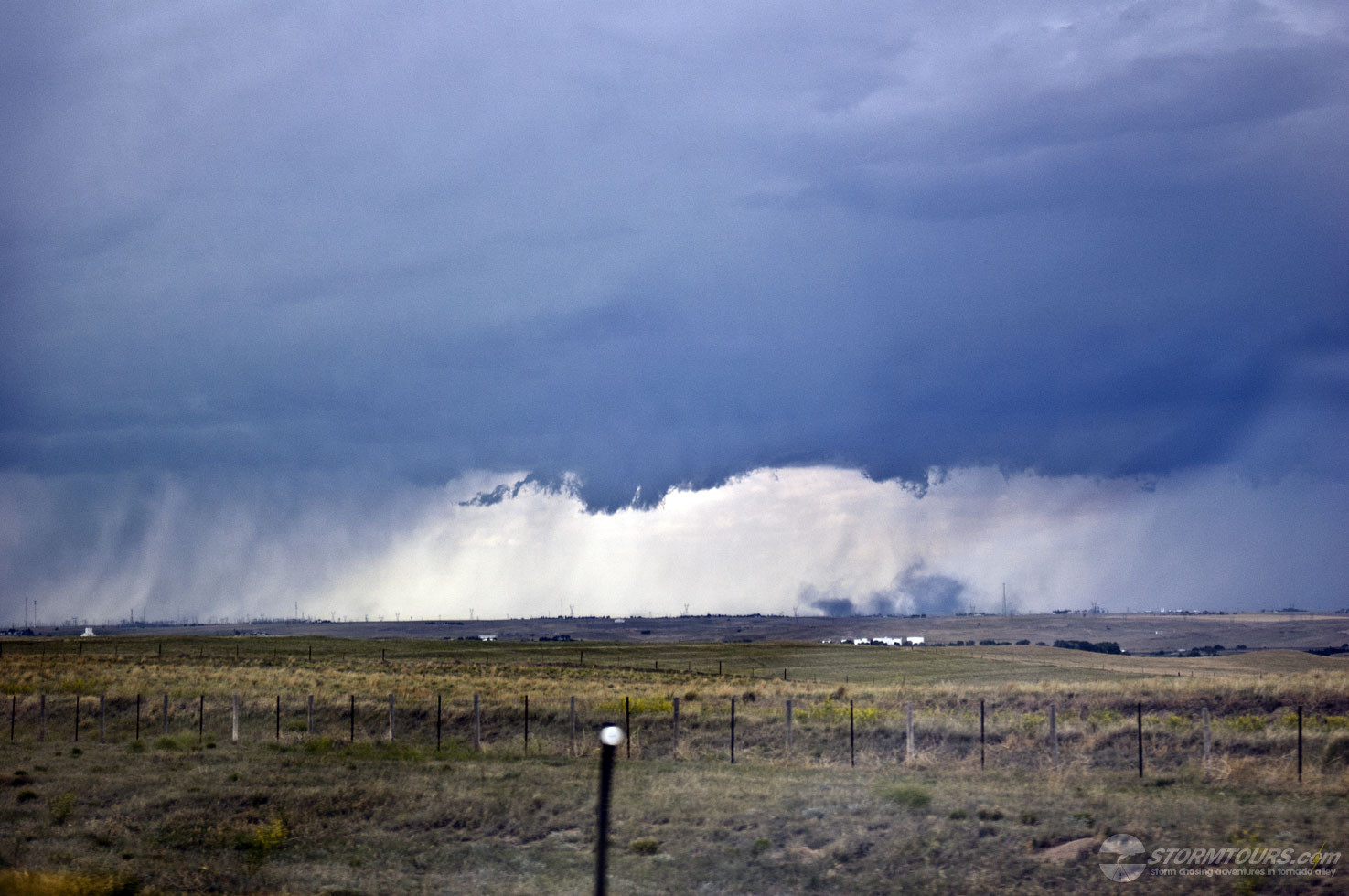
In this case, it was the Dryline in the Texas Panhandle intersecting with a warm front. Monitoring surface observations from mesonet weather stations helped us to pinpoint where the dry air layer from New Mexico was punching furthest east. That area was near Limbscomb, Texas.
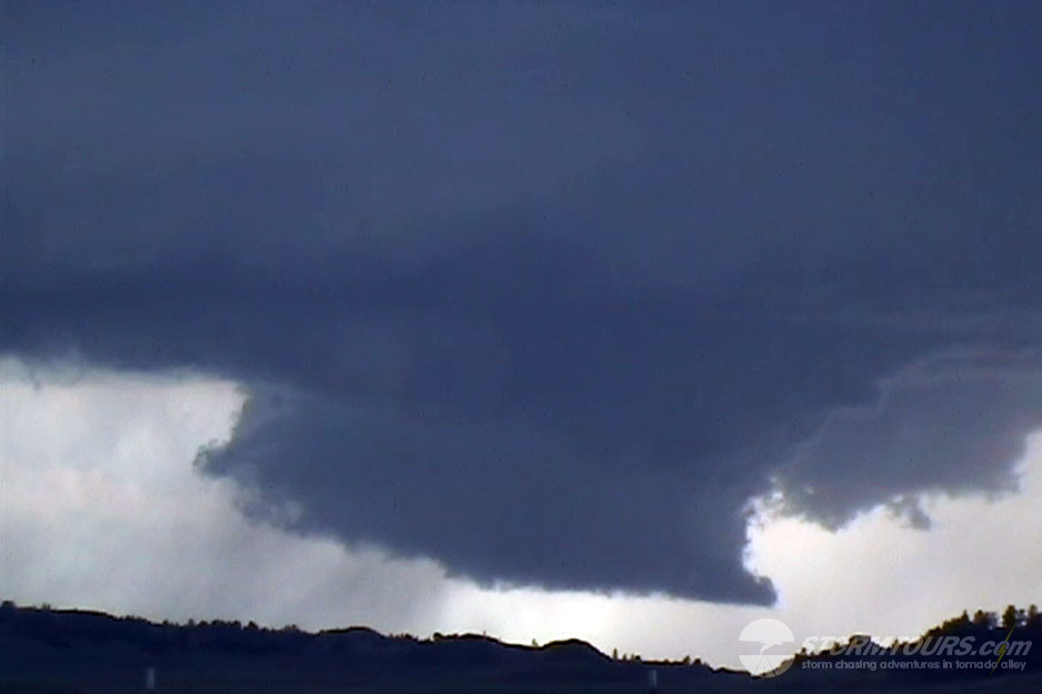
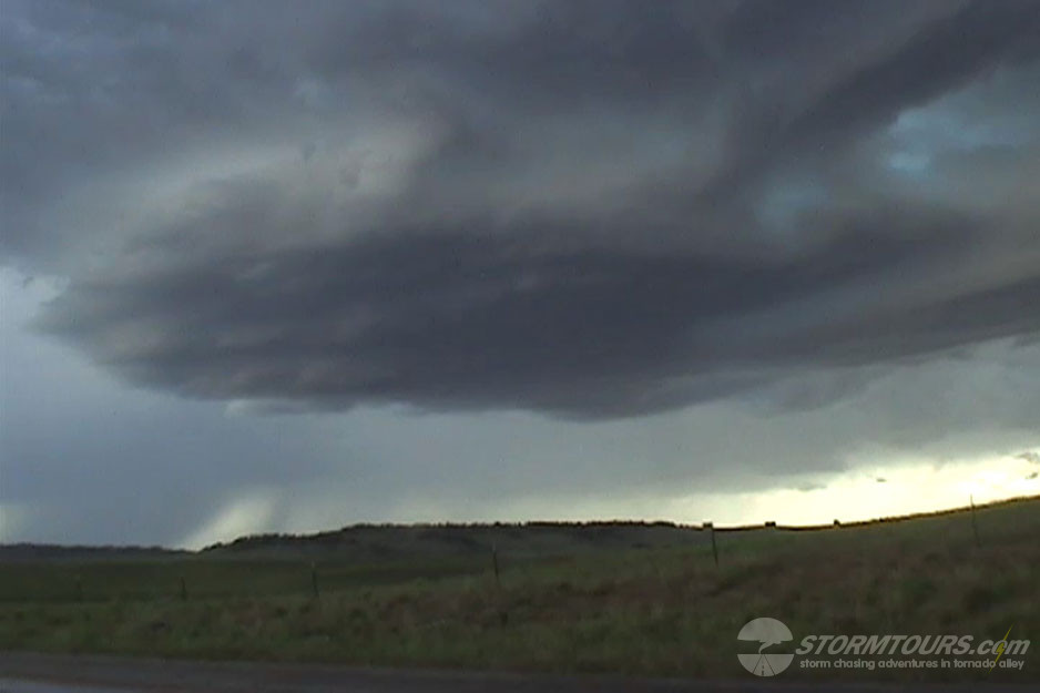
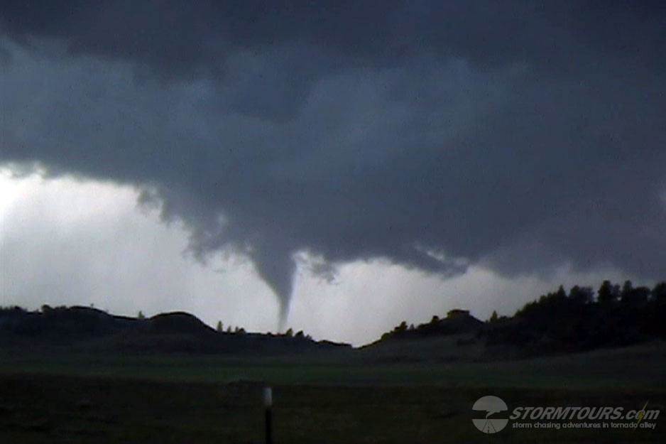
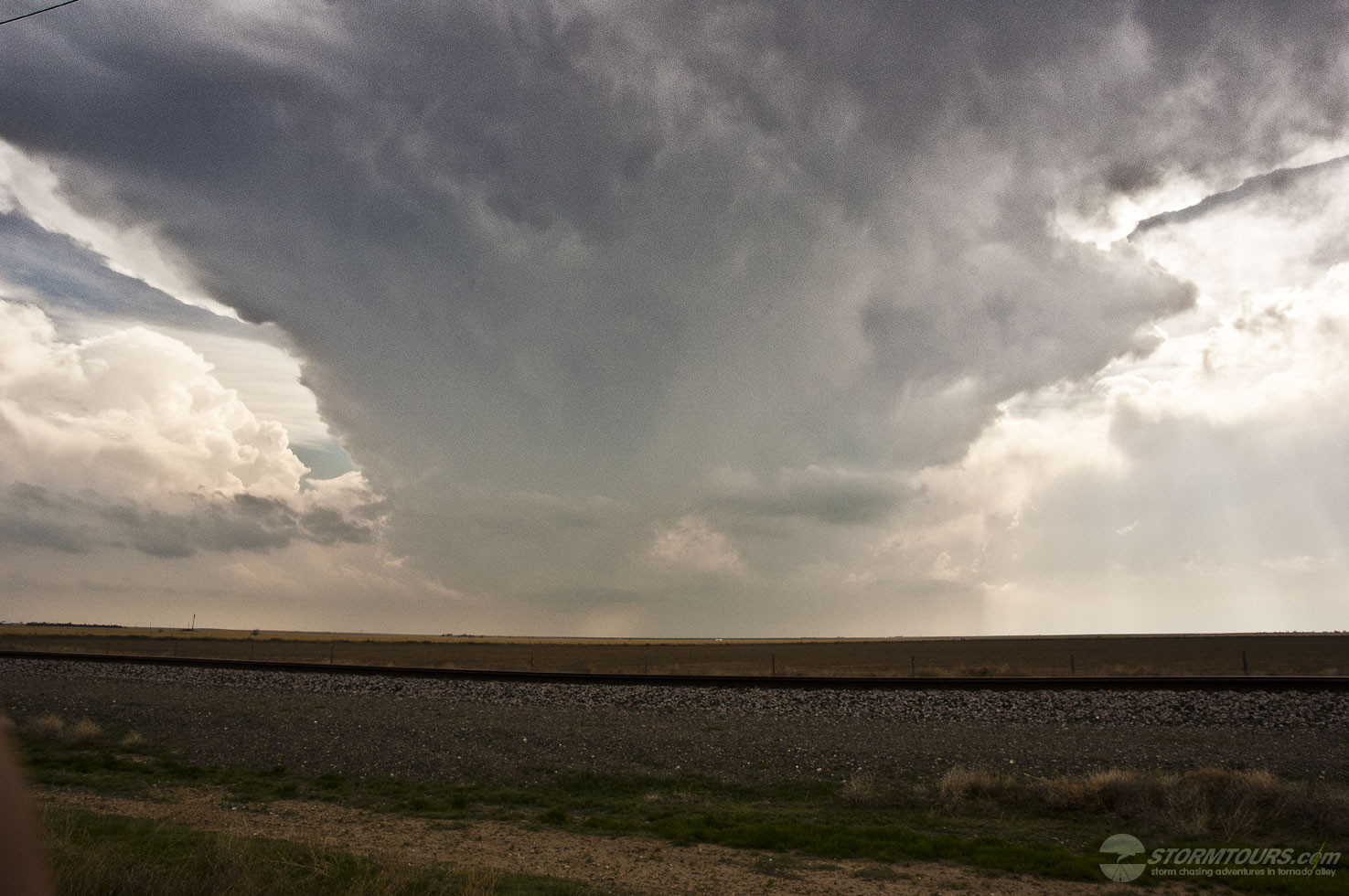
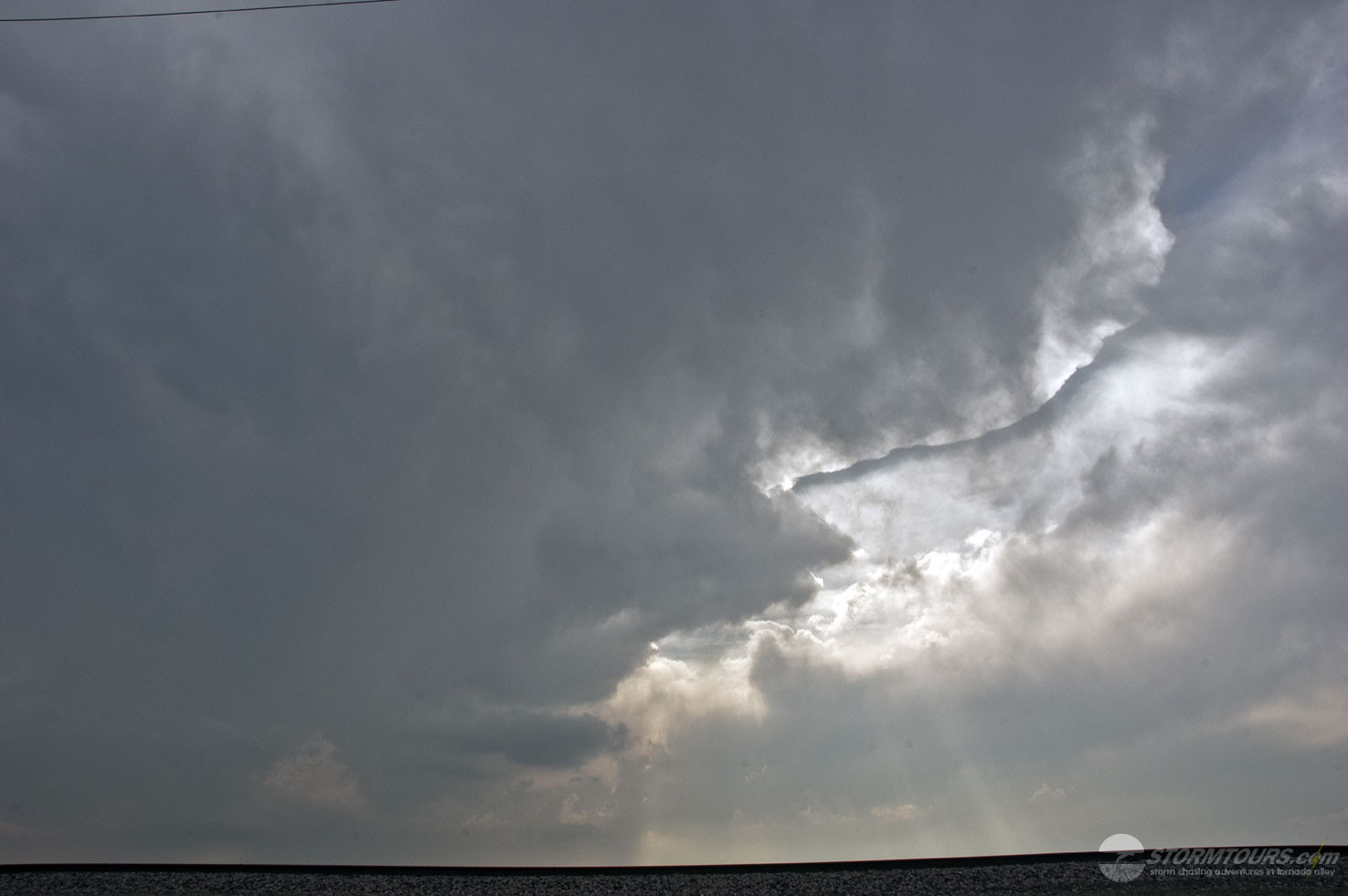
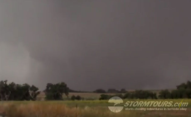
By late afternoon thunderstorm development was well underway with strong lift near the triple-point. Moisture was limited, a recurring theme over the past week. It was likely the limited moisture that prevented this supercell from producing a tornado.
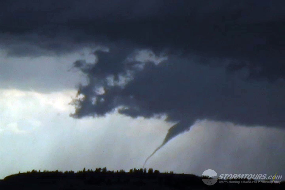
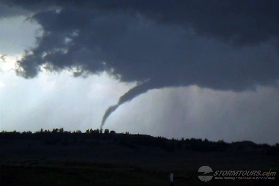
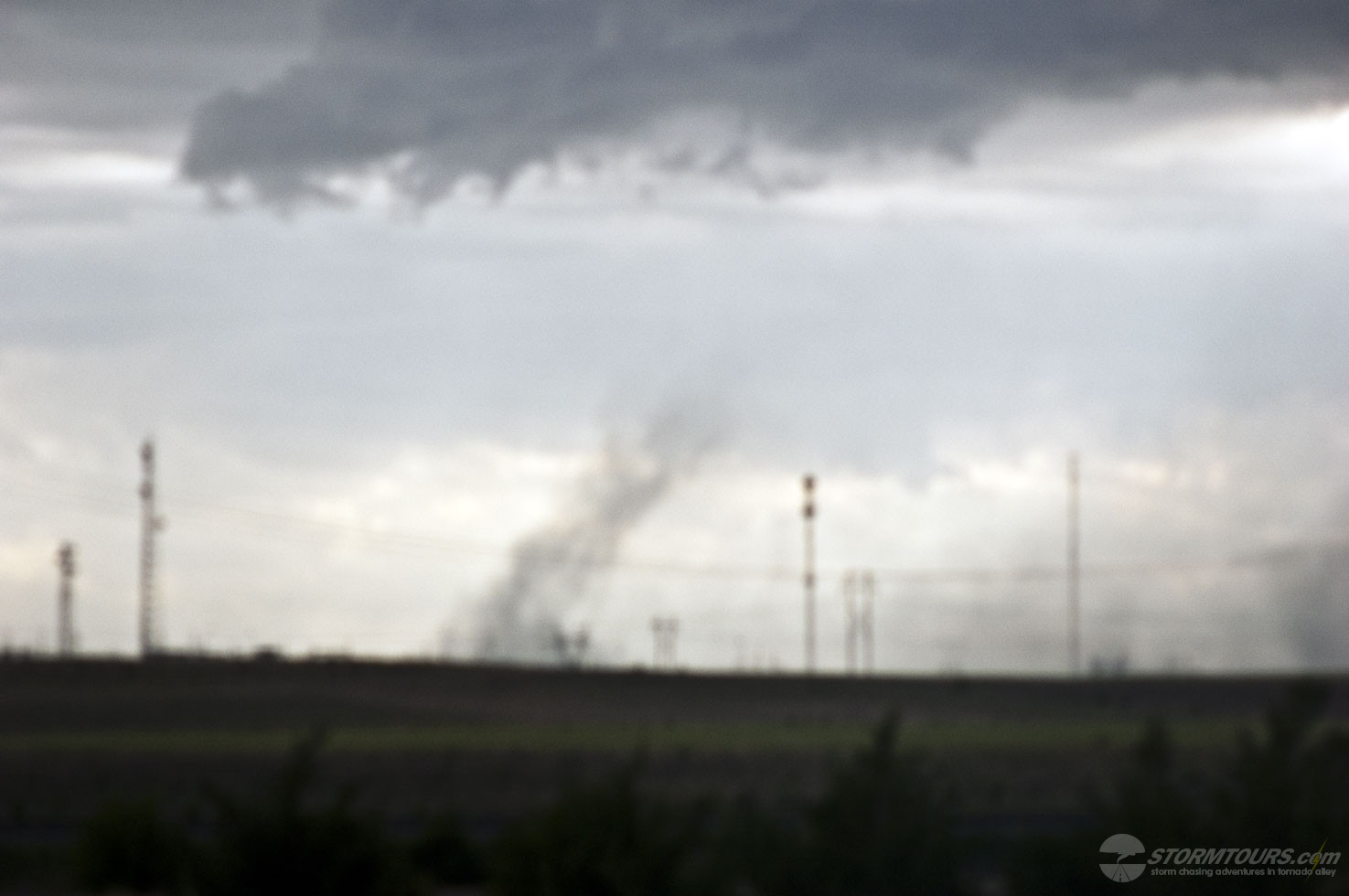
The highlight of the day was a large cone funnel that formed and began slowly filling in with condensation as it tried to touchdown. The funnel lasted for several minutes but failed to transform into a tornado.
Today brought us to Jefferson County in eastern Kansas where we caught a tornadic supercell that went from forming cumulus to a tornado producing supercell within 40 minutes. Tornado was a long rope that branched out over the treeline as viewed from the highway, the rope out stage lasted several minutes.
An amazing day of storm chasing in Montana started bleak and ended with a mini-tornado outbreak.
Moist upslope flow and weak large scale height falls were expected to encourage thunderstorm development across much of south-central Montana by mid-day. The Storm Prediction Center only issued a mere 2% chance of tornadoes, but we felt there was a good enough chance to warrant the drive to Montana.
We started the day in Casper, Wyoming and shot north into Montana.
We drove to Ekalaka, Montana and waited. After several hours, a high-based low precipitation supercell formed and quickly fell apart. Shortly afterward, another storm rapidly developed and intensified.
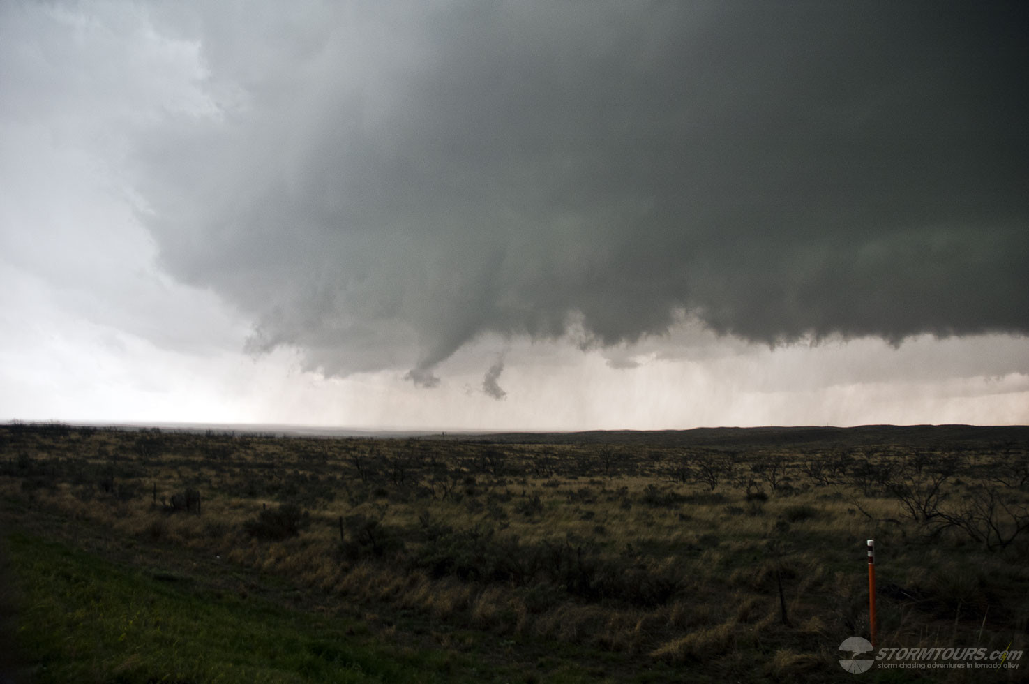
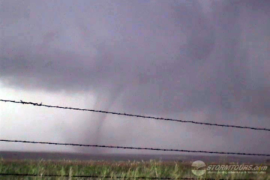
This storm had amazing structure and developed a rotating wall cloud. It didn’t take long before a funnel formed on the southwest side of the storm and attempted to reach the cloud, but dissipated.
A second funnel then formed that wasn’t connected to the updraft, then a debris swirl on the ground and then it connected to the updraft base. Yes, it was weird! The tornado stayed on the ground for several minutes before roping out.
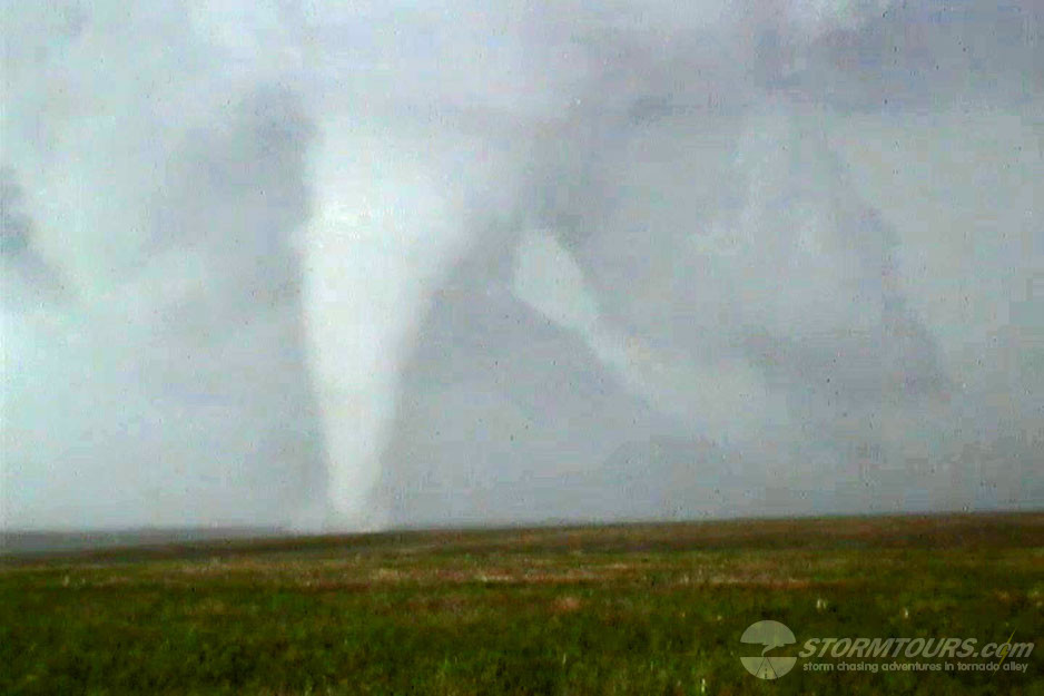
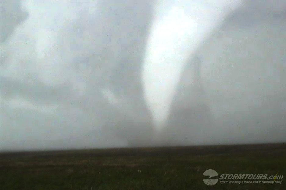
The third funnel from this amazing little storm then formed and became an amazing elephant trunk shaped tornado with rapid cascading motion in the cloud base.
As if two tornadoes in Montana wasn’t amazing enough, a fourth tornado formed as a truncated cone and lasted about five minutes before roping out. What an amazing day of storm chasing in Montana!