May 29, 2004: Central Kansas – Tornadic LP Supercell

day1probotlk_20040529_1630_torn_prt
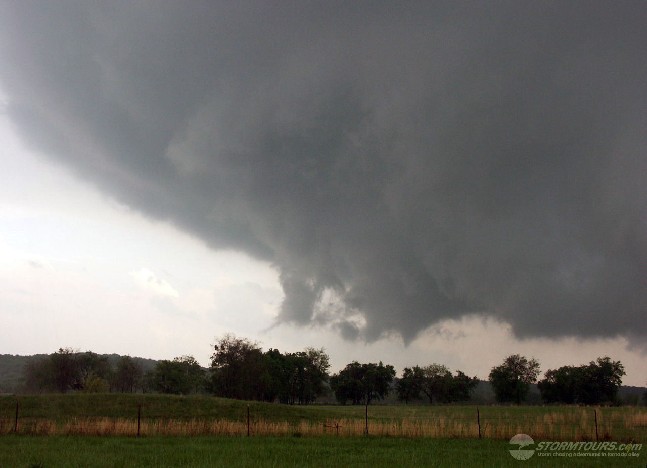
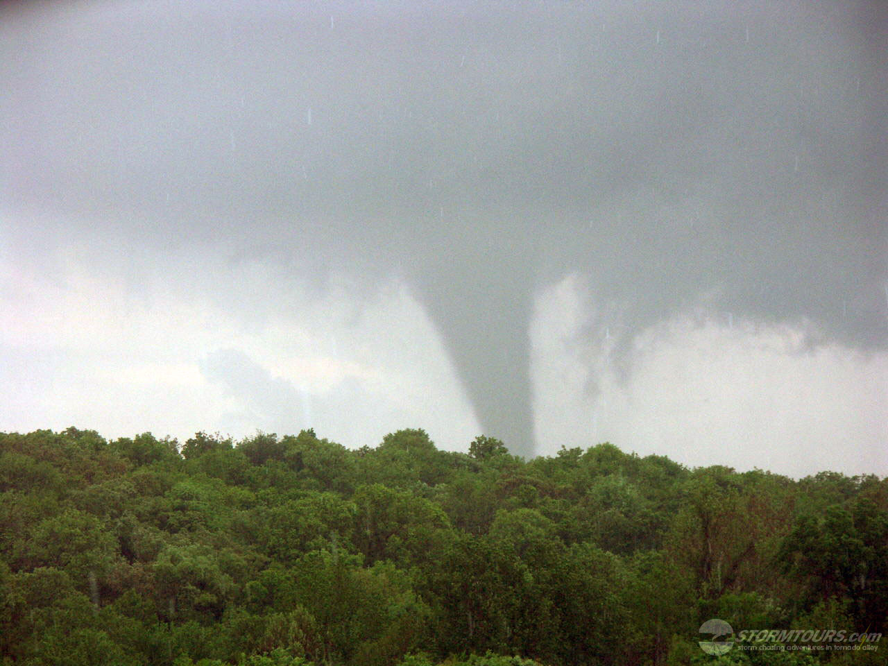
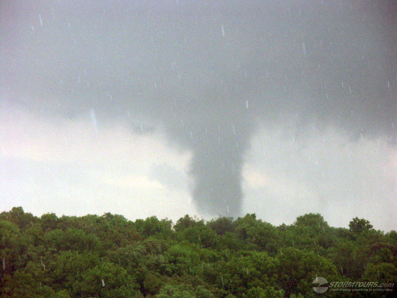
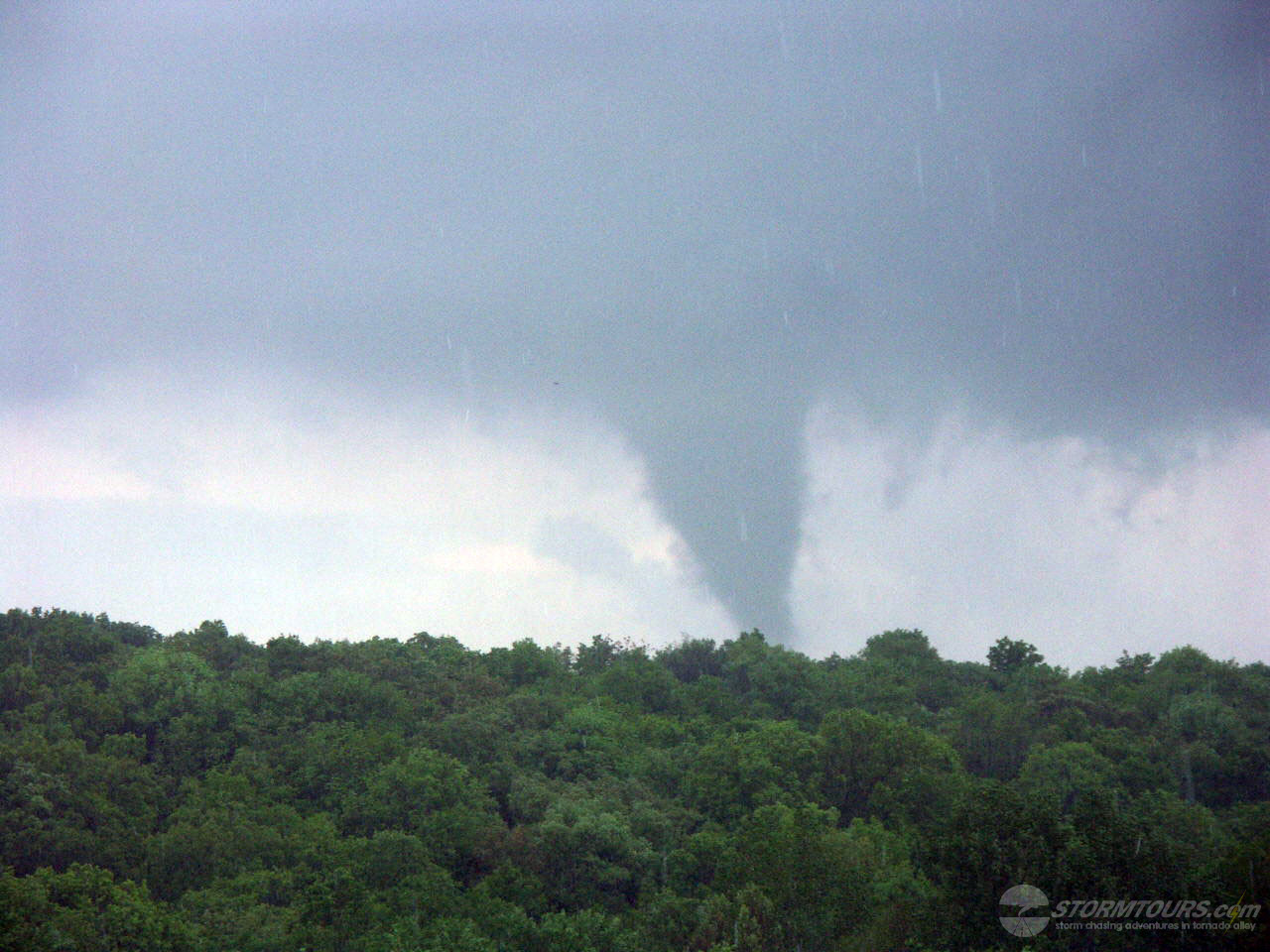
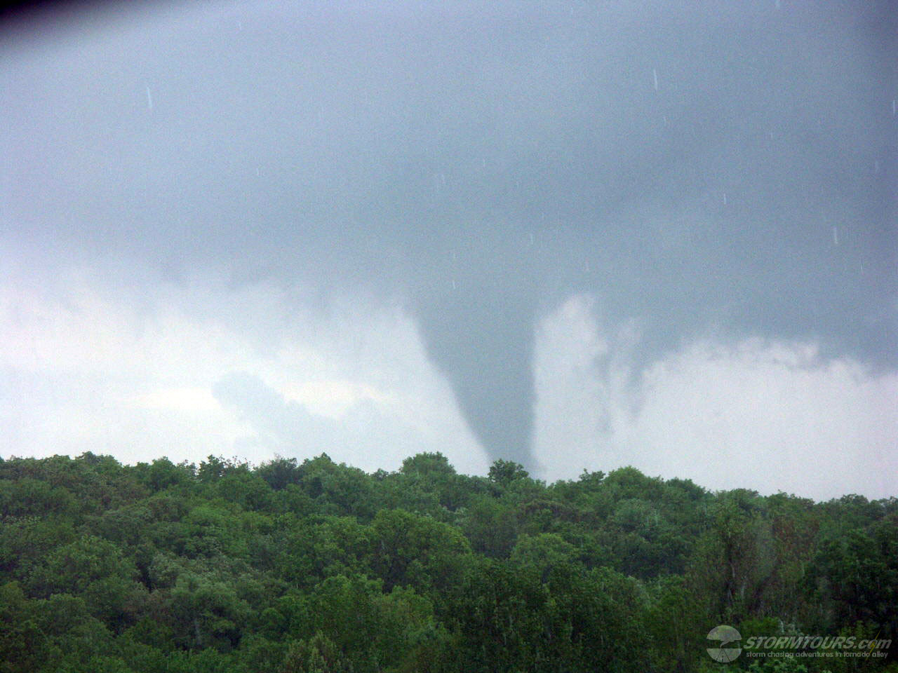
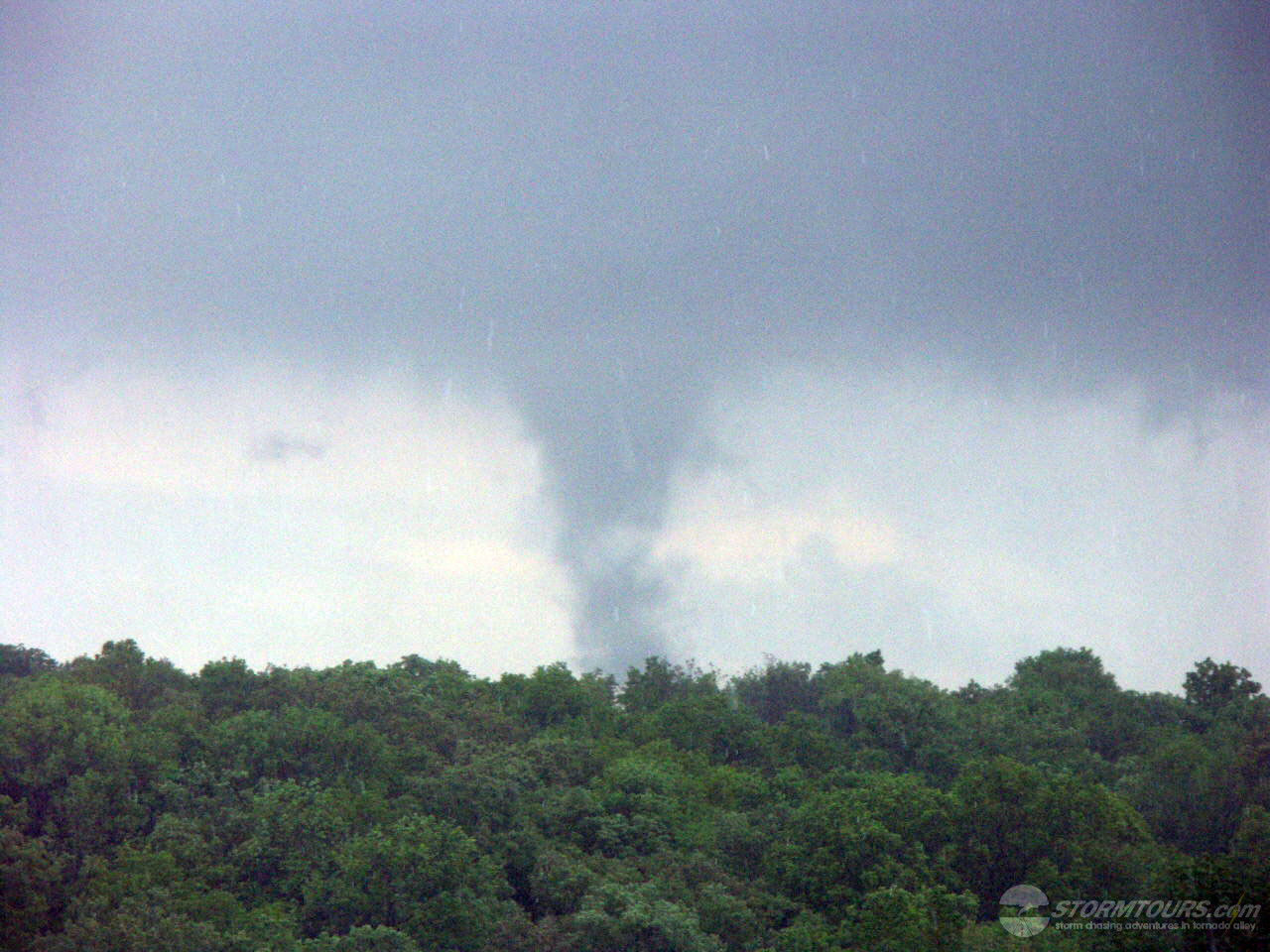
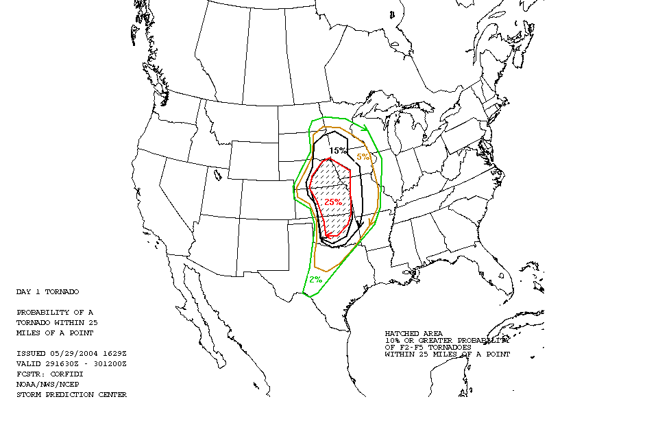
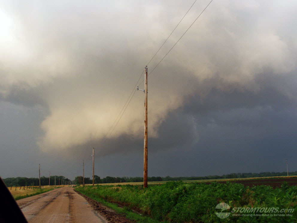
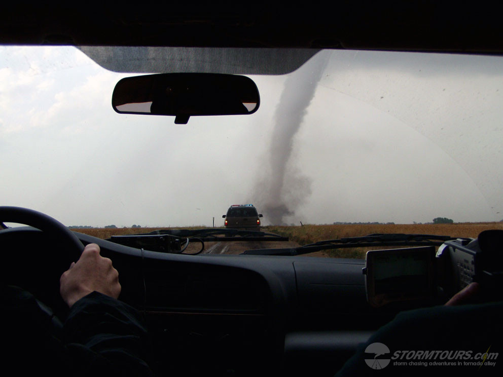
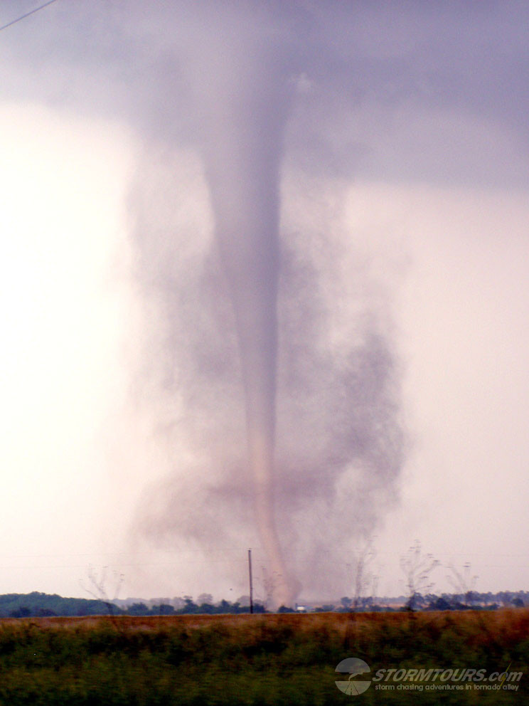
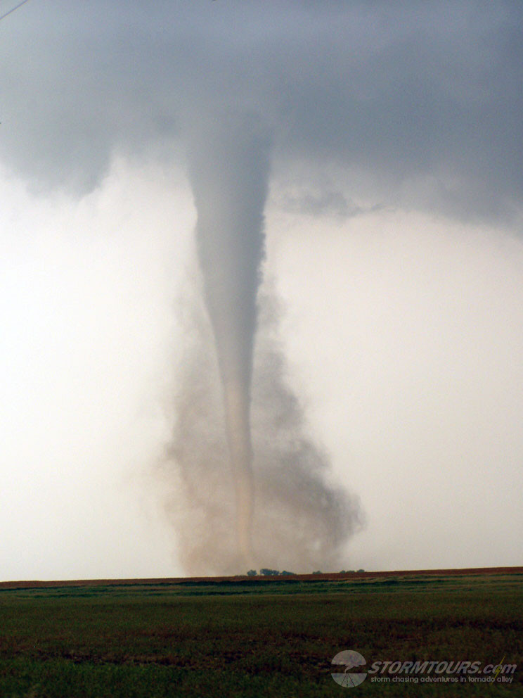
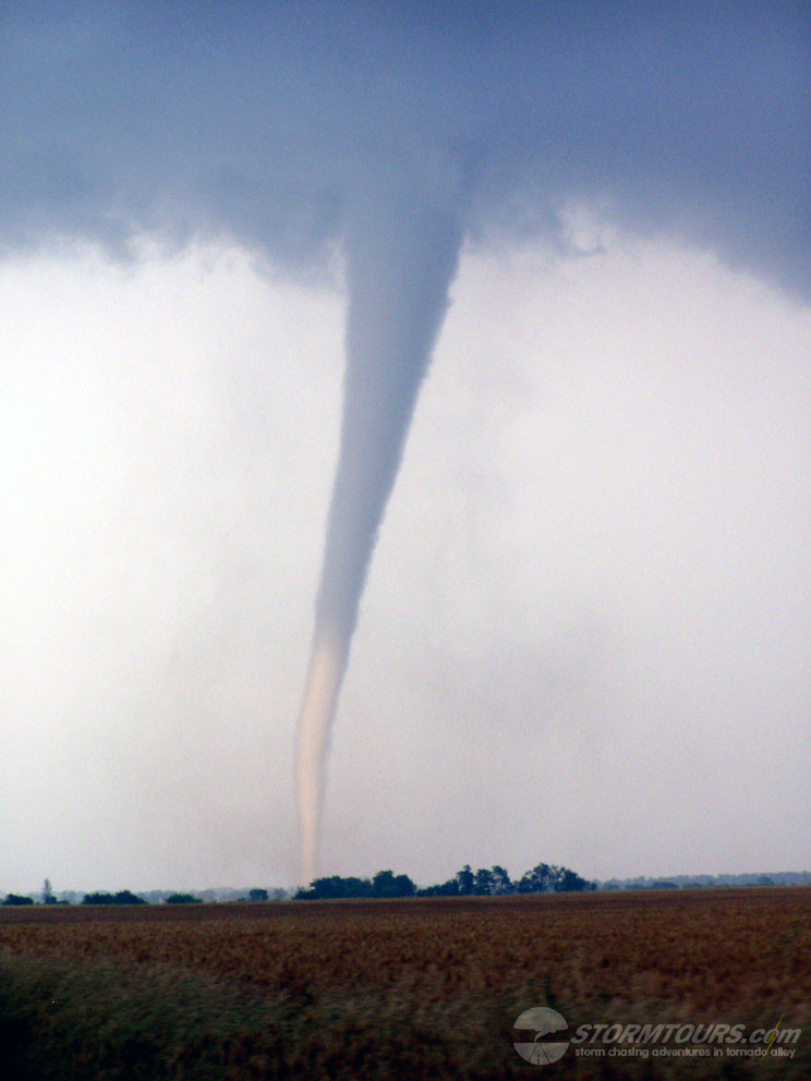
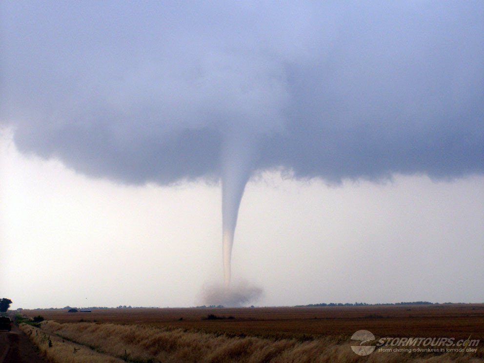
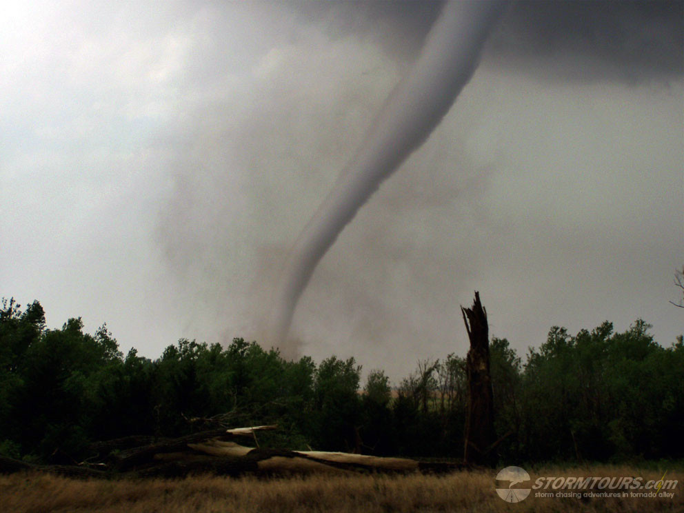
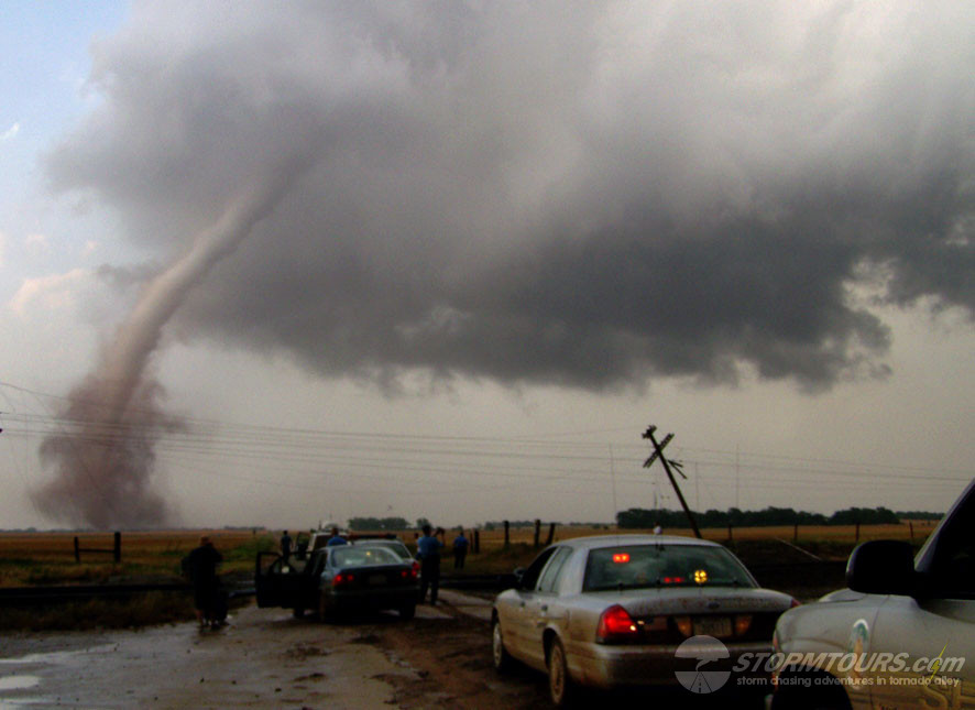
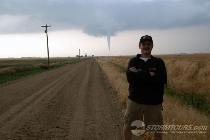
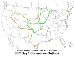
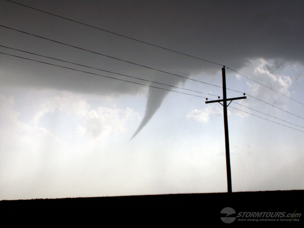
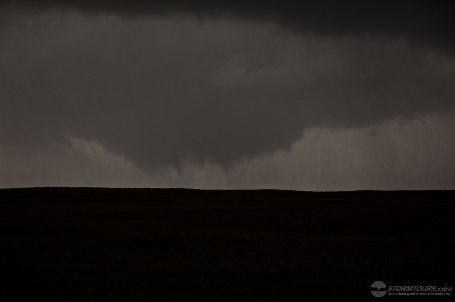
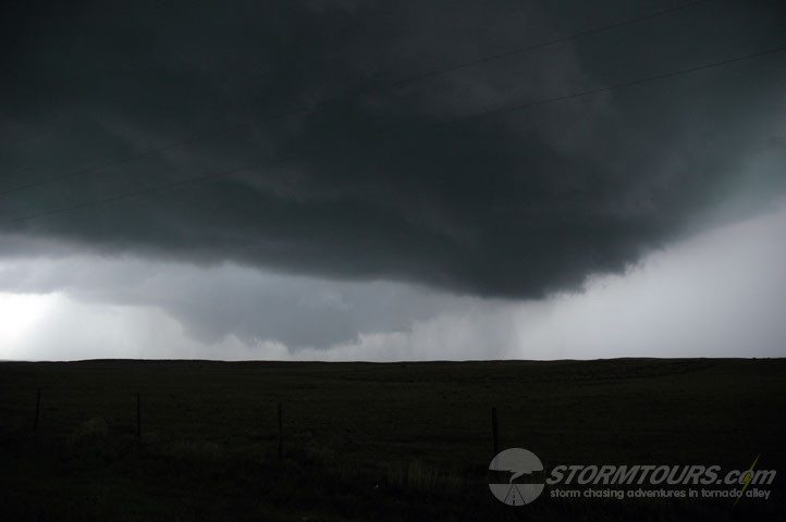
May 29th was the type of day you live to chase for, a “classic triple point” with a strong dryline punch in central Kansas and a deep low pressure system near Wichita and 1800 CAPE on the DDC 0z sounding.  SPC had issued a high risk area covering most of the central plains, a very large area which was more or less useless when you need to narrow it down to a single corn field.  I choose to play the dryline punch as opposed to the triple point and it paid off extremely well.  My late afternoon cumulus towers began to build and shortly after a couple of low precip supercells formed between Highway 54 and the OK/KS state border.  We could monitor both storms from one location, but quickly got into position when a wall cloud began forming on the southern cell.  With more cells popping up just south of the OK border, the pressure began to build, our storm was rotating, but it wasn’t in a hurry to produce a tornado.  Meanwhile, tornado warnings were being issued across north-central Oklahoma, and we had time to get to them.  I decided to wait as patiently as possible and not long after that, our storm tapped into some extremely moist air with dewpoints in the high 60s and began to spin like a top.  We were positioned less than a mile from the first tornado formed, giving us easy access to pursue the tornado for several miles during its 31-minute lifespan.

May 12, 2004: Harper, KS – Tornadic Supercell

day1otlk_20040512_1630_prt

May 12th was an interesting day that brought a series of tornado producing supercells across parts of southern Kansas.  Strong low-level convergence was taking place along an intersection of a surface low, dryline and quasi-stationary boundary in southern Kansas to northeastward along a surface front that extended into central Kansas with deep layer shear of 35-55 knots and a very unstable air mass with CAPE values of 3000 j/kg in the warm sector extending across the southern half of the state.

I chose to play the triple point that was occurring in Harper County.  Which produced a couple of tornadoes for us.  Unfortunately, my camera’s battery was near dead and I was only able to capture a few structure images and the first brief funnel (which later confirmed to be a touchdown/tornado) before losing my battery.


April 23, 2003: Clarendon, Texas – Tornadic Supercell

day1otlk_20030423_1630_prt

Not the most productive storm chasing day of 2003, but we ended up with a brief tornado near Clarendon, Texas.

The Storm Prediction Center issued a Moderate Risk for the area in and around Wichita Falls. A much larger Slight Risk area extended from the Gulf of Mexico to the Colorado/Nebraska Panhandle.

We started our day from Liberal, KS. The initial target area was near Wichita Falls. However, as we were driving south through the Texas Panhandle we crossed the Dryline and made the decision not to proceed to our initial target near Wichita Falls.

Most of the day was spent monitoring conditions via satellite. We parked at a truck stop along Interstate-40 at the State Highway 70 Intersection.

This is about 25 miles north of Clarendon. By mid-afternoon, we visually noticed towering cumulus to our southwest and opted to begin our day’s chase operations.

Storm development began in dry air. As the developing storm crossed the Dryline boundary, the skies grew dark very quickly. At times we encountered some large hail, about golf ball size. The windshield on the storm chasing tour van ended up getting a large crack in it.

Chasing in this part of Texas is always a wonderful experience. The paved rural roads greatly help in intercepting storms without risk of getting stuck. We got on the storm and stayed with the updraft base, which at times became wrapped in rain with a strong rear-flank downdraft present.

Staying southeast of the east traveling storm, there was a quick break in the occluding rain curtain that gave us a quick peek at a tornado as it was weakening.

All in all, as stated it wasn’t the most productive day in terms of tornadoes, but any day with a tornado is worthy of a celebratory dinner. We traveled to Amarillo and had dinner at The Big Texan, a landmark of the Texas Panhandle.

May 07, 2002: Pratt, KS Tornadic Supercell

Everything seemed to be coming together for a significant tornado outbreak. We decided to target storms in southwest Kansas east of Dodge City. Strong wind shear and instability would set the stage for supercells that could produce tornadoes. Storms struggled throughout the evening with the strong shear ripping apart any storm that tried forming. Finally, a supercell developed near Pratt that became tornado warned. It produced a weak tornado and many funnel clouds. About an hour later, after dark, several supercells developed and produced numerous tornadoes. We were able to intercept six of the tornadoes, but due to staying busy with navigation and limited light, unable to capture good photographs of the night time tornadoes.

April 19, 2000: Cherryvale Kansas Tornado

day1_1630
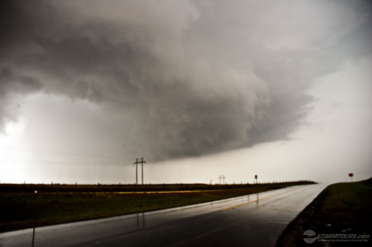
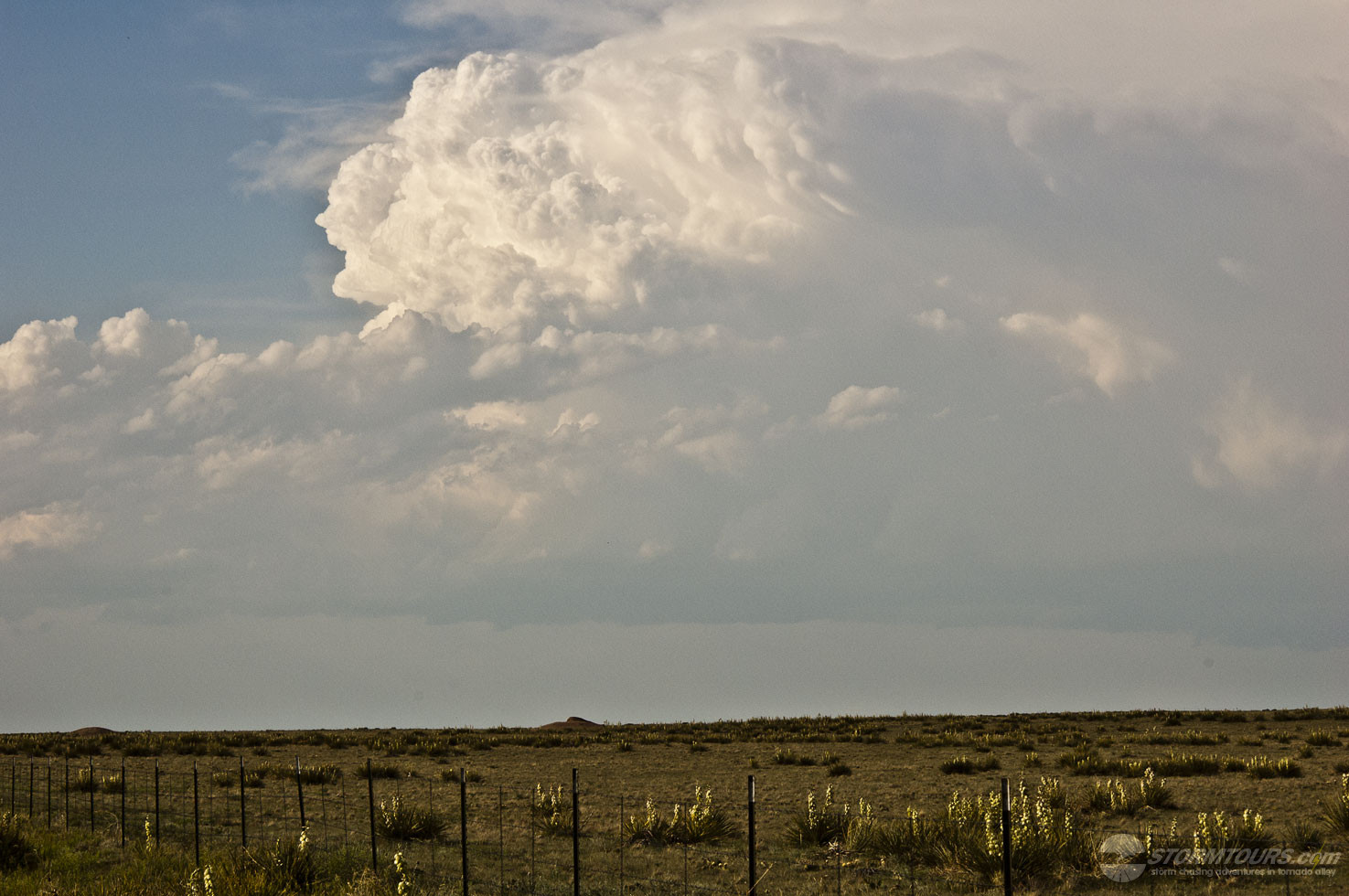
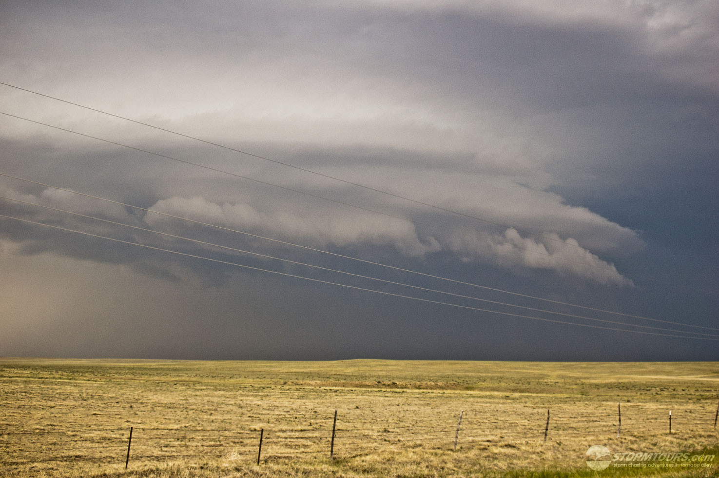
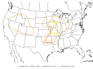
Severe thunderstorms developed ahead of a pre-frontal dryline just after 7 pm CDT.

The first supercell developed across Montgomery county, with the first brief tornado touchdown (F0) near Havana just before 8 pm.

The same supercell produced another brief tornado (F0) as it passed just south of Cherryvale. This storm intensified as it moved across northern Labette county and produced a longer track tornado (12 mile path) with F3 damage occurring in the city of Parsons around 8:50 pm.

The second supercell storm moved across Neosho county, producing a tornado southwest of Erie around 8:25 pm. This tornado produced F2 damage along its entire track across Neosho county.

Today was the first official organized storm chasing tour in our company’s history. Last year, I took a paying passenger along on the chasing during the May 3rd Bridgecreek-Moore Tornado, to help cover expenses of the day. That event laid the foundation of creating a storm chasing company and today is the result of those efforts. We started our first tour from Tulsa and left for southeastern Kansas.

Cloud cover looked to be a problem early on and was keeping surface temperatures low. By mid-afternoon, the clouds began to erode away and with 3500+ j/kg of CAPE in-place. It was a matter of time before the heating was to break the cap.

A surface low was in-place in northern Kansas which pushed a cold front into SE Kansas and NE Oklahoma. The cold front was the focal point for late afternoon development.

I drove to Independence on Highway 75 and then turned left on 160 to 7-Mile Corner. Sitting near Cherryvale for about an hour, I began watching the cumulus beginning to tower.

Without anything more than a cell phone to use to retrieve any information, I hit the jackpot and was quickly on a forming supercell that produced a large tornado. The tornado damaged several structures but thankfully didn’t produce any serious injuries.

The terrain was, of course, the biggest failure as the tornado formed in an area of thick trees and hills near the Cherryvale lake. As a result, there were limited road options coupled with a fast-moving storm that moved quickly to the northeast.

1 11 12 13 14 15