April 23, 2007: Tornadoes near Protection, Kansas

day1otlk_20070423_2000_prtWhat a day this turned out to be! Not only did the folks on Tour 2 get an up and personal meeting with a tornado on the 21st of April. But, just two days later they saw seven tornadoes in Southwestern Kansas on the 23rd!

The day presented many challenges with a couple of interesting target locations. The Texas Panhandle and southwestern Kansas were both in-play.

The Storm Prediction Center issued a Slight Risk area extending from near Lubbuck, Texas to northwest in extreme southwestern Nebraska. Additionally, there was a Moderate Risk area covering most of western Kansas.

Starting off from Amarillo, Texas, our original target was the northern Texas panhandle. But, it became evident by early afternoon that it was the wrong play as moisture was just too limited in this area with low dewpoint values. We repositioned on the second area of interest in southwestern Kansas and northwestern Oklahoma.

The first storms of the day were intercepted near Buffalo, Oklahoma. We witnessed our first brief tornadoes of the day (I believe there were three out of this storm) just to the north.

That cell died out and a new cell formed on its southern flank. As a result, we drove north to intercept the new supercell as it crossed into Kansas.

When the storm finally caught up to us it went crazy! Producing tornado after tornado for a show that lasted several hours.

As the evening progressed and sunlight grew dimmer, we moved a few miles to the west and continued shooting video of this tornado producing beast.

We caught a total of at least seven tornadoes between these two supercells. Spending much of the early evening hours photographing lightning out of this thing as it moved away from us to the northeast.

What an incredible day for an already incredible tour!

April 21, 2007: Boys Ranch, Texas Tornado

Can you imagine what it must be like to want to see a tornado your entire life and on the very FIRST day of your tour you get within 1/4 of a mile from one? That is exactly what happened to this tour group – and a great group they were!

Atmospheric Conditions on April 21, 2007

Tour 2 started off bright and early, actually, it was 4:30 am so it wasn’t so bright…

We wanted to get an early start because this day showed all the signs of a potential tornado outbreak from the Texas panhandle up through extreme western Kansas.

A large upper level low pressure system (cut-off low) was positioned over Arizona providing Southerly flow in the upper levels. The dryline was positioned along the Texas/New Mexico border, and a pacific cold front was pushing through Eastern New Mexico.

By mid-afternoon, we began narrowing down our target area in the Texas Panhandle. A few hours later, we had one of the most beautiful tornadoes that I have ever seen on the ground and less than a quarter of a mile away from us.

Just as the tornado formed we had to move our position a little in order to get out of the tornado’s path and what happens? A flat tire!

So, we outran this tornado on 3 tires and a rim and were unable to pursue after it. This storm continued on and did cause damage to the town of Cactus, TX about 20 minutes after it first produced this tornado. Meanwhile, we were alongside the highway changing out a flat tire.

The following day, we got the tire fixed – remounted the spare tire and set ourselves up for a possible tornado outbreak on the 23rd of April (which was insane!).

NOTE: I want to personally thank Dr. Tom for being a great sport while chasing with our second tour group. He made a wager on our first day that if I could get the group a tornado on the first day that he would shave his head. Long story short (in case you don’t read all this) we intercepted a beautiful tornado between Vega and Dalhart, Texas near Boys Ranch and Dr. Tom kept his word and allowed one of our tour guides to give him a little haircut….(okay…we bic’d it!). Tom, as always – you are da’ man! You made this tour funny, exciting and I look forward to chasing with you in the future.


March 28, 2007: NW Kansas Tornado

day1otlk_20070328_1630_prtThis was an incredible day that eventually involved so many tornadoes that I lost I count. I was unable to obtain quality photos/videos for every tornado that I saw because most occurred near sunset and I was chasing alone on this day and driving so for this chaselog I’m only posting the best catch of the day – a beautiful tornado that had perfect contrast and took on many forms.

I also witnessed a very large wedge tornado at the end of the day that was near the Bird City, KS area. This occurred after dark, so the only way to see this tornado was to view it when the lightning from the storm would back-light the tornado.

The day started out for me in Wichita, KS and it was apparent that I had two chase targets that were possible – either the Texas Panhandle or extreme NW
Kansas. My initial inclination was to chase in the Texas Panhandle, but I eventually set my focus on western Kansas. The reason for this decision was due to the fact that it became obvious to me, early in the day, that the Texas Panhandle storms would be well covered by multitudes, while there were less storm chasers in western Kansas and an extremely good potential for supercells that would produce tornadoes.

With that in mind, I headed to the Ulysses, KS to sit on the dryline and try to get on any storm that formed very early. I drove west along US 160 and my weather station showed a dramatic decrease in dewpoint temps just west of Ulysses, I turned around a drove back to the east and again I went from a 39 F dewpoint to a 55 dewpoint within a few seconds. Around 3 PM a cu field began to develop just to my west in extreme eastern Colorado and began to slowly move into western Kansas.

A few towers began developing and would get sheared over and die off, finally I caught sight of a large tower going up just slightly to my northeast and I quickly drove up Highway 83 to Scott City and left on 96 to Tribune and then north on 27 where I intercepted the storm near Sharon Springs.

I had to drive through Sharon Springs and I could just barely make out the outline of the tornado through the core once I was on the north side of town. I could have just shot photos from there, but I decided to punch into the core and get a better position on the tornado as carefully as possible. Once I did I came out in a perfect spot with the tornado just paralleling Highway 27 as it slowly moved north. As I approached the tornado from the south and broke through the rain curtain, I was only a few hundred yards from the base of the tornado. I pulled over, looked straight up at it and started taking photographs as it moved north and away from me.

I got back in the van and followed it for several miles, stopping several times and taking photographs. It was on the ground for at least 10 minutes before it roped out and the only other person I saw along 27 during the duration of this tornado was the county’s sheriff who was sitting in his truck and trying to get cell phone video of the tornado.

Once the tornado roped out another chase vehicle pulled up behind me and I chatted for a few minutes with 2 other chasers. They saw the tornado as well, but from a distance and had to look at it through the core for a perfectly understandable reason – they didn’t want to get any hail damage. Still yet, that was it as far as “chaser convergence.”

The storm started to look a bit as if it were becoming outflow dominant and I thought about calling it a day for a few minutes, but it wound itself back up and started producing tornadoes again, but by this time it was near I-70 and there was less than a few minutes of daylight left in the day. I saw this storm produce at least another 10-15 tornadoes within just a few minutes. Once it crossed I-70 it was still producing tornadoes and there were a few more chasers along the interstate so some of these tornadoes are well documented since those chasers were in a better position and “camera ready” and I was not due to driving in from the west with now poor contrast on any developing tornadoes.

To end the day, I decided to do some quick lightning shots and I drove east to Brewster, KS to set up there so I could hopefully get some structure that would be illuminated by lightning – what I saw amazed me yet again. During the lightning flashes I could see a developing tornado on the base of the storm. The lightning died down for a few minutes, but the next flash of lightning made my jaw drop – there was already a large wedge tornado on the ground! I was lucky enough to get that flash of lightning within the exposure time of the photo I was taking. Those images are also shown below.

SUMMARY: A stalled upper-level low pressure system in late March brought height falls across eastern Colorado and western Kansas while increasing a backed wind field throughout much of the central plains with increasing dewpoints and steep mid/upper shear values. A tornado outbreak resulted across northwestern Kansas. I was able to get the first tornado of the day from the Sharon Springs, KS supercell and followed the storm north of I-70 through the late evening hours to witness at least another 10 to 12 tornadoes from this amazing storm, including a large wedge tornado that caused damage near the community of Bird City, KS.

The best part of day was that most other storm chasers were currently in the Texas Panhandle sharing several tornadoes amongst themselves, while StormTours.com has this tornado event in northwestern Kansas pretty much to ourselves (or since this pre-season and I had no customers with me, I should say, “myself”), and this is the only place where you’ll find images of the long-lived tornado that occured just north of Sharon Springs, KS.

March 26, 2007: Southcentral Texas Tornadoes

day2otlk_20070324_1730_prt
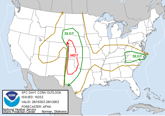
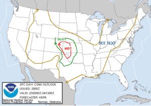
Despite a moderate risk issued by SPC for parts of Wisconsin on Sunday March 25, I decided to not take the chance of chasing in that area due mostly to the terrain (big hills and valleys, and no roads) of southwestern Wisconsin. However, the second option wasn’t much better – the Hill Country of southern Texas and a lesser chance of tornadoes for the following day. The gamble paid off though because the moderate risk was a complete bust, and the less marginal risk area in Texas produced at least 5 tornadoes that we saw – 4 tornadoes and 1 landspout to be exact.

We made it to Kerrville, TX on Sunday before getting into a hotel for just only 4 and a half hours of rest and waking up to a cloud filled sky with torrential downpours in the Hill Country. Not exactly the place you want to be when a Flash Flood Warning is issued!

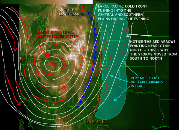
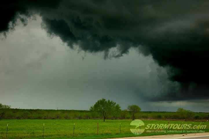
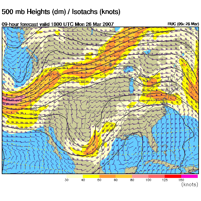
After looking over the morning forecast data, I had some mixed emotions. The tornado forecast had a lot of potential, but it was obvious that a nasty MCS would develop quickly and there wouldn’t be a lot of time for any cell to get its act together and produce a tornado before it became mulched by the squall line.

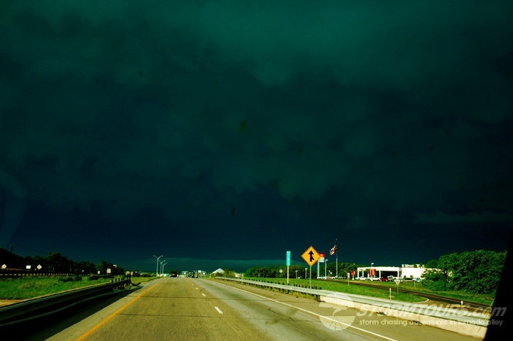
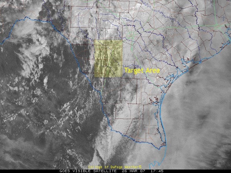
Satellite VIS imagery showed a dry notch just south of Kerrville with an upper 50 knot jet coming off the Mexican Escarpment and -14 C temps at mid-levels. This combined with extremely rich tropical moisture that happens in extreme southern Texas and decent backing just ahead of a mesolow seemed to be the place to be at – with that in mind we drove through a developing river in the middle of Kerrville and headed down Highway 173 to Hondo, TX. As we broke through the cloud deck my weather computer started showing a rapid increase in temp/dewpoint and went from 64/59 to 72/70 within 5 minutes! I started to get very excited!

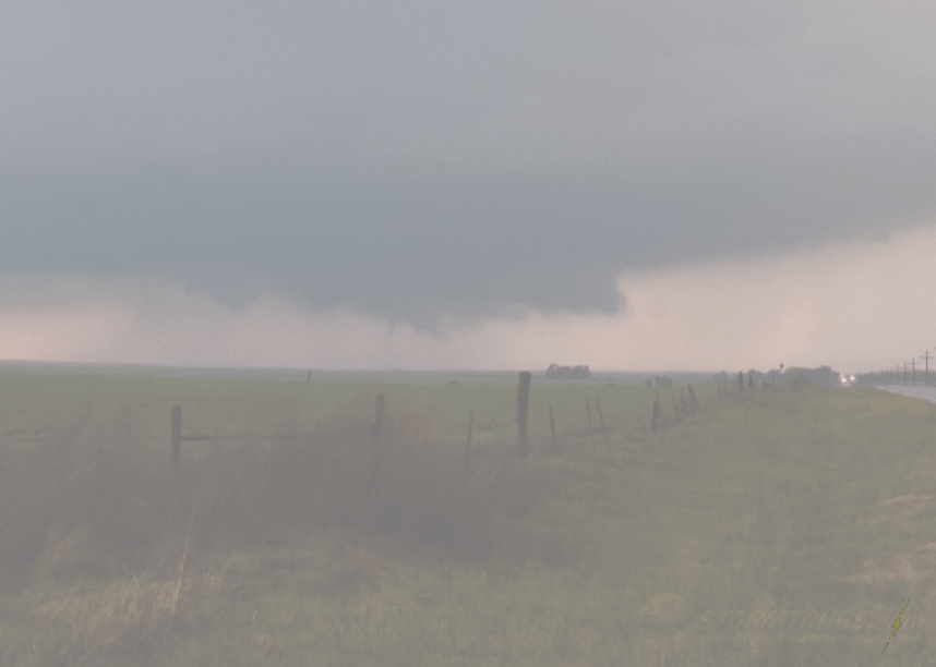
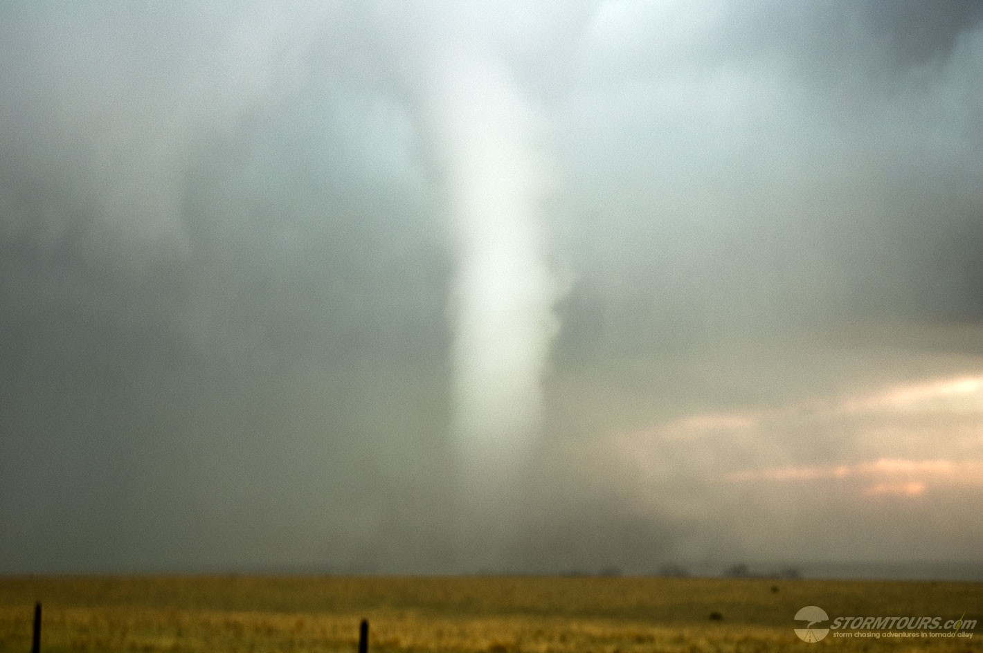
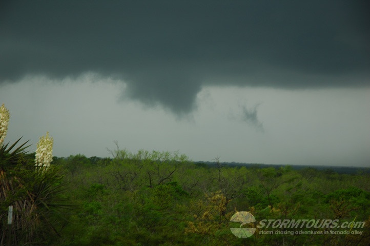
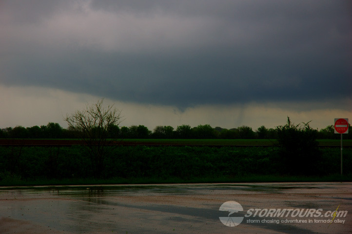
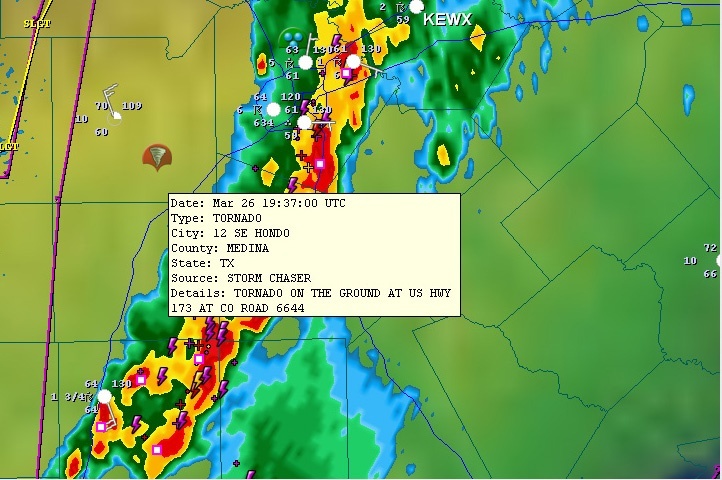
I filled up the tank when arriving in Hondo and noticed a tower developing overhead. After getting fuel, I pulled into an empty parking lot just off the highway and started looking at more forecasting data. The storm overhead looked terrible on radar, so I decided to continue going south to investigate a storm that was developing near Pearsall, TX. Just as I turned the van to exit the parking lot, something caught my eye to the left (east) – TORNADO!

I couldn’t believe it! This tiny looking cell with horrible structure had already produced a tornado and it most likely developed right behind me and I didn’t even see it.. I got so excited jumping out of the van to grab my camera that I actually tripped over my own feet and ate some pavement – back on my feet to run around to the other side of the van and get my cameras out..meanwhile Renee was trying to load a tape in the video camera with less than steady hands.

I started snapping away and out of the excitement I also forgot to check the settings on my camera and the images turned out overexposed, so I have done my best to correct them below.

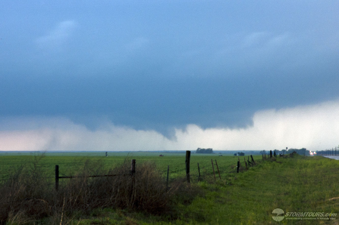
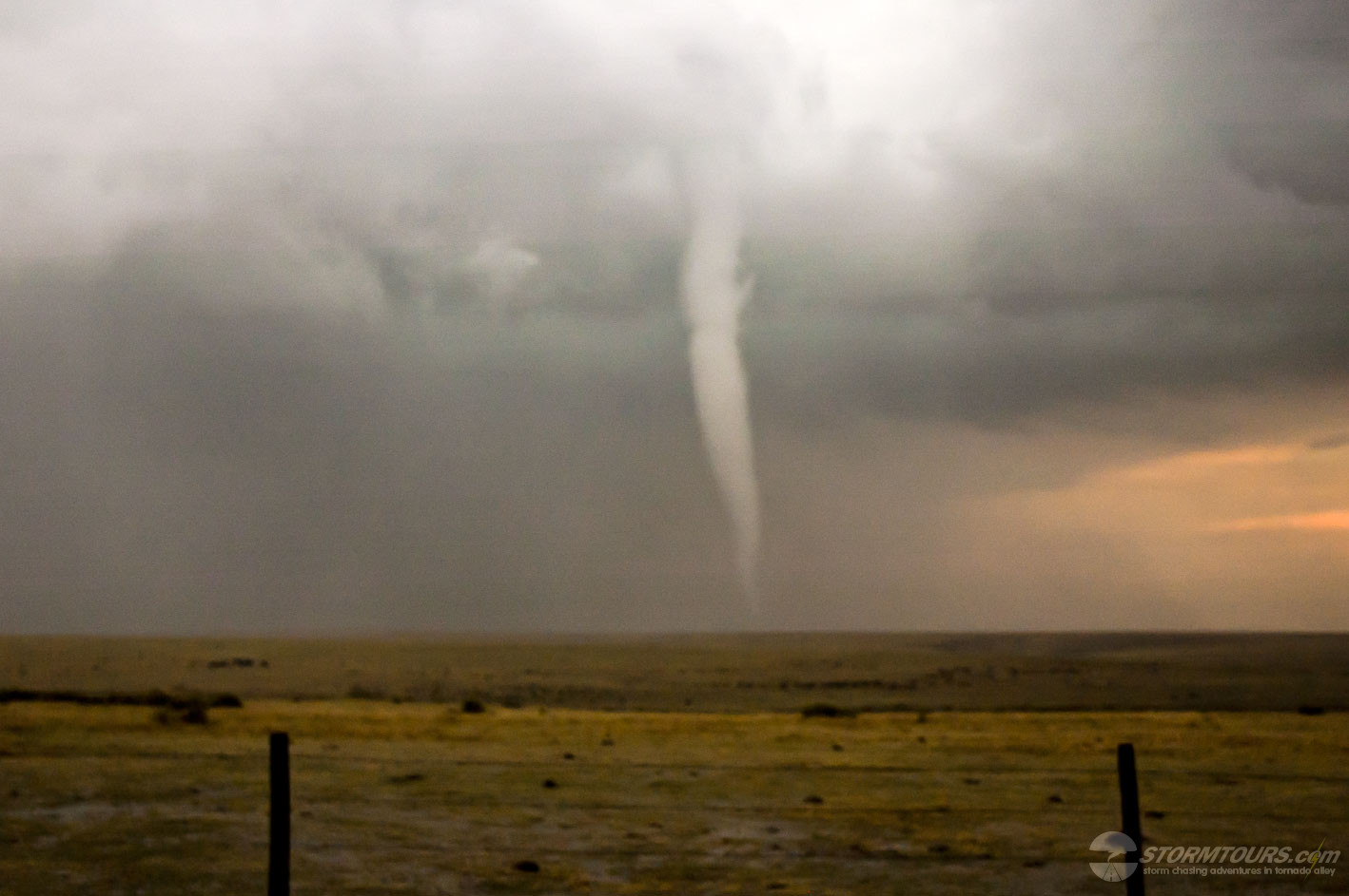
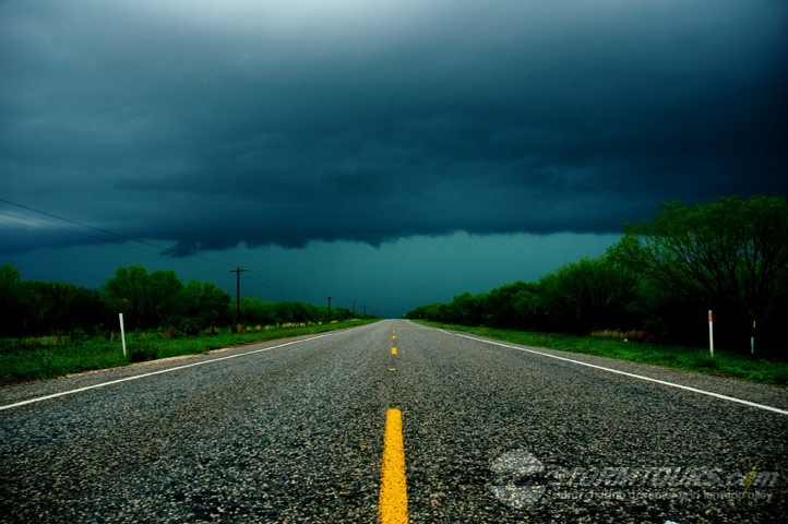
I jumped back into the van to pursue the storm getting on Highway 90, crossing Highway 173 and driving east. Once I got past the overpass the tornado had already begun to rope out and the funnel crossed over the highway just about a mile in front of us. I wasn’t going to doubt this little storm again – so I decided to turn around get back on 173 and head north to find a better east option and try my best to stay with this storm.even though it was moving pretty fast.

Storm Reports
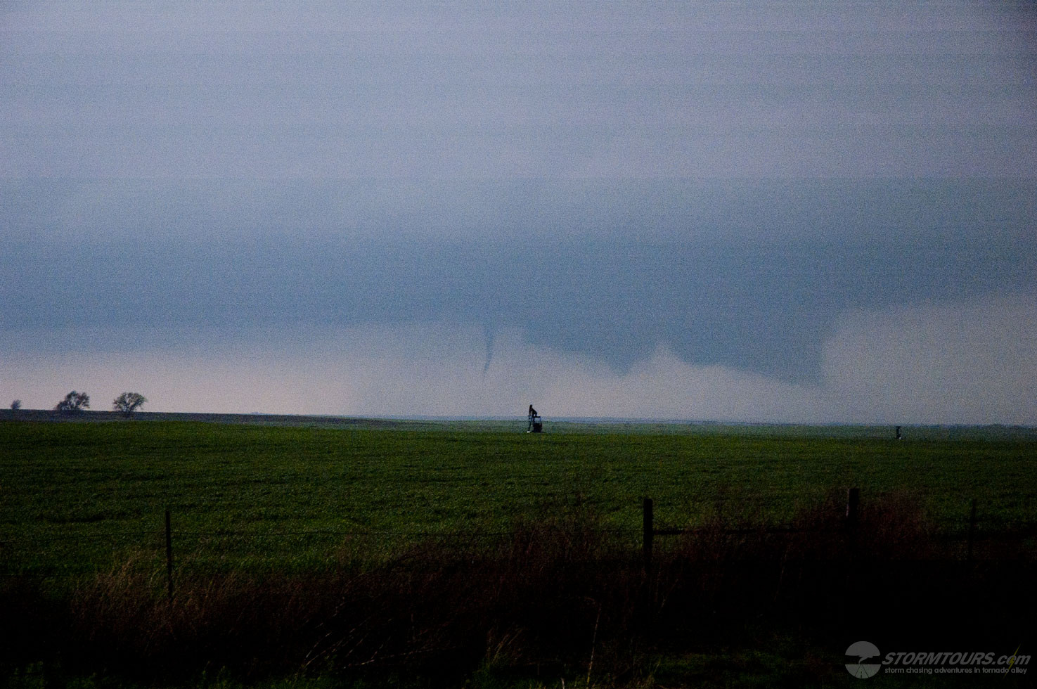
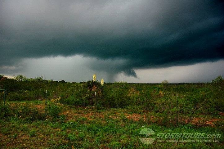
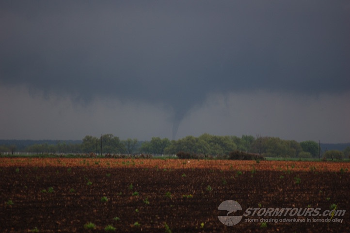
I took Highway 2767 to the northeast and drove about 10 miles – realizing the storm was getting further and further away and this highway would soon make a turn back to the southeast. No other road options, except muddy country roads, I pulled over and just started to snap photos. The cell produced a brief, weak landspout off the rear-flank that appeared to be in contact with the cloud base, but I don’t believe it was and at the same time it had another tornado on the ground, which from my best estimate would have been just to the north of the “New Fountain” area (not much located there). I had to let this storm go because it was merging with a developing squall line and there was still that cell to our south that I wanted to chase.

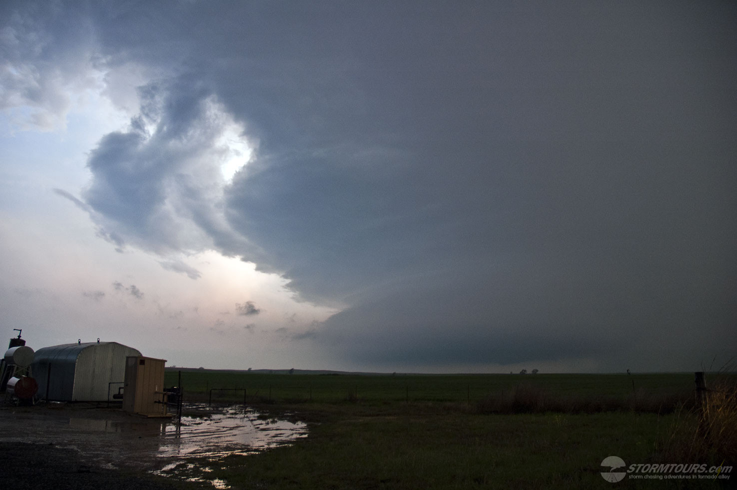
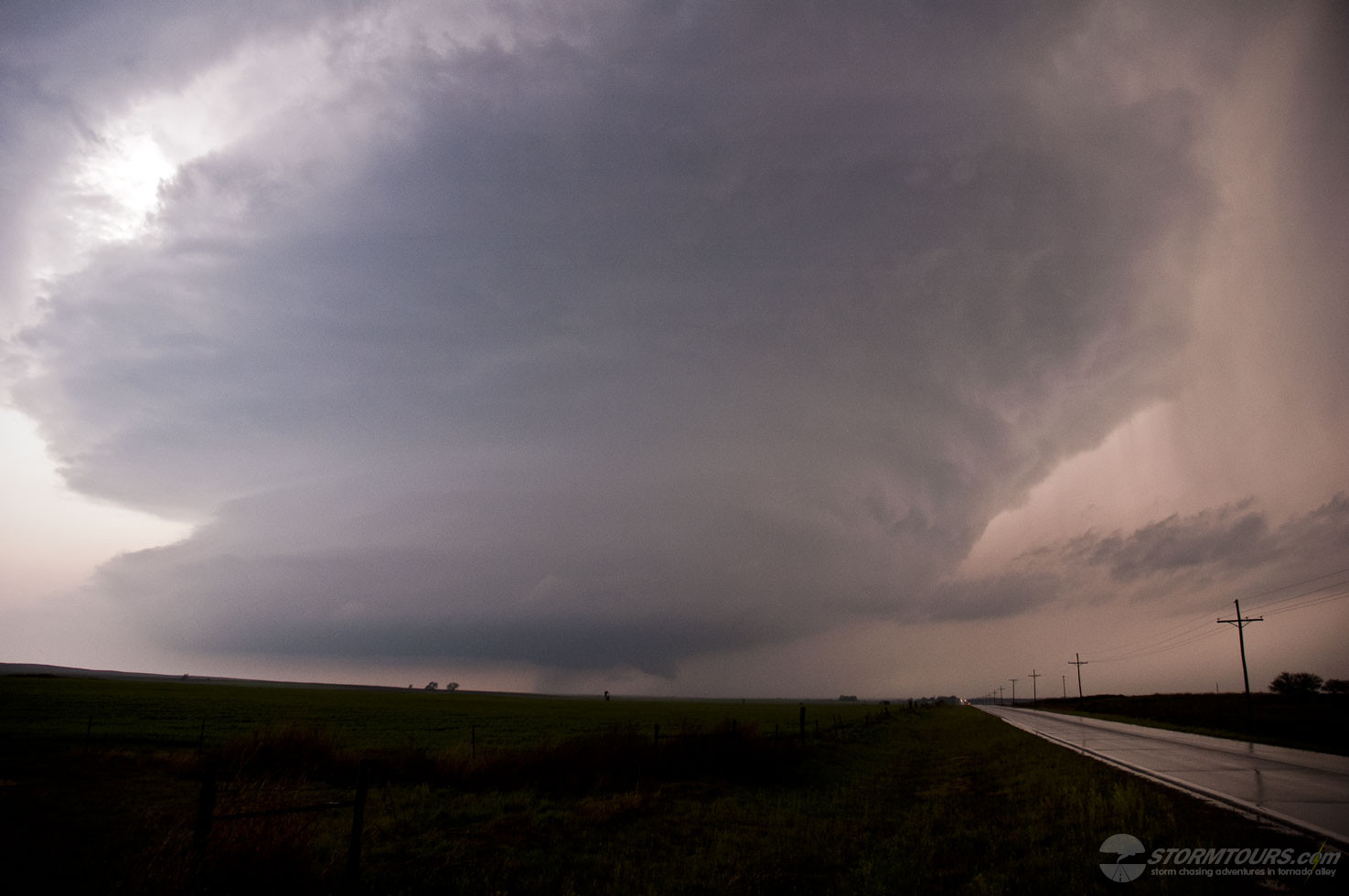
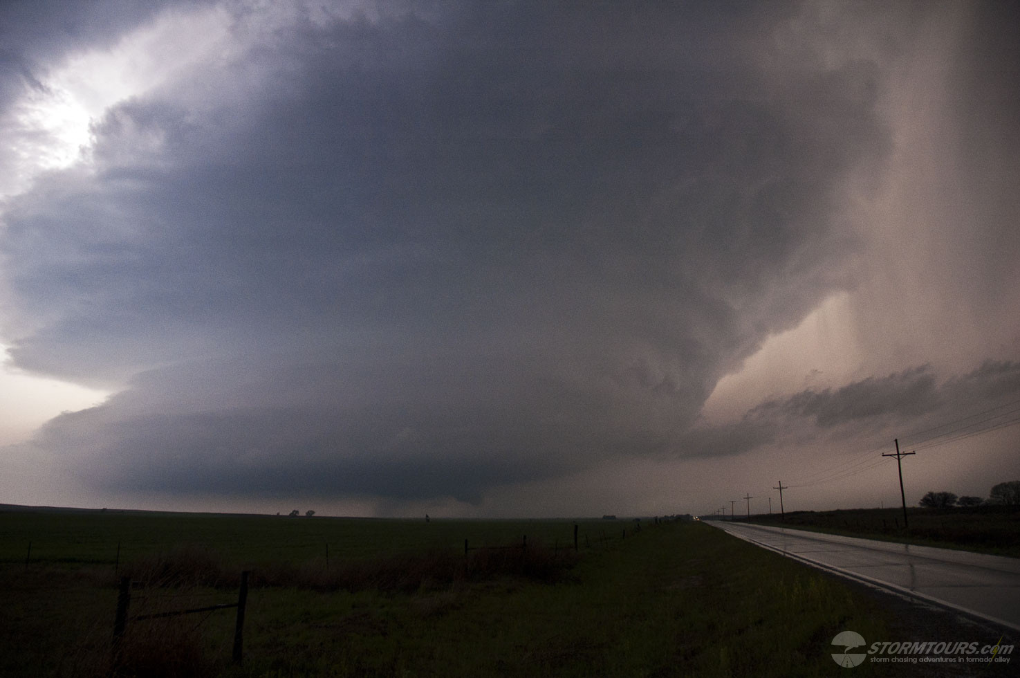
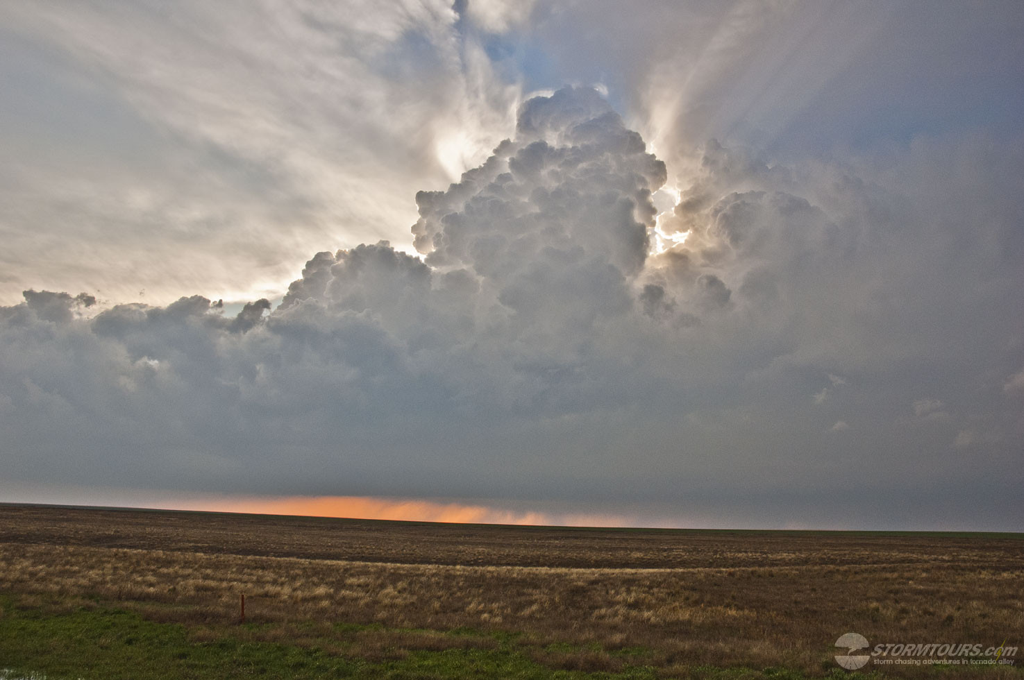
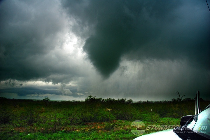
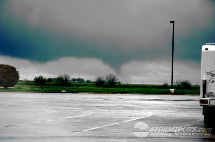
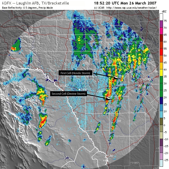
Drove south on 173 and intercepted the second cell just to the north of Devine, TX. This cell looked much healthier on radar and the structure wasn’t bad either. We punched through a rather nasty core with some dime size hail and heavy rain and soon found the updraft base, which had a wildly rotating developing wall cloud.

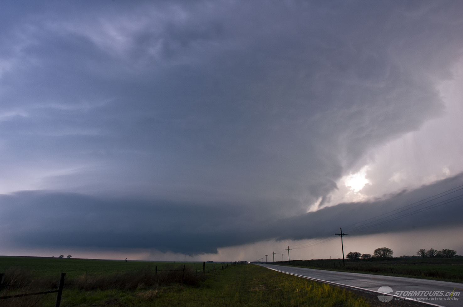
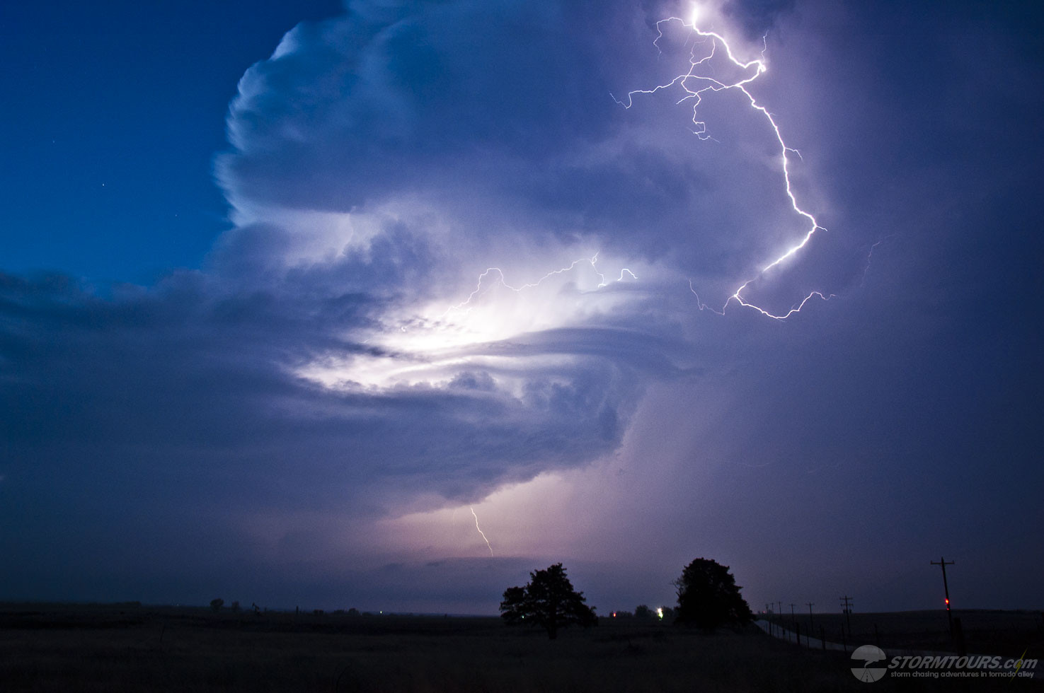
We found a high spot and stopped to watch the third (or forth if you count the landspout) tornado of the day develop and just as it did a rain curtain began wrapping around the tornado. We moved about a half mile back to the south where we had a better view of the storm, but in the time it took us to get back into the van and move a half mile – that tornado had already lifted and I could still see the funnel cloud, nearly overhead with some wild cascading motion – that looked incredible to look nearly straight up and see that ‘up and down’ motion!

I knew I was in this things way – so we went back up the hill to try and get clear. That is about when the second tornado in the video below develops. It formed a truncated cone and was tearing through mesquite trees right in front of us, then it ripped up a well built fence along the highway and cross highway 173 just at the location where we were sitting just a minute earlier.

Again, that storm started moving away to our NE, we could still see the tornado as it moved away from us – but there were no roads and I wasn’t about to attempt driving across muddy trails that are normally gravel roads in the Texas Hill Country.

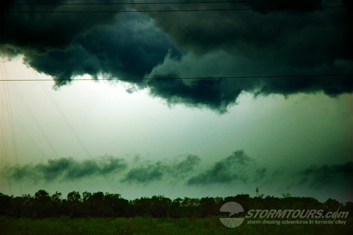
So we had to let the storm go and quickly jumped onto another cell developing even further south near Pearsall close to I-35, but that storm was undercut just about the time that we got to it and the only thing left to do for the day was to get cored by the MCS that was just to our west.

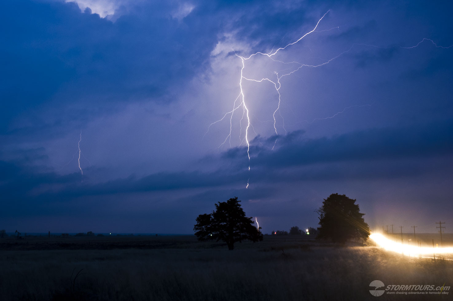
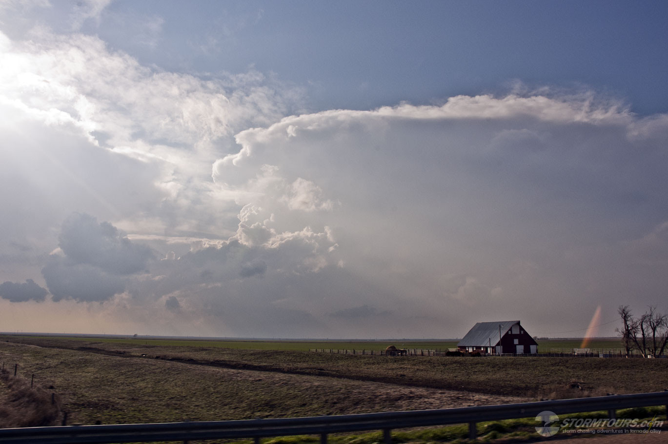
We were under the squall line for about 15 minutes and at times the rain and hail were so heavy that we couldn’t even see the road in front of the van. Finally we made it back to I-35 and the day was over for us, with the exception of a few more shots of the double rainbow that developed behind the squall line.

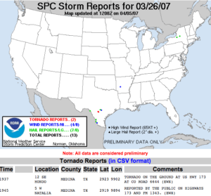
SUMMARY: 4 Tornadoes and 1 Landspout for a total of 5 Tornadoes for the day, a pretty exciting day for a less than marginal chance of tornadoes in southern Texas.

1 2